The small boat cruise terrain is at a glance at a glance!"Smart surveying and mapping" for Wuhuang high -speed reconstruction and expansion
Author:Hubei Highway Time:2022.07.14

On July 12, under the Kojiadun Changgang Bridge, which is connected to the Wuhuang Express intersection, a 1.1 meter -long and 7 kg intelligent unmanned measurement ship is cruising on the lake. It only takes 15 minutes. The lake below the bridge is 6,000 square meters. Within the scope, the underwater terrain geographical map is automatically presented on the laptop of Gong Qichen, an shore engineer Gong Qichen.
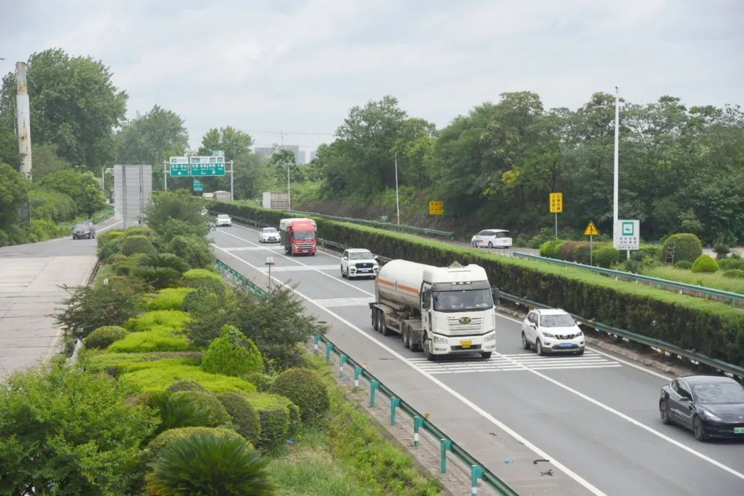
Wuhuang Expressway Ezhou Section
The move marks the attention of the Wuhuang high -speed reconstruction and expansion project that has attracted much attention. It is reported that the reconstruction and expansion section of the Wuhuang high -speed speed started from the new Wudong toll station in Wuhan City. It stopped at Huangshi City Huangshi Interchange Toll Station. Take the feasibility research project.
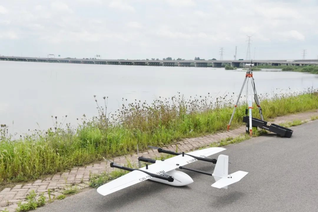
Drone equipment is ready to take off
Water and land air test painting becomes smarter
Under the Changgang Bridge of Kejiadun, the wide lake was rippling. Gong Qichen, an engineer of the Central South Survey and Design Institute, holds the "game handle" and controls a green, two "braids" boats through waves, and shuttles back and forth on the water.
At the age of 33, he told Hubei Daily all media reporters that this is the most advanced intelligent unmanned measurement ship, and he can test the underwater geographicalforms without dead corners. The small boat is entered, and the data and images obtained can be transmitted to the background in real time through the 5G network, which is clearly displayed on the computer screen. It is reported that with this surveying artifact, more than 10 rivers measurement can be completed in a day.
On the ground, the surveying and mapping have land "raptors" to help out. A car equipped with a laser radar device enters the Ezhou service area of Wuhuang high -speed speed. With the increase in the traffic of high -speed returns, the three -dimensional coordinates, reflection intensity of the road and the two -sided objects on the service area and the system accuracy will be quickly obtained. Level 5 cm.
"Om ..." With a brief roar, a mid -size drone with a length of 1.6 meters in length and 2.6 meters of wingspan was lifted off. It can reach 60 kilometers, and it takes a few minutes to rise to 4,000 meters high. It is reported that the "Dapeng" wings showed a coverage area of 78.5 square kilometers in Wuhuang high -speed speed within a week, and completed the 1: 2000 terrain diagram testing task at a high quality.
Truly and mapping, advanced army of highway construction. No one measuring ships, vehicle laser radar point cloud measurements, drone photography three -dimensional real -view models such as high -precision "equipment, such as high -precision" high -precision "equipment, appeared in Wuhuang high -speed, and the preliminary surveying and mapping operation of the" water, land and air "all -round intelligent era, became Hubei Traffic Investment Group empowers the vivid embodiment of the industrial chain and help smart high -speed.
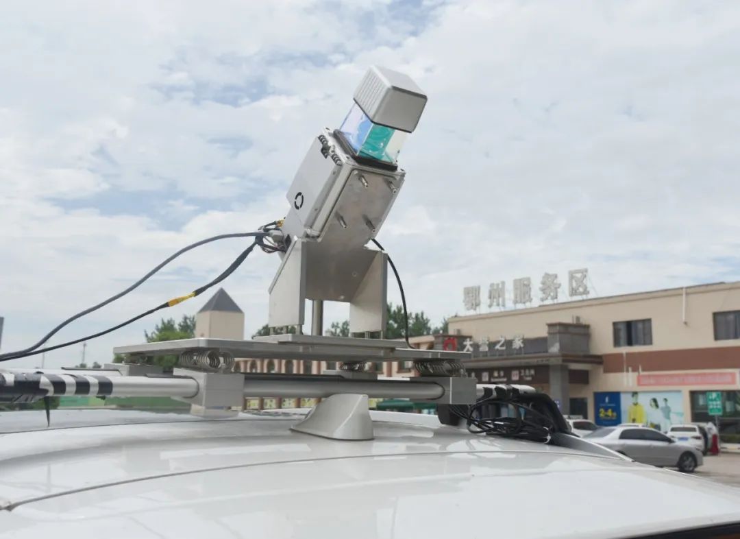
Car laser radar equipment is carried out in the service area for surveying and mapping
Improving efficiency of surveying and mapping 5 times
Gong Qichen said that underwater surveying and mapping is the difficulty of surveying the design community. In the past, renting ships in traditional waters, and manually measured a river underwater terrain of about 50 meters wide. It took half a day. "By operating high -tech unmanned equipment, the efficiency of surveying and mapping in the waters has increased by 5 times." He said happily that the battery life of unmanned ships is up to 6 hours. In addition to ordinary water, it can also reach dangerous waters, which can realize online real -time remote remote range Patrol shooting, underwater terrain landform audition, hydrological measurement, etc.
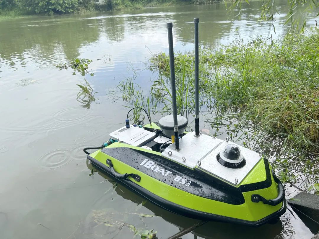
Intelligent unmanned measuring boat launch operation
Science and technology liberate manpower. It is reported that the 53 -kilometer Wuhuang high -speed opening and expansion lines used to take at least one month in summer. With high -tech means, all foreign industry measurements were completed in one week. "Traditional surveying and mapping requires 12 technicians, and they need to carry GPS, full station instruments and other equipment. Now there are surveying and mapping drones, and only two people can get an average accuracy of 20 cm." Gong Qichen said.
Advanced scientific and technological methods have greatly improved efficiency and speed up the busy reconstruction and expansion projects. At present, the vehicle laser radar adopted by surveying and mapping is used to create a high -precision digital topography. Even if the subsequent design line changes, you only need to re -extract the data without rework and re -test. The labor investment has decreased significantly. "Four modifications and eight" to open the bottleneck
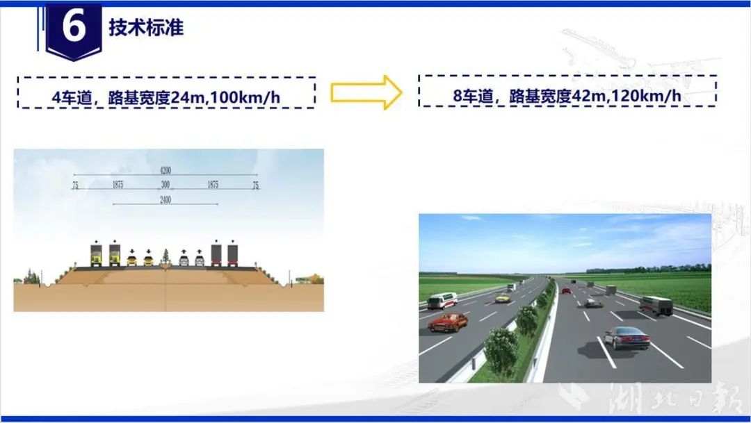
In 1991, Wuhuang Expressway, known as "Chutian First Road", was called "Chutian First Road". From the South Railway Bridge of Guanshan Road in Wuhan to Huangshi City, Huangshi City, two -way four lanes, a total length of 70.299 kilometers. During the 30 years, the traffic flow has increased daily, and the daily traffic traffic has increased by 18.6 times. The average traffic volume of the road section is at the forefront of the province.
As a co -section of the Shanghai -Chongqing High -speed and Fuyin high -speed speed, the busy Wuhuang high -speed opening bottleneck is imminent. Its reform and expansion has become one of the 139 "hard Unicom" roads in our province. "Modern Comprehensive Transportation System Development Plan". The reporter learned that the method of reforming and expansion is "Four Reforms and Eight", that is, on the basis of the original 24m road base width and 4 lanes, the two sides are widened to 42 meters width and 8 lanes. To 120 kilometers.
The Wuhuang high -speed reconstruction and expansion project will be completed before and after the "14th Five -Year Plan". At that time, it will effectively improve the traffic capacity of the national trunk line, serve Ezhou Huahu Airport efficiently, and accelerate the construction of the "aviation passenger and cargo dual hub". The province is currently strengthening the investment scheduling of fixed assets of transportation, and the construction of five reconstruction and expansion projects such as Wuhuang and Huanghuang is super routine.
Source: Hubei Daily
- END -
How to deal with medical waste 6 times the surge in medical waste since March?

About 2167 words in this articleIt is expected to read 4 minutes longWaste masks, ...
Rizhao "Sunshine Coast" appeared in Hohhot
On July 16th, the One Shandong Travel, Life Shan East Love 2022 hostel Shandong Cultural Tourism Promotion Conference hosted by the Shandong Provincial Culture and Tourism Department was held in Hoh