What will happen to the clouds in the rainy season?| Satellite cloud map takes you to know the weather ⑤
Author:China Meteorological Administr Time:2022.07.10

Meizi is familiar
Meiyu will come
Every year from June to July
my country's Jianghuai, Yangtze River midstream and downstream
There will be continuous rainy weather in the Jiangnan area
At this time, the maturity period of plum
So it is called the Meimei Season
The continuous rain of the rainy season
What is the satellite cloud map?
first
You have to understand Mei Yifeng
Mei Yufeng
Mei Yufeng is the interface between the monsoon and other gas groups. It has a rain belt that runs through the East Asia and the West Pacific region with thousands of kilometers. Mei Yufeng is characterized by the low temperature gradient, but the humidity gradient is large. How to understand this characteristic? That is, the humidity is relatively large, which will cause your home to be easily "moldy".
On the satellite cloud map, it grows like this
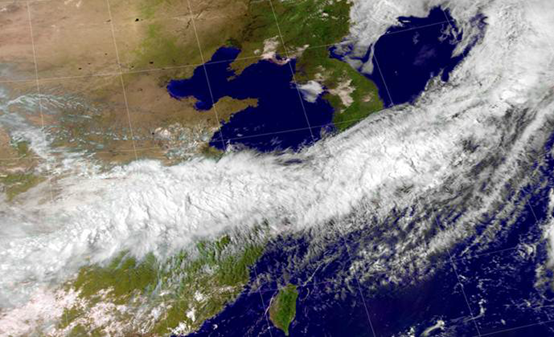
"Mei Yufeng" under the Fengyun Satellite: National Satellite Meteorological Center
Come a moving picture, feel it?
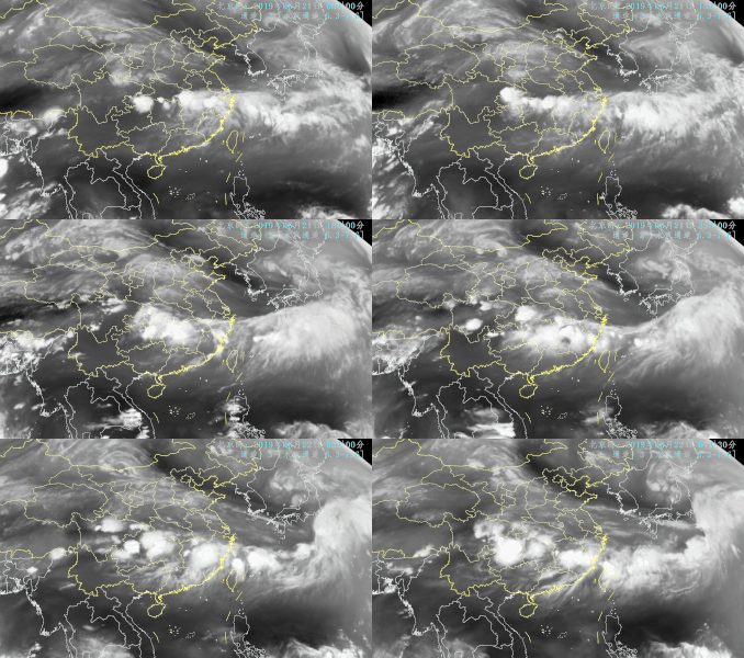
On June 21, 2019, the dynamic development of the "Mei Yufeng" monitored by Fengyun Satellite Source: National Satellite Meteorological Center
How is this year's Meiyu?
According to the monitoring data of the National Climate Center, in 2022, the middle and lower reaches of the Jiangnan and the Yangtze River in my country entered the plum on May 29, respectively 11 days and 16 days earlier than usual. This year, the rain belt during the rainy period is unstable, showing the atypical features of small rainfall and high temperature days. Mei Yufeng, corresponding to Mei Yuyu Belt, also shows the characteristics of north and south this year.
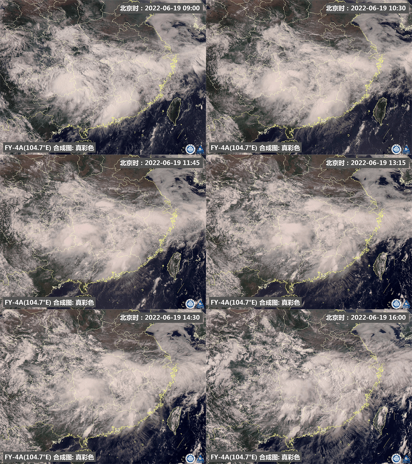
On June 19, 2022, it can be seen in the dynamic drawing monitored by Fengyun No. 4 A star that can be seen in the middle and lower reaches of the Yangtze River. , Caused the uneven distribution of rainfall. Source: National Satellite Meteorological Center
Generally, during the Meiyu period, from the Jianghuai Basin to southern Japan, a stable and lasting rain belt will be maintained. The heavy rain distribution in the rain belt is uneven, and there are often several heavy rain centers. Although Mei Yufeng's heavy rain intensity is generally much smaller than the heavy rain caused by strong streaming weather; however, due to the long duration of Mei Yufeng and a wide area of heavy rain, the flood disasters cannot be underestimated, such as the "violent plum" in 2020.
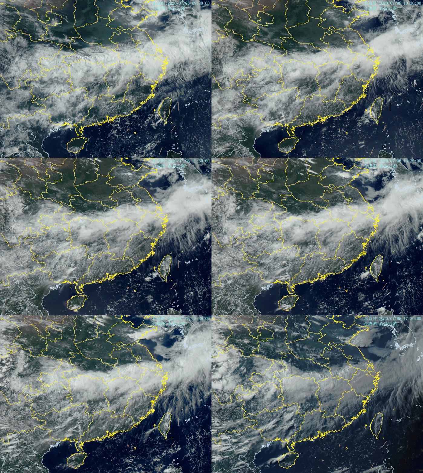
The picture shows the plum rain map under the monitoring of Fengyun Satellite on July 6, 2020. In 2020, Meizi was early, and the plum time was late. Meiyu died for 62 days (June 1st to August 1st), and it was listed as the longest since 1961. Large rainfall, extreme precipitation incidents frequently source: National Satellite Meteorological Center
What should I do when I see Mei Yofeng?
Preparing umbrella is necessary. The rainfall has a wide range of rainfall, long duration, frequent rainfall, and heavy rain and heavy rain. Please pay attention to forecast early warning information and pay attention to preventing landslide and floods.
Want to pass the satellite cloud map
Learn more cloud system
Come and leave a message in the comment area!
Elephant invitations invite meteorological satellite -related experts
Come and answer for everyone
See you next time!
- END -
"I followed too fast, I thought it was a liar."

Due to the negligence for a while, the child's ten -year cold window was hard t...
Labor at high temperature | Garden workers: from dusk to late night drought to keep green and keep green
Entering high -temperature weather, from every day and dusk to late night, there a...