How important is the "China's Second River" Pearl River?
Author:Authentic style Time:2022.07.07


In late June 2022, the heavy rainfall in South China, the most concentrated rainfall on the 22nd, half of the top ten precipitation places in Guangdong Province, all in the Pearl River Basin. The water level of the second largest dry flow in the Pearl River rose sharply. Shaoguan and Qingyuan in the basin broke the precipitation records in many places. The most serious Yingde was soaked in the water.
As of July 5, Beijiang had encountered floods No. 3 this year, breaking the record since 1949. The current flood prevention situation in the Pearl River Basin is not easy.
A disaster situation allowed the people in the country to pay attention to the victims of Qingyuan, Yingde and other places, and also allowed the Pearl River to enter the field of vision of the people of the country. However, the importance of this "low -key" river is still greatly underestimated by us.
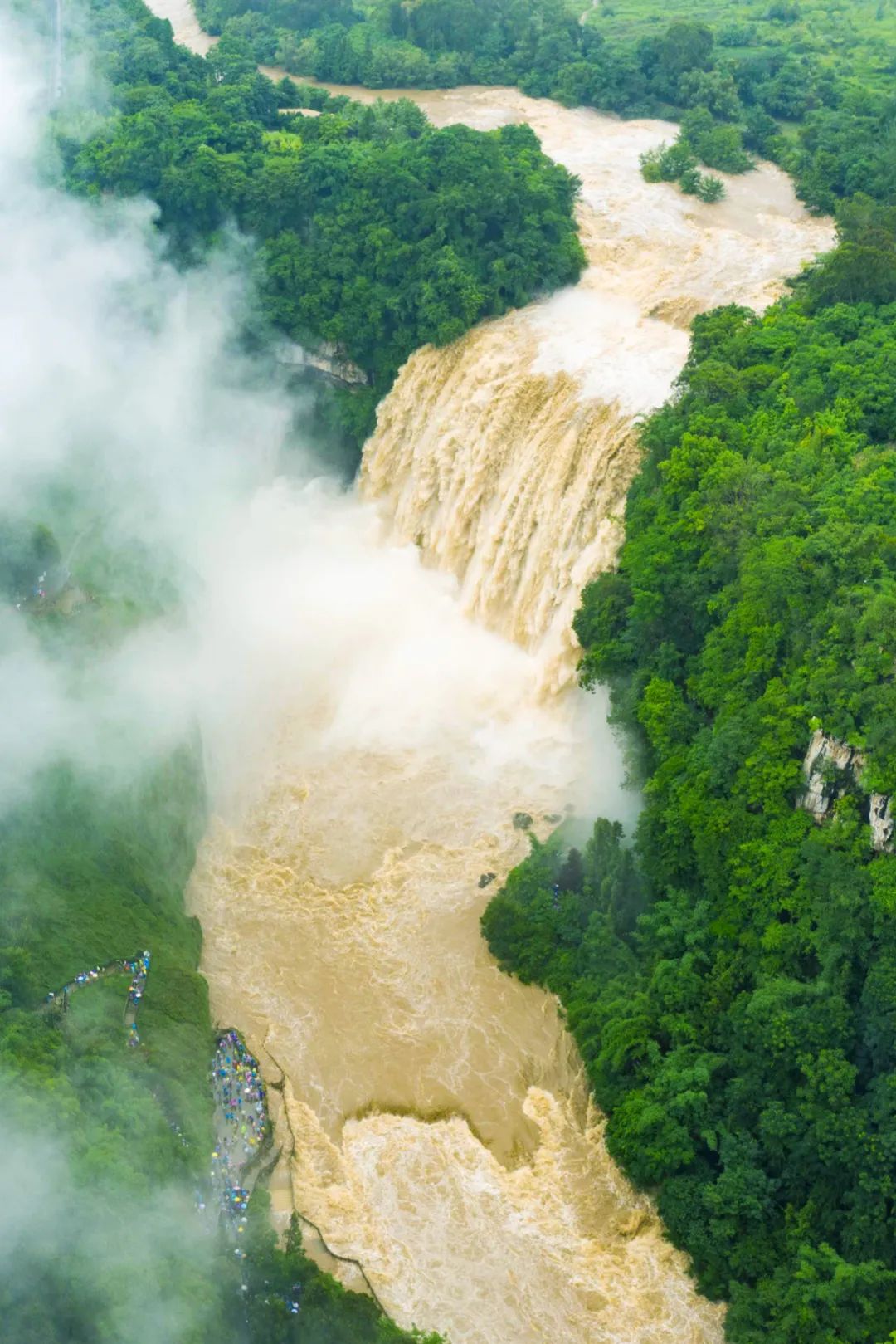
The Huangguoshu Waterfall in the Pearl River Basin ushered in the largest water in the flood.
So, how important is the Pearl River?
She crosses Yunnan, Guizhou, Hunan, Jiangxi, runs through Guangxi, and eventually enters the sea in Guangdong. The annual runoff ranks second in the country and is the mother river of 124 million people in the basin.
She has a world -faced Guangdong -Hong Kong -Macao Greater Bay Area, which has become the "second engine" of the Chinese economy;
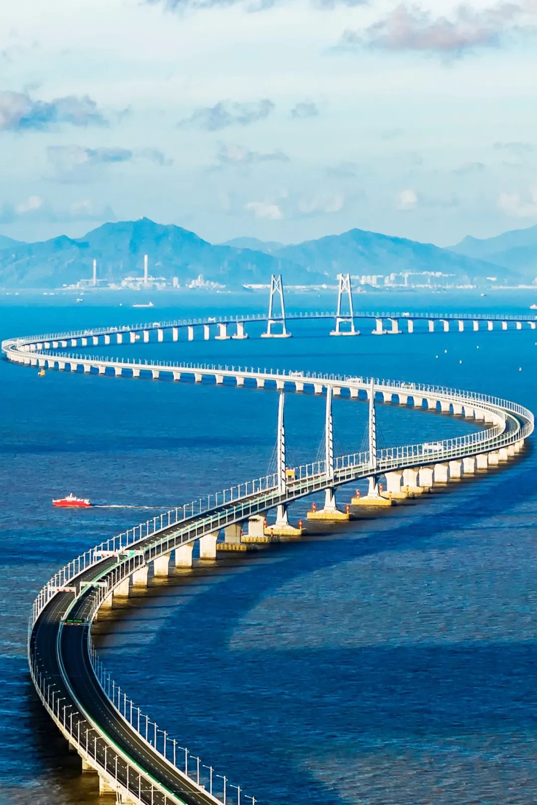
Hong Kong -Zhuhai -Macao Bridge.
Photography/Huang Kunzhen
She washed out of the strange landforms of the southern country. The beautiful scenery of Huangguoshu Waterfall, the landscape of Guilin, and Danxia Mountain was just the tip of the iceberg;
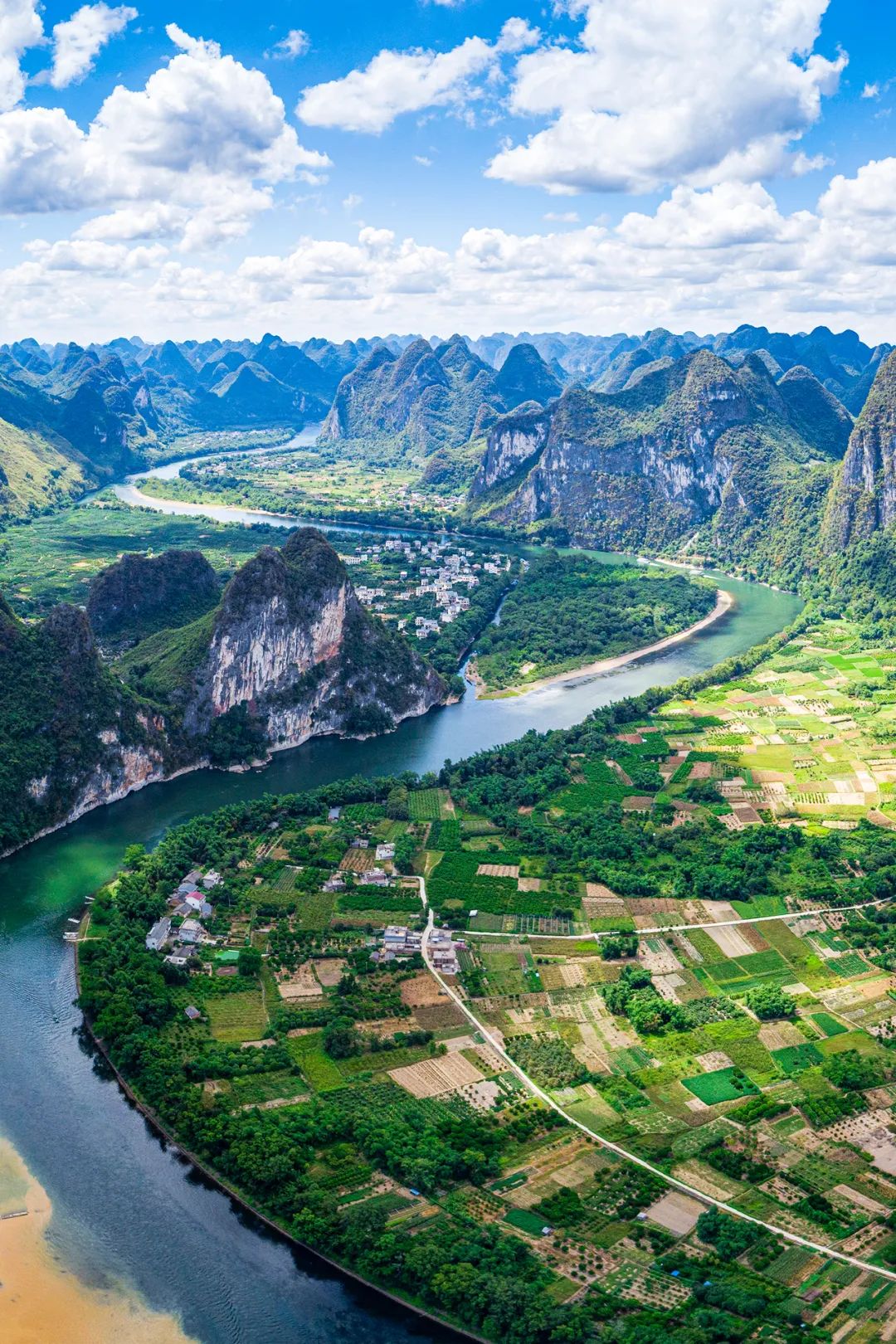
The east bank of the Lijiang River, lawn township.
Core area of Karst landforms in southern China.
Photography/Lu Yu
Qisheng landforms have shaped the colorful life of more than 50 ethnic minorities; a generation of immigrants went south to the south to cultivate the cultivation of Guangfu and Hakka's unique and mutually integrated culture.
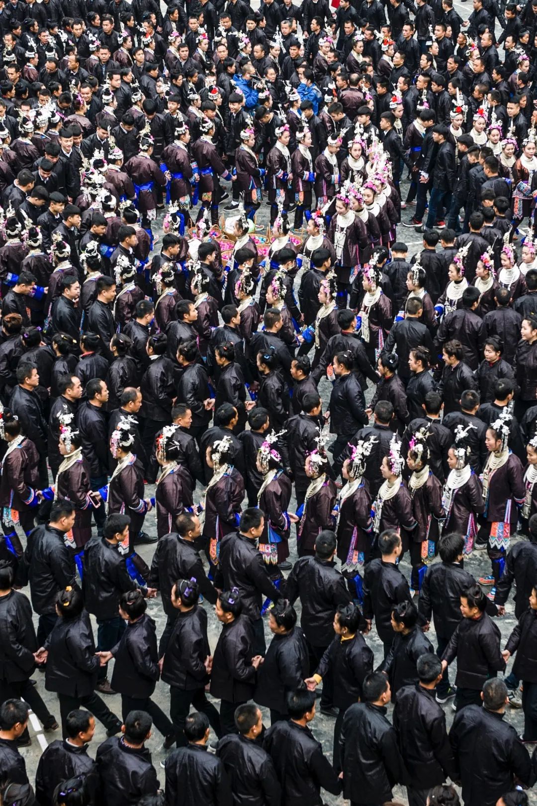
The celebration of the Dai people in the New Year,
Thousands of people stepping on Ge Hall.
Photography/Yin Zhong
The Pearl River, why is it the second largest river in China?
Compared with the Pearl River, the cultural significance of the Yangtze River and the Yellow River is more heavy, and it is often mentioned by the world. Even when the singer Zhang Mingmin, who was born in the Pearl River Basin, sang "My Chinese Heart", the lyrics were "Yangtze River, Great Wall, Huangshan, Yellow River" without the trace of the Pearl River.
In fact, the size of the river is usually calculated in runoff, rather than the length. The Pearl River is a well -deserved second river.


Foshan Sanshui Sanjiang Association.
The chaos of the lower reaches of the Pearl River is evident.
Photography/Xiong Jiacheng
The Yangtze River and the Yellow River define the standard templates of the Great River in the hearts of Chinese people. From west to east, there is a very clear dry flow. The tributary of the same day as the dry flow is distributed around the dry flow.
However, when you open a map of the Pearl River Basin, it is not difficult to find that almost one of the Pearl River in "rebellion" does not meet, but it is more like a few rivers of "bulk".

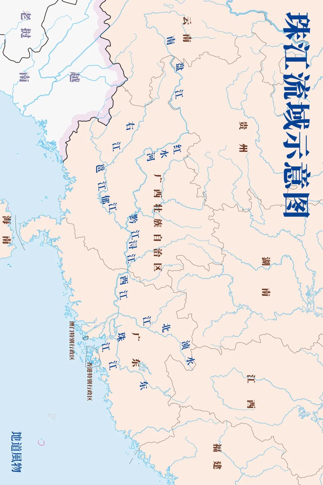
Drama diagram of the Pearl River Basin
Map/Sun Lu
The endless Hengduan Mountains, Nanling and Wuyi Mountains delineate the scope of the South China Sea in the South China Sea today, and also determines that the rivers in Lingnan are gathered from the surroundings. The Dongjiang, West River, Beijiang and Pearl River (West Channel) of the mountains are rushing out of the mountains, and have a large amount of sand, with strong land -building capabilities, and constantly pushing the Delta to the south.
The Pearl River has formed the wrong river network on the unstable freshman land, and it is scattered into the eight river channels into the sea. Among them, more than 500 bridges are established in Zhuhai City, which is in the mouth of the sea, which shows the complexity of the river network. However, these river networks have become a big river.
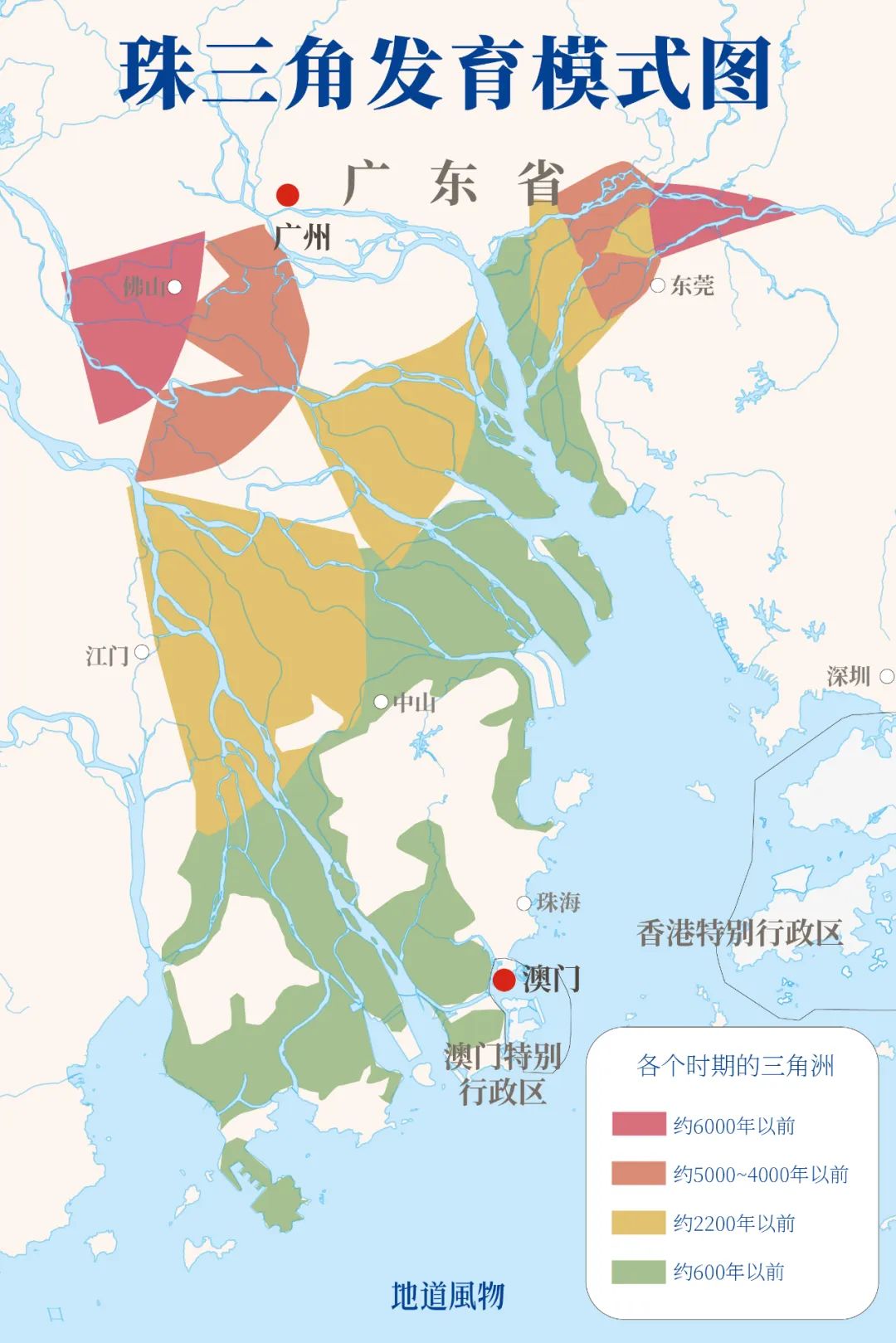
The development of the Pearl River Delta.
Map/Sun Lu
This young river integrates almost all the large rivers in Lingnan. The vast water flows like the highway of the ship, becoming the traffic artery of Unicom, Guangnan, and south of Jiangnan. Her drying upstream terrain was rugged and the water was turbulent. Qunshan and rapids have become the geographical barrier between eastern Yunnan and southeastern Guizhou, forming a source of peach blossoms, retaining the most authentic ethnic culture.
Xijiang, Beijiang, and Dongjiang were originally different. How to call this important river became a problem.


Guangzhou Nansha Port,
A footnote of the Pearl River Delta economy.
Photography/Zhang Xiangliang
The earliest referring to the Pearl River was a small river exclusive to the Pearl River Delta. It originated in Sanshui District, Foshan City. It is that this Xiaojiang dedicated the name to the Pearl River Basin, and it became the western channel of the Pearl River.
How important is the "Pearl River Heart" Pearl River Delta?
The process of named the Pearl River can see the unshakable position of the Pearl River Delta in the Pearl River Basin. The Pearl River Delta is not only the entrance to the Pearl River, but also the booming heart of the Pearl River Basin.
The Pearl River Delta is one of the few large plains in South China. The geological structure of Guangzhou has stabilized and has become the earliest place to develop the Pearl River Delta. Since the Qin and Han dynasties, it has been the center of South China politics, economy, culture, and education. It is an important node of the Maritime Silk Road.


Looking back at Zhuhai and Macau from Zhujiangkou.
Photography/Li Qiong
From the mature Guangfu culture in Guangzhou, the cultural background of the Pearl River Delta has not only laid the cultural background of the Pearl River Delta, but also profoundly affected the western Guangdong and Gui East. With the footsteps of immigrants, it was spread overseas. Chinese dialect.
This is the 1.0 era of the Pearl River Delta.
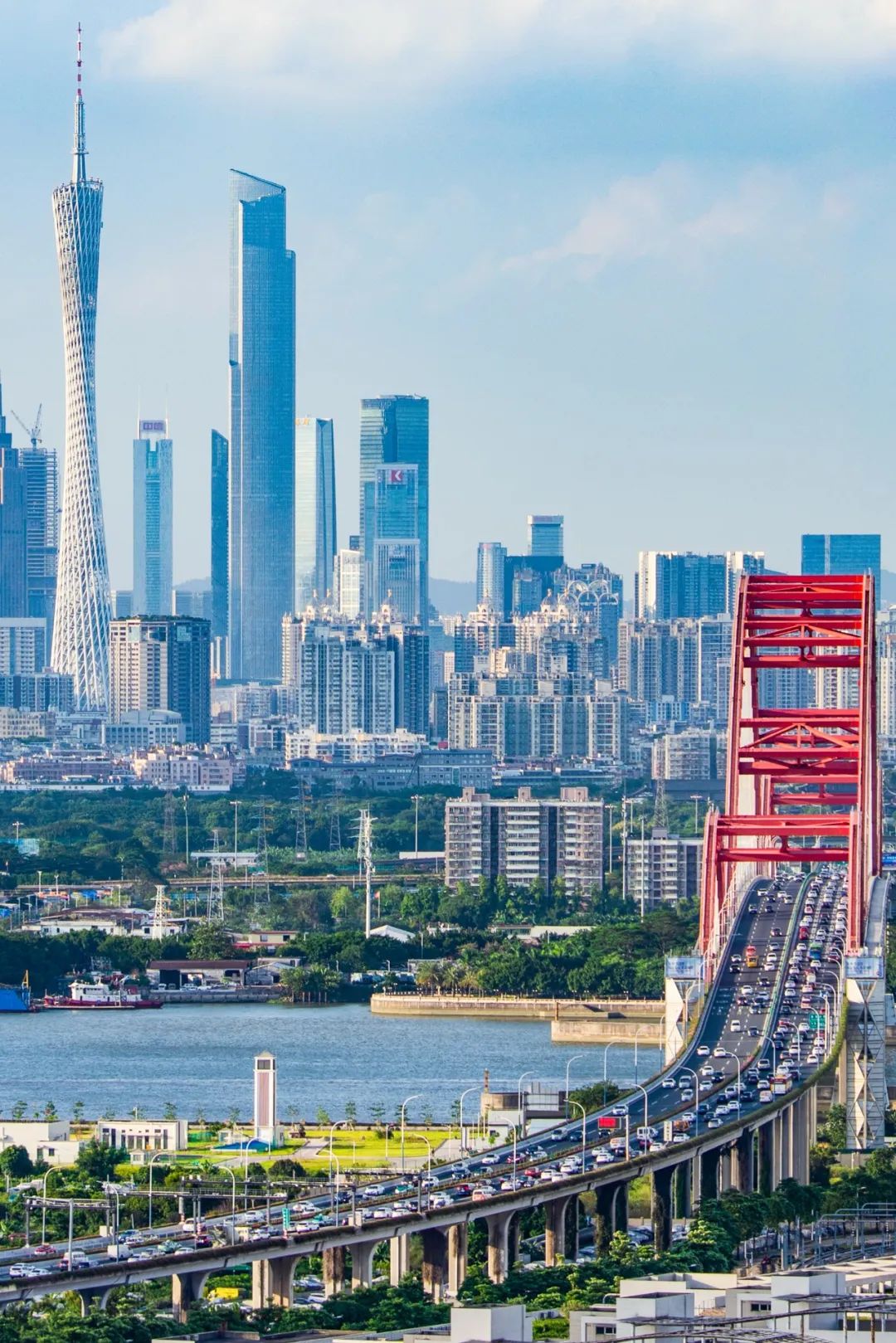
Xinguang Bridge and Skyline in Haizhu District, Guangzhou.
Photography/Seven Escapes who walked on lying down
Guangzhou not only accumulates its own wealth, but also drives the development of surrounding cities. At the latest of the Qing Dynasty, Foshan and Huizhou have become the heavy town of economically developed and prosperous business and trade, which has achieved the 2.0 era of the Pearl River Delta.
In the past 40 years, the Pearl River Delta has entered the 3.0 era. It has used the seven ports to develop a highly exterior economy, so that Shenzhen will rise from the fishing village. The Pearl River Delta used less than 30 % of Guangdong, carried more than 60 % of Guangdong, and created more than 80 % of GDP. This is the heart of the world's factory and the source of Chinese technology companies. Guangzhou Chengzhong Village has countless young people who have dreams of dreams,

Shipai Village has accommodated Ding Lei and five people.
Photography/Brother III
In the future, the Pearl River Delta will also strengthen the economic and cultural exchanges with Hong Kong and Macao, forming a strong existence that is sufficient to compare with the New York and Tokyo Bay -the Guangdong -Hong Kong -Macao Greater Bay Area.
The riverside flow, gathered out of the old wide taste
The rivers and rivers gathered the most flat and fertile hidden plains in South China, and also gathered a diverse and inclusive cultural atmosphere. Here, the three major people of Guangfu, Hakka, and Chaoshan, which have been fighting for hundreds of years, have been integrated after hundreds of years of exchanges. Wake -ups, martial arts, and tea drinking have become the common cultural symbol of the Pearl River Delta.
The Grandpa in Guangzhou scratched the dragon boat across the Hunting Bridge.

Photography/Lu Wen
Because of the existence of the Pearl River, Guangzhou has the huge advantage of Haihe Lianlian. Since the Qin and Han dynasties, it is an important (even the only one) foreign trade port. People from Guangfu see that products, culture, and merchants from abroad will naturally face foreign culture with a more open attitude.
Perhaps because of seeing foreign culture, the residents of the Pearl River Delta will consciously inherit the tradition. In the city landscape at the end of the Greater Bay Area, every time the Dragon Boat Festival, the charters will leave the mahjong table and go to the river to "patent water" to experience the happiness of the dragon boat drift.
Slide to the left

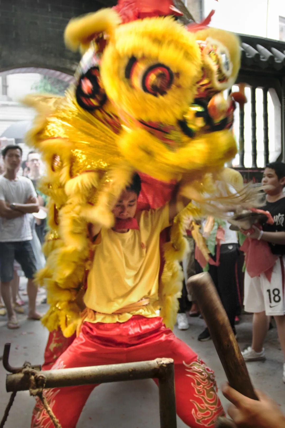
Figure 1: Dragon Boat of Nanhai City, Guangdong Province (Dragon Boat Dragon Boat);
Figure 2: Shooting in Lioni Town (Lion Dance) in Shunde City, Guangdong Province.
Photography/Lu Wen
People in Guangzhou like to visit the modern western -style buildings on the weekend, and they will also go to the Tianhou Palace from the southern Fujian culture. Dongguan is distributed in the surrounding villages built by the Hakkas, and there are also scholars who have re -engraved Suzhou garden styles. The contradictory characteristics of the open and conservative coexistence of the Pearl River Delta have brought a bit of conflict to the cities in the Greater Bay Area.
Some traditional activities are still deep into urban texture,
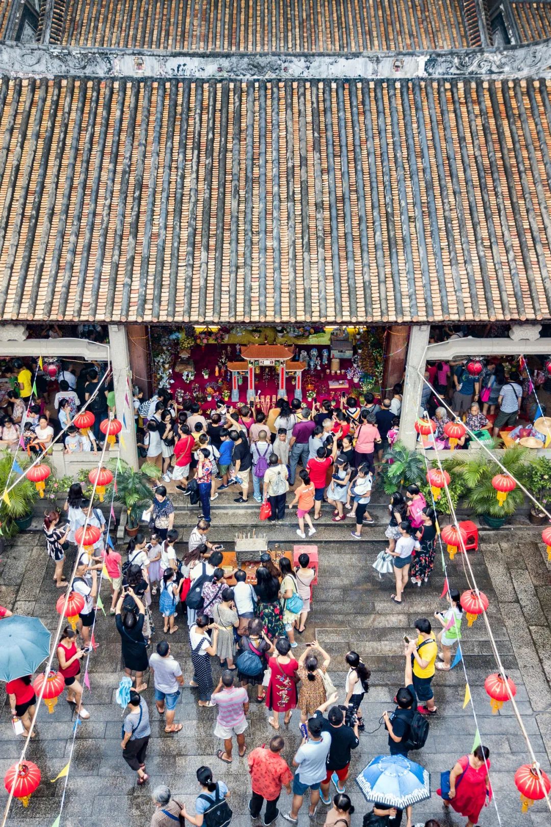
The picture shows the Qixi Festival in Tianhe Zhu Village, Tianhe, Guangzhou.
Photography/Lu Wen
This tolerance culture has not stopped there, and its contemporary version is the phrase "is from Shenzhen."
Go to Xijiang East to shape the most beautiful China
After seeing the diversity and prosperity of the Pearl River Delta, it is easy to treat her as the normal state of the Pearl River Basin. In fact, the source of the dry flow of the Pearl River is far from Yunnan, leaving countless waterfalls, deep valleys, and dangerous beaches all the way, bred the magnificent landscape of the Southwest Karst landform, and also shaped a variety of lifestyles of ethnic minorities.
The Pearl River is far more complicated than expected.
Karst landforms on the east bank of the Lijiang River.

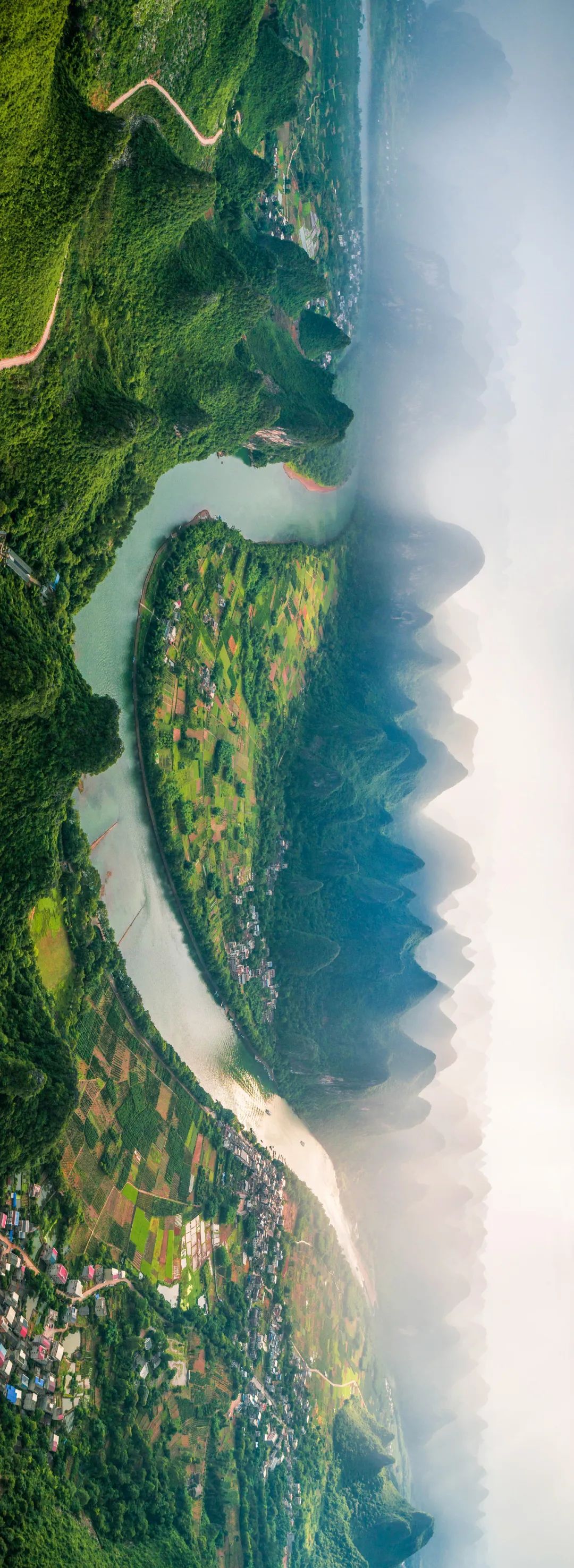
Photography/Lu Yu
The rugged Yunnan -Guizhou Plateau is a water tower in Southeast Asia and South China. Numerous rapids were stunned between layers of valleys, and the endless Xijiang River. The Xijiang rushed out of the east of Yunnan, crossed the mountains in southeast Guizhou, nourished the land of Guangxi, and eventually crossed the western Guangdong region and entered the sea from the Pearl River Delta.
The water flow in the upper reaches of the Xijiang River is too turbulent, and from the generation of the parents to the Huangguoshu Waterfall in the Holy Land, it is actually a part of the upstream tributary of the Xijiang River.
Look at the Huangguoshu Waterfall from another perspective,
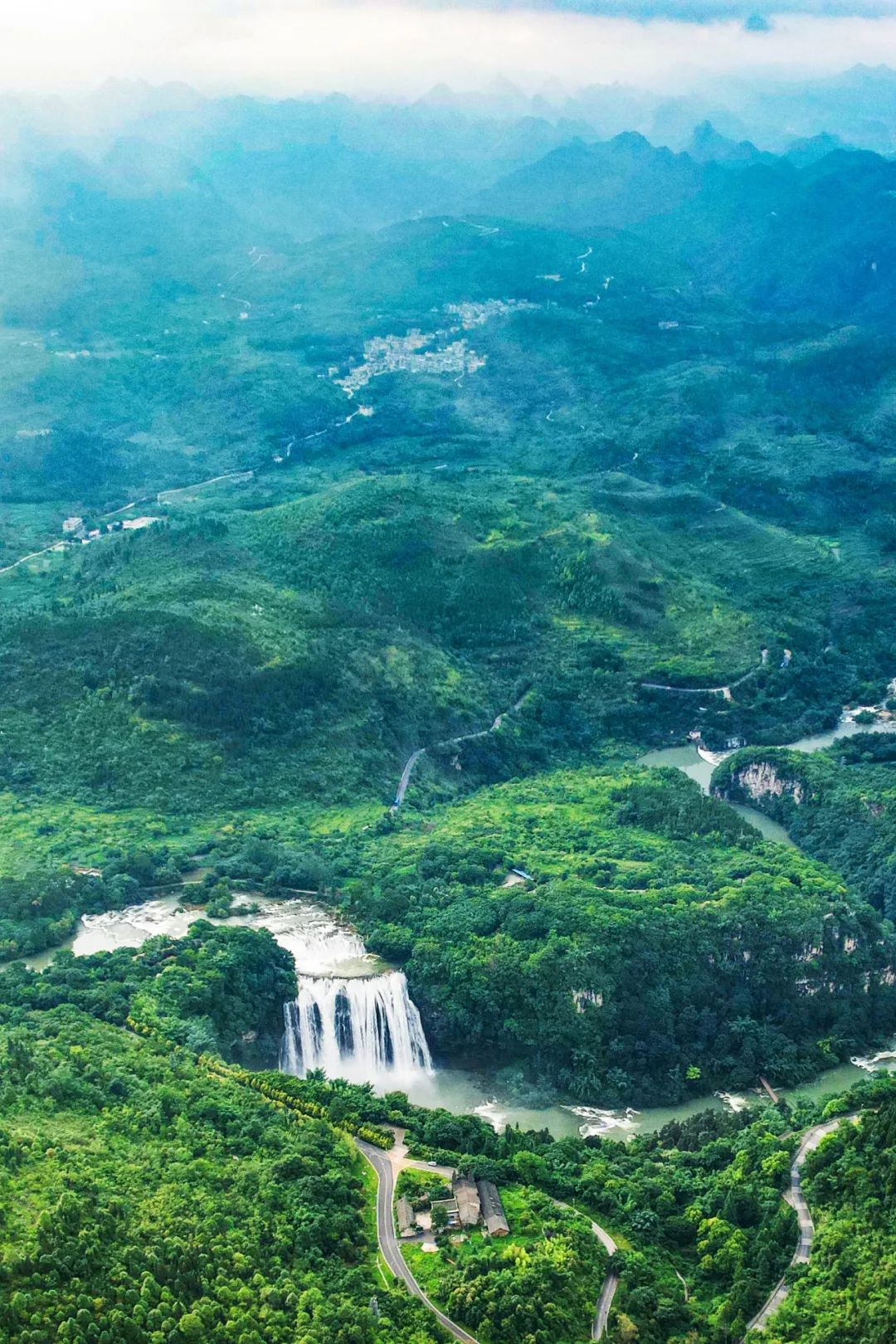
It is not difficult to see that it is part of the river.
Photography/Wang Zirong
The huge gap determines the poor navigation capacity of the West River, limiting the local development in history, but now it has given the local hydropower abundant advantages.
As a contemporary China of infrastructure madness, a heavy water conservancy hub and bridge were designed and built in the upper reaches of the Xijiang River, while flooding and power generation improved their traffic capacity. While the water conservancy project helps contemporary development, it has also reduced the pressure of downstream flood control.
Ma Linghe Bridge.

Photography/Tang Coco
The rainwater and the dark river were washed out of Guilin, Guangxi, and achieved the most beautiful landscape in the minds of the Chinese people. In fact, the southwestern land is located in the Karst landforms, Liphakarst, Xingyi Wanfeng Forest ... are part of the world's natural heritage "Karster in South China".
Le Ye Tiankeng Group is a treasure trove of biological resources.
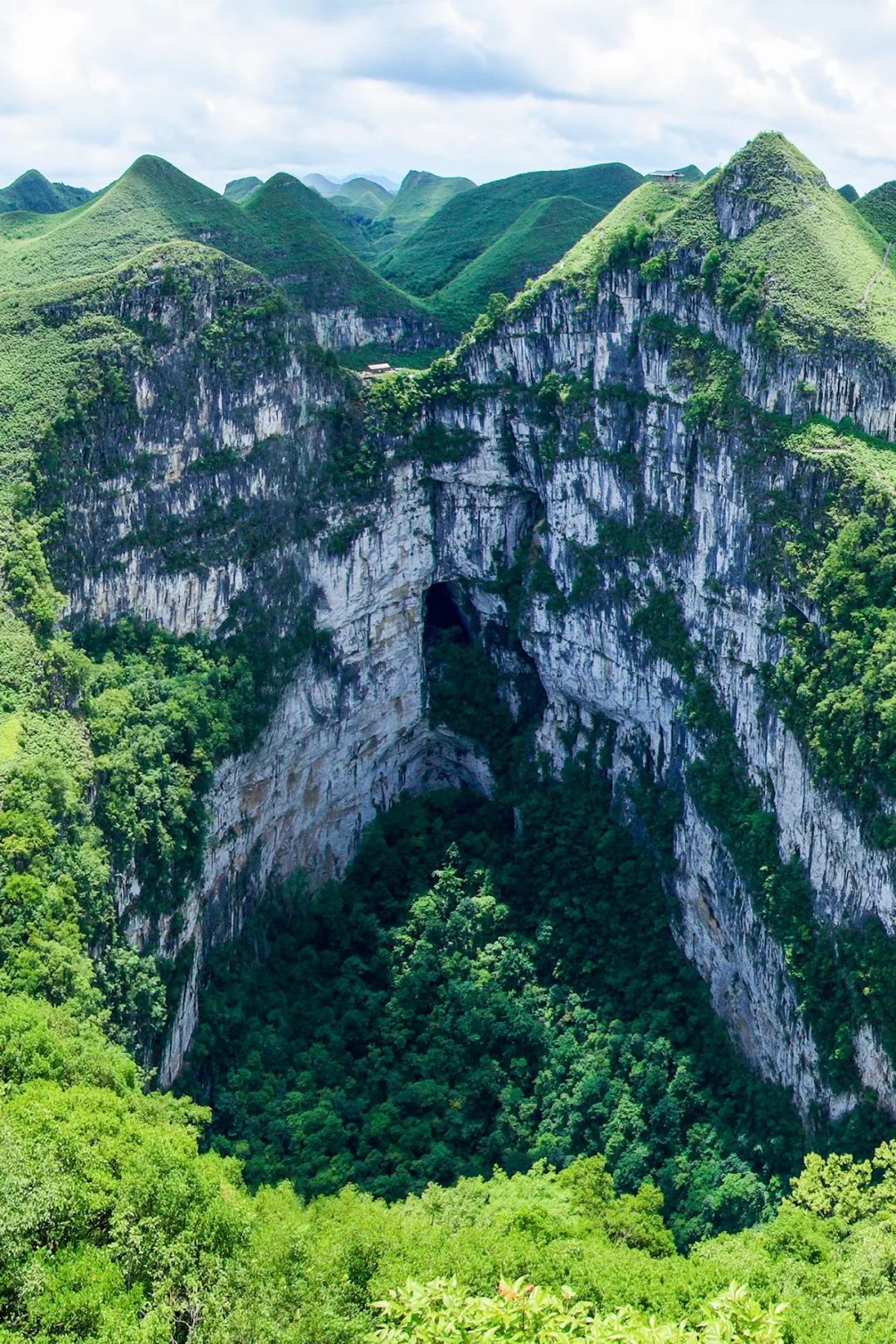
Photography/Li Jin
In the caves and Tiankeng, not only the scenery is rich, but also the biological resources are extremely rich, and even the special species that need to be studied in depth. In addition to Karst, there are still some Danxia landforms in the Xijiang Basin, adding a bit of a bit of a bit of a bit of a few feet in the southwestern region.
The mountains and rivers are recovered, concentrated on the colorful China
The surging Xijiang River was rushed out of the fertile river valley plains, and more than 50 ethnic minority compatriots had a rich and colorful life. The nations such as Miao, Yao, Zhuang, and Dai adapted to the local humid climate and rugged environment, developed slowly slopes into a terraces for rice and fish, and created a wonder of natural and humanistic integration.
Similar to the terraced fields in Southeast Guizhou,
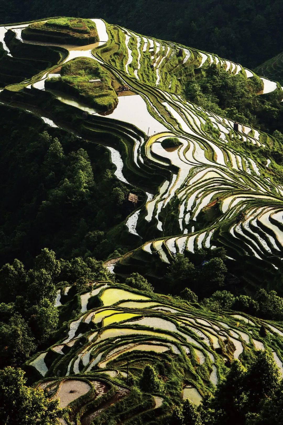
It is not uncommon in southeast Guizhou.
Photography/Cao Jingjian
The Dai people use the woods of the forest to build the drum tower, becoming an indispensable public space in the lives of the same village people: Miao uses beeswax and earth cloth to produce a stunning contemporary wax dye. The Zhuang tribe woven the color silk thread into Zhuangjin, and has the aesthetics that cannot be carved in the tide. Various nations in Dashan use limited resources to live a dragon and tiger.
Gao Zengzhai, Jiangxian, south of Guizhou.
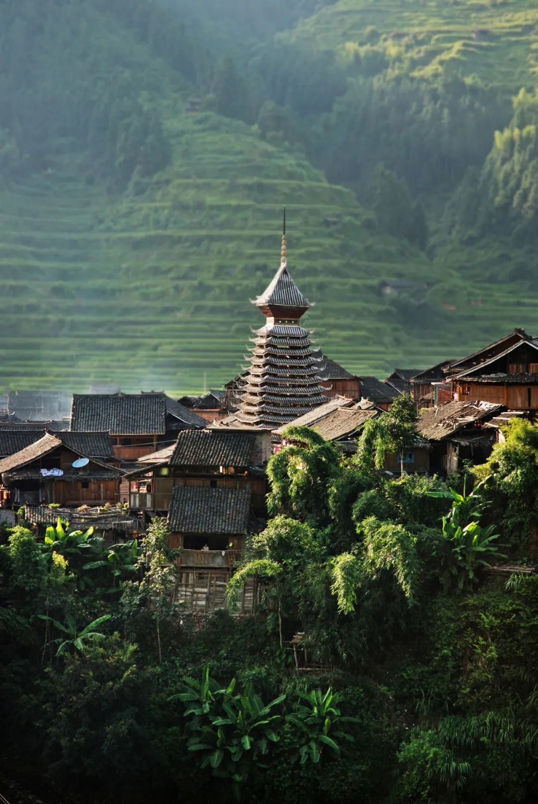
Photography/Chen Peiliang
Even after the Han people entered the mountains, they had to eat mountains, which became more and more like ethnic minorities in the southwest, forming a unique existence such as the Han nationality in the northwest of Gui. According to the legend of the Han nationality, their ancestors were a branch of the peasant rebels of the Li Dingguo at the end of the Ming Dynasty. After the defeat, they entered the mountains and lived a life -like life. The older generation still retained traditional costumes and concepts. Slide to the left
The Xijiang Basin retains a variety of ethnic minority culture.


Figure 1-2: Guizhou Miao.
Figure 3: Guizhou Yi nationality.
Photography/Feng Dawei
When it was rushed out of Yunnangui, the Xijiang River came to the relatively gentle Guangxi, and the narrow river valleys and precious plains were deposited, reflecting the integration characteristics of Central China, South China, and Southwest Cross.
Guangxi people not only eat five -color glutinous rice, but also fermented the sour soup with all things, and turned the cow into a medicated meal. It also invented the variety of rice noodles known as the wild and wild. Chinese taste map.
Guilin sacrifice Sa.
Photography/Lu Yu
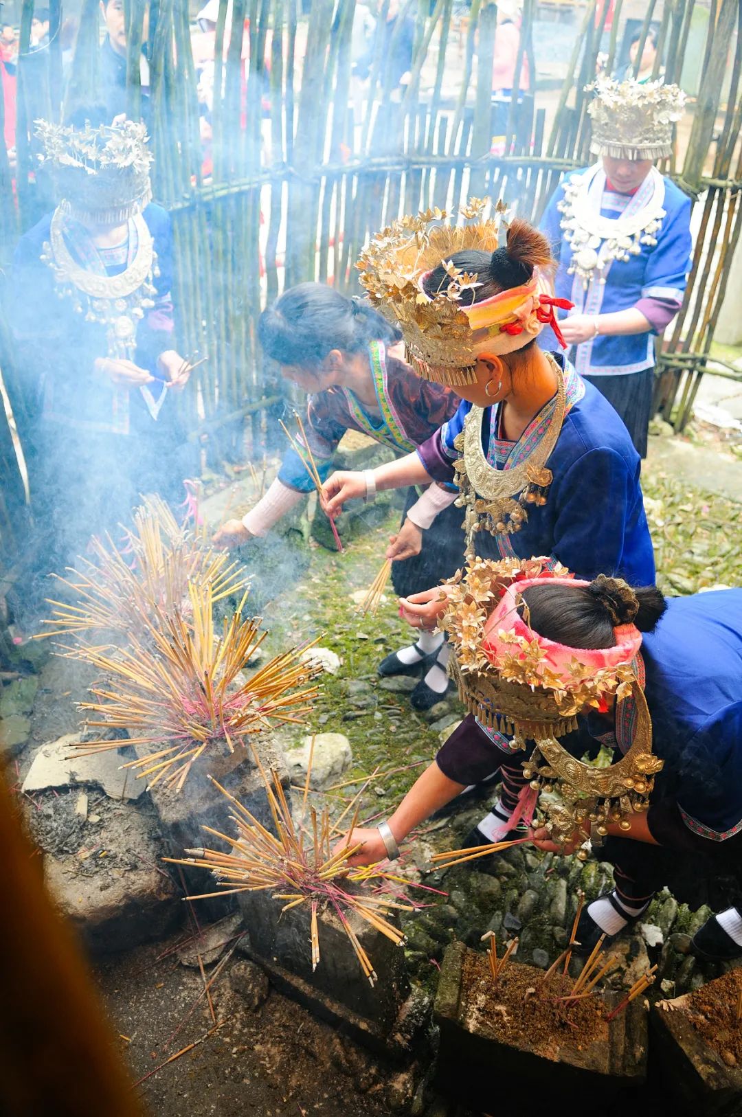
The unique landform and climate form a unique product, which has created a unique lifestyle and bred a unique nation. From the perspective of water, ecology, or national culture, the middle and upper reaches of the Xijiang River are the secrets worth exploring and protected.
Along the way, how did the Pearl River bring Cantonese?
The Pearl River is an endless history, implying the life of Cantonese. The process of jurisdiction of the Pearl River reflects the process of blending population.
Hakka is one of the three major people's departments in Guangdong today. In fact, from a historical point of view, who is not under the south of the river, and eventually treats Lingnan as the "guest" of his hometown?
Chengzhong Village is a special existence in Guangzhou,
It accommodates countless newcomers.


Photography/laughing snow
Emperor Qin Shi ordered the excavated Lingqu to connect the Xiangjiang River and the Xijiang tributary Lijiang. After continuous repair of later generations, it became an important channel for the Central Plains to enter Lingnan. It also allows Guangxi to make Qi Min, who was originally located in the eastern edge of the Yunnan -Guizhou Plateau, and has the taste of the Central Plains. So much so that Guilin is located between mountains and rivers, but has cultivated the heir home, and nearly 400 Jinshi Education Town in the Ming and Qing Dynasties.
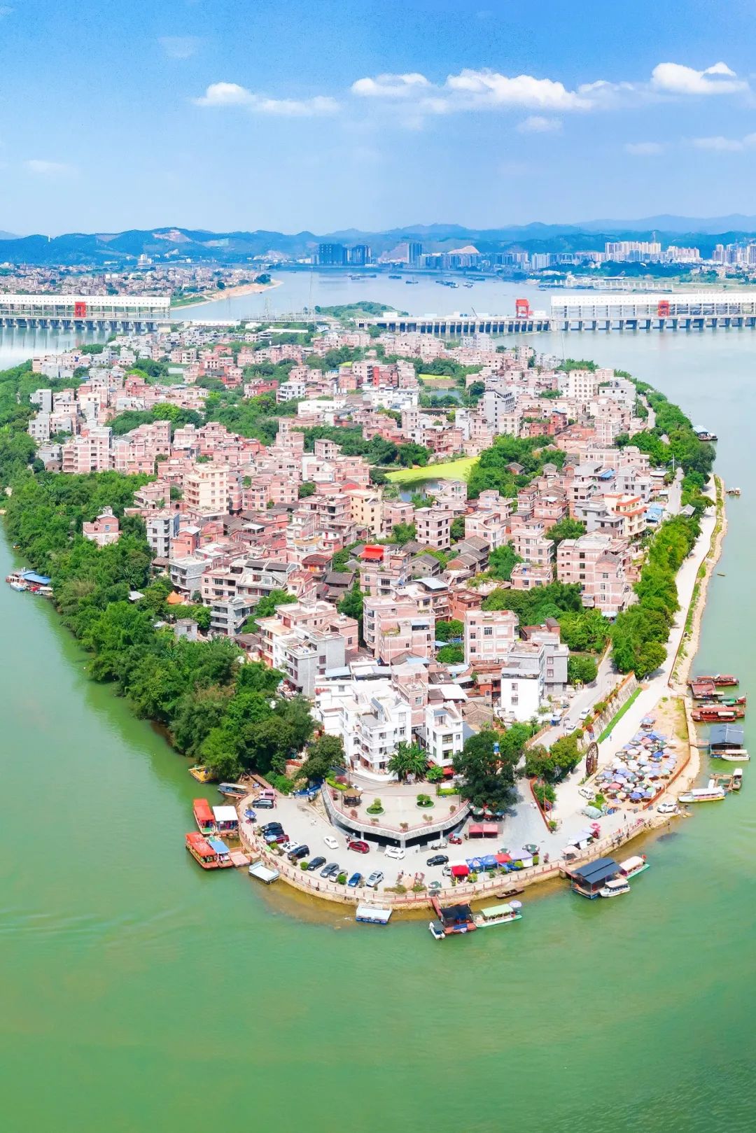
When Xijiang entered the plain area represented by Wuzhou, the two sides of the strait became more and more Guangdong. In fact, Guangxin near Wuzhou is the earliest birthplace of the Guangfu Min Department. These ancestors came to the Pearl River Delta with the West River water all the way to the east, and eventually developed into the Guangfu Min Department.
Guangxi Wuzhou Sizhou Island.
Photography/Lu Wen
The Beijiang originated in Xinfeng County, Ganzhou City, south of the river. The upstream area passed southern Hunan. It connected three provinces with huge cultural differences in the original cultural differences. Later, through Shaoguan, the Qingyuan remitted into the Pearl River. Danxia Mountain, which defines Danxia's landform, records the traces of flowing water erosion in the Beijiang Basin. Dongjiang originated from Xunwu County, Ganzhou City, Jiangxi Province, worn through the river source, and imported into the Pearl River via Huizhou.
Ganzhou, the source of Liangjiang, is an important source of Hakka culture and the first stop for the Hakkas to move south. The routes of the two rivers are the south routes of Guangdong immigrants. Among them, Shaoguan and Heyuan are important transit stations for immigrants. Along the coast of the rivers, the fence and tea gardens of the Hakkas were scattered, and the cultural heritage such as cat head lion, dance, and tea picking show were left. This affected Yingde is the famous black tea production area.
Streaming Guili Guicun Castle.
Witness of Hakka immigration history.
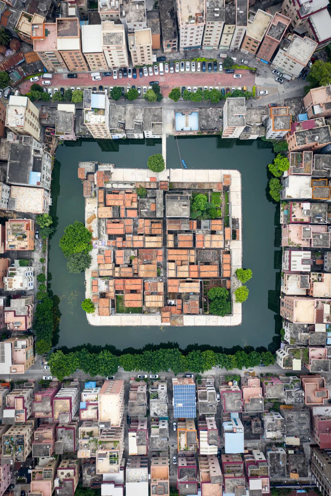
Photography/WYATT
The people from Guangfu lacked the ancestors from the Vietnamese ridge since the Tang and Song dynasties. Nanling blocked the exchanges between South China and the Central Plains, but generations of immigrants developed along the Pearl River, and recognized his hometown as their hometown, becoming a fresh blood for Lingnan.
This historical process has not yet ended. After graduating from college, a generation of Hunan and Jiangxi youths who have been thinking about it will still be in the direction of the Pearl River, trying to fight for their own world, but I don't know how many can stay here.
Guangzhou University Town, Kobayashi Island, surrounded by the Pearl River.
Photography/Zeng Mianxuan
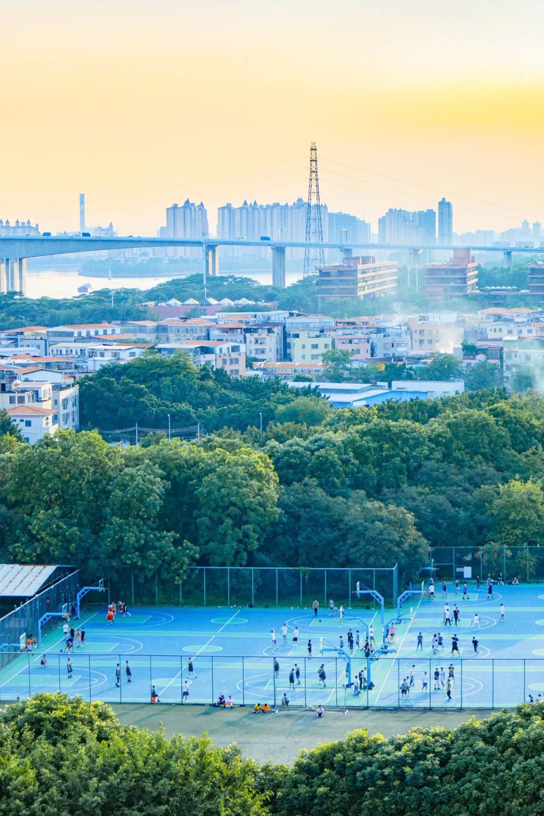
The Pearl River that originated from the mountains, the most wise and half China carved with the most beautiful and half of China, to accommodate a colorful life with the fertile river valley; it also connected the area where the original wind and horses were not good; ; Finally, the engine of China's economic development -the Guangdong -Hong Kong -Macao Greater Bay Area.
The Pearl River may be the lowest -key mother river in China, and the mother river that needs us to understand the most.
I sincerely wish that the people on both sides of the Pearl River in the flood can be safe and restore a colorful life as soon as possible.
The peaceful state of the Pearl River incorporates people's daily life,
The picture shows Xing'an Lingqu, which communicates the two major water systems of the Pearl River and the Yangtze River.
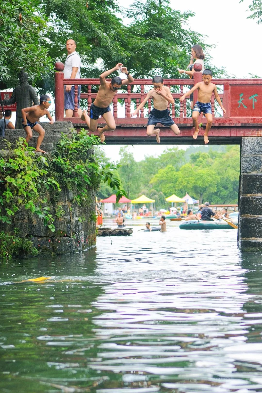
Photography/Lu Yu
Edit | Bi Humin
Picture Edit | Whale
Map Editor | Sun Lu
Covering Photography | Lu Wen
Headmap Photography | Lu Wen
Unablfeted picture source | Visual China
Bleak
Reference
"Authentic style · Guangxi"
"Authentic style · Southeast Guizhou"
Gu Xihui, Zhang Qiang, Liu Jianyu, Zhang Zhenghao. In the environmental environment, the characteristics, causes and influence of the flood frequency of the Pearl River Basin (1951-2010) [J]. Lake Science, 2014: 23-32.
This article is the original content of authentic style
Reprinting at randomly without account authorization
-NickName = "Authentic Wind" data-alias = "didaofengwu" data-signature = "Wind Wind Encyclopedia, see the difference between China every inch of land." Data-FROM = "2" Has-Insert-PRELOADING = "1"/> For "low -key mother river", click "Watch"!


- END -
The Gansu Provincial Department of Ecology and Environment organizes the study and implementation of the Sixth Plenary Session of the 19th Central Committee of the Communist Party of China and the spirit of the spirit of the 14th Party Congress of the Provincial Congress

In order to thoroughly study and implement the spirit of the Sixth Plenary Session...
Zhaoqing's golden signboard, the brighter it!

recently,Relying on the New Era Civilization Practice Center (office, station)Carr...