Notice!Although "Siam" has been stopped, the effect of rain is still not small!| Weather Outlook
Author:China Meteorological Administr Time:2022.07.04

Continue to follow
Typhoon Siaba No. 3 this year
this morning
"Siam" further weakened in the northeast of Guangxi
It is difficult to determine its circular center at present
The Central Meteorological Observatory stopped the number at 08:00 on the 4th
have to be aware of is
"Siaba" has stopped editing
But its residual circulation can also bring the South China Sea Water and Voices
Save sources are continuously transported to land
Made in a large range of heavy rainfall
Still need to pay attention to prevention
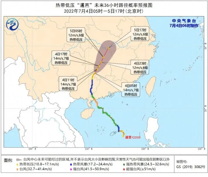
It is expected to be three days in the future
"Siaba" residual circulation is deep into the inland
Combined with Western Wind Tank
It will give more than ten provinces (districts and cities) in the central and eastern parts of my country)
Bring a wide range of rainfall
The rainfall in some areas can reach
Torrential rain or heavy rain level
Central Meteorological Observatory continues to issue heavy rain blue warnings
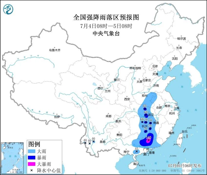
Affected by it
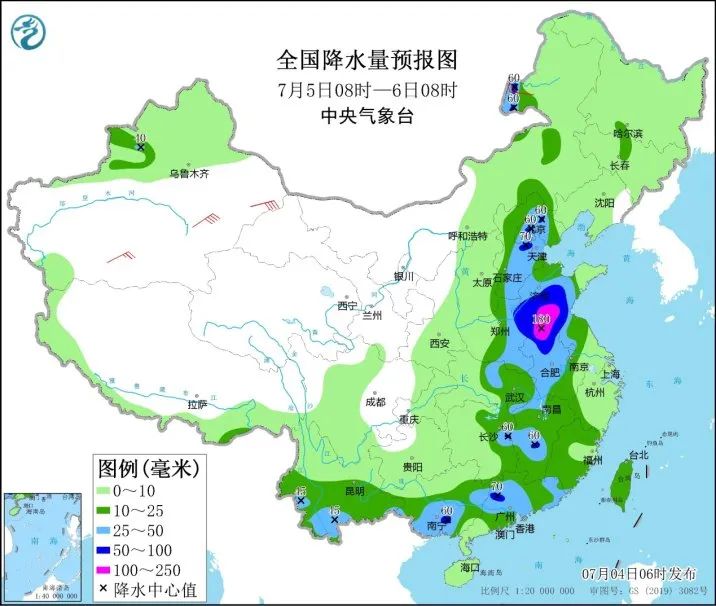
Today to night
Most of Guangdong, eastern Guangxi, and central Hunan
West and southern and central Hubei in the west of Jiangxi
There are large rainstorms in some areas in eastern Henan and other places
Among them, northern Guangdong and other areas
There are heavy rainstorms (100 to 140 mm)
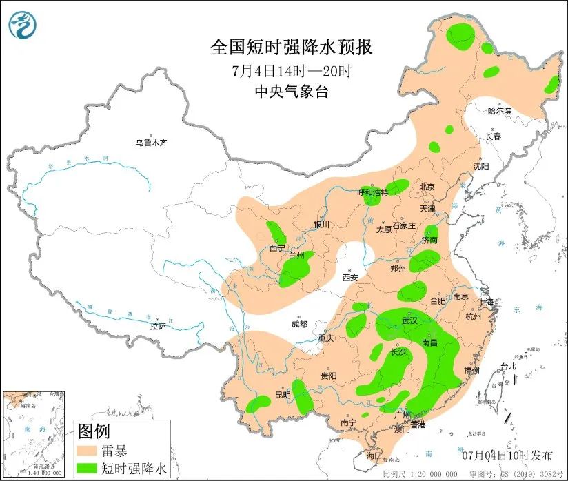
Some areas are accompanied by short -term heavy precipitation
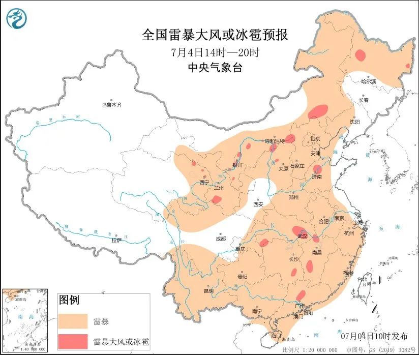
There are strong convective weather such as thunderstorms and wind winds
safety warning:
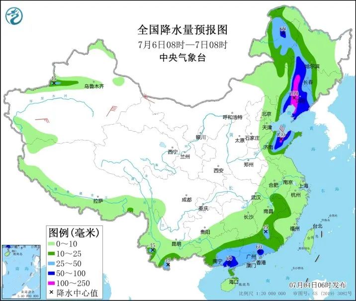
It is expected that "Siaba" will continue to north
Combine with the West Wind Tank
It brings significant rainfall to North China, Northeast China and other places
Cumulative rainfall in some areas
Pay attention to prevent urban waterlogging and floods
Mudstone flow, landslide and other secondary disasters
What is the weather trend in the future?
Display mid -term forecast display
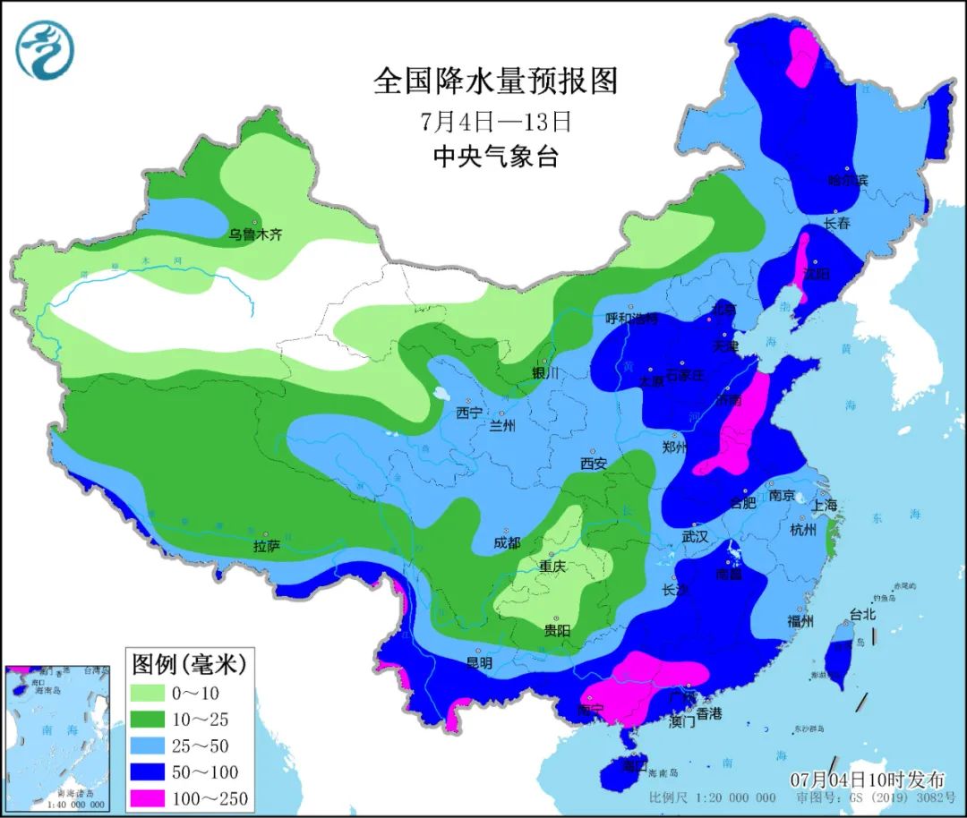
① Precipitation
In the next 10 days (July 4th to 13th)
Northeast, eastern North China, Huanghuai
South China and western Yunnan and South China
The cumulative rainfall is 40 to 80 mm
There are 90 to 150 mm in some areas
The precipitation in the above areas is more than the same period of the same year
Or close to perennial year
Most of the rest of our country have less precipitation
② high temperature
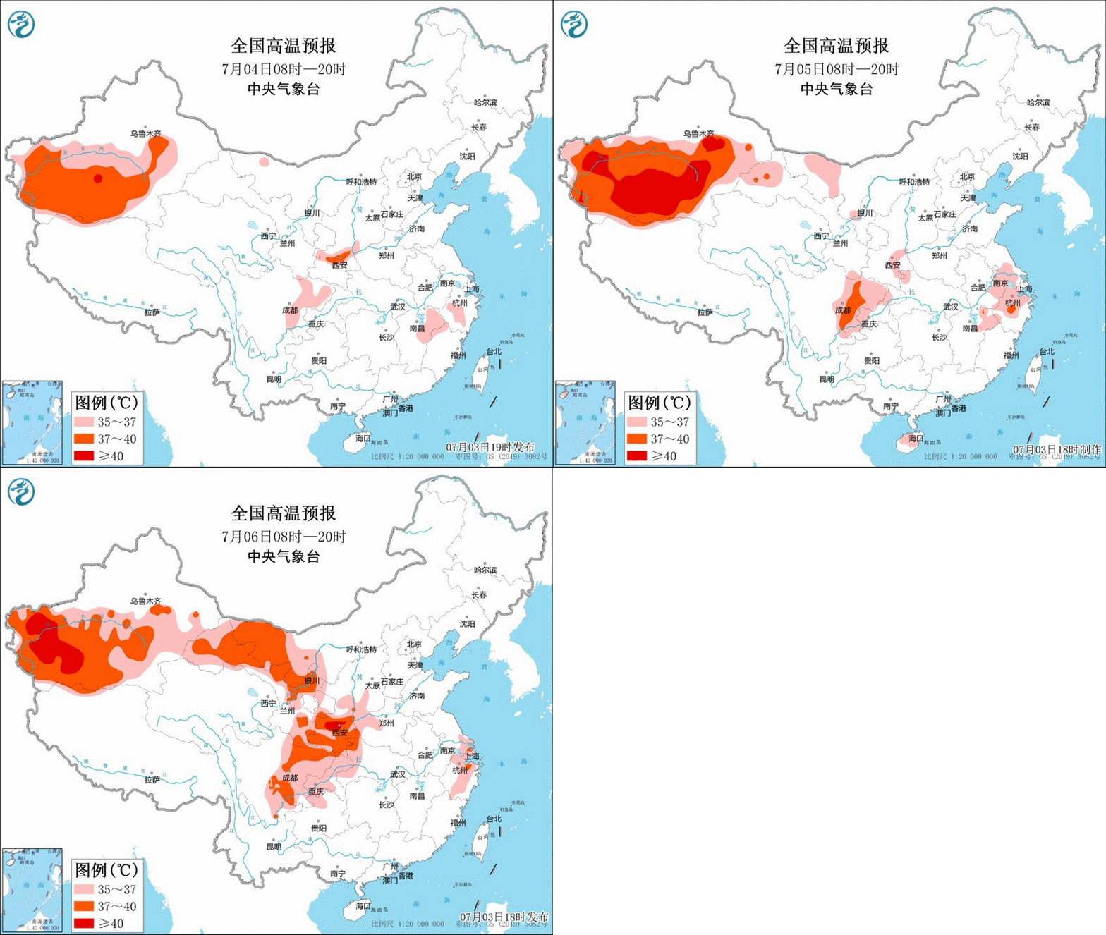
It is expected to be in the next 10 days
Central South Basin area
Western Inner Mongolia, Gansu, Ningxia
Shaanxi Guanzhong Plain, southern Hebei, Henan and other places
There will be 4 to 6 days of the highest temperature
High temperature weather exceeding 35 ° C
The maximum temperature in some areas can reach 37 to 39 ℃
Land 40 ℃
③ Typhoon
It is expected to be in the next 10 days
Tropical Northwest Pacific and South China Sea Sea
There may be one typhoon generated
It will not affect my country's offshore
Please pay attention to the weather forecast early warning in time
Pay attention to safety
Produced by China Meteorological Administration Xuanke Center (China Meteorological News Agency)
Reference materials: Central Meteorological Observatory
Edit: Wen Ge
Review: Cui Guohui

- END -
The second phase of Nanshan Pedicide Highway in the western part of Changji Prefecture opened to traffic
Changji Daily (all media reporter Yang He) On June 30, the second phase of Nanshan accompanying highway projects in the western part of Changji Prefecture was submitted and officially opened to traffi
Aba Prefecture hosts food safety training courses for religious activities

In accordance with the requirements of food safety party and government responsibi...