Three days and two rounds!There are heavy rains in Henan situation, pay attention to prevention
Author:Top news Time:2022.07.03

Since June 29
Strong convection weather becomes a veritable "C" position
Short -term heavy rainfall, thunderstorm, hail
Every day is "guerrilla war"
Localization and sudden characteristics are obvious
Weather
Since June 29, the province has frequently developed decentralized short -term heavy precipitation, thunderstorms, hail and other strong convection weather. The weaknesses have strong weaknesses, and heavy rain or heavy rains appear locally. Among them, from the afternoon of June 29th to the night, there are levels of thunderstorms above 10 or more in Xinyang, Zhumadian, Zhoukou, Pingdingshan and other places. Heavy rain above 100 millimeters, the smallest rain is 104.6 mm (Hongmen Hongmen, Hongqi District, Xinxiang). On the afternoon of July 1, the maximum diameter of 4 to 5 cm of hail appeared in Ruyang and Song County. From the afternoon of the 2nd to the morning of the 3rd, there were local heavy rains in the urban area of slippery counties, inner Huang, Junxian, Nanle, and Kaifeng.
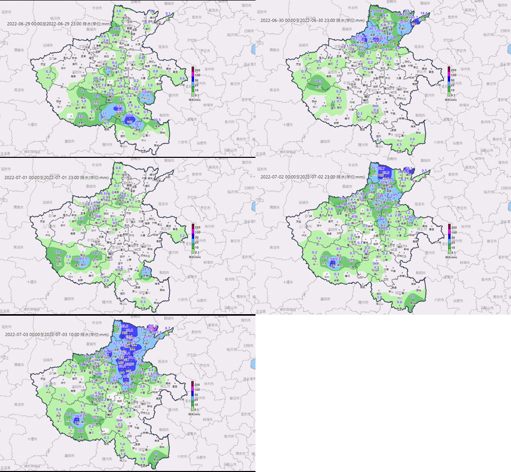
Rainfall
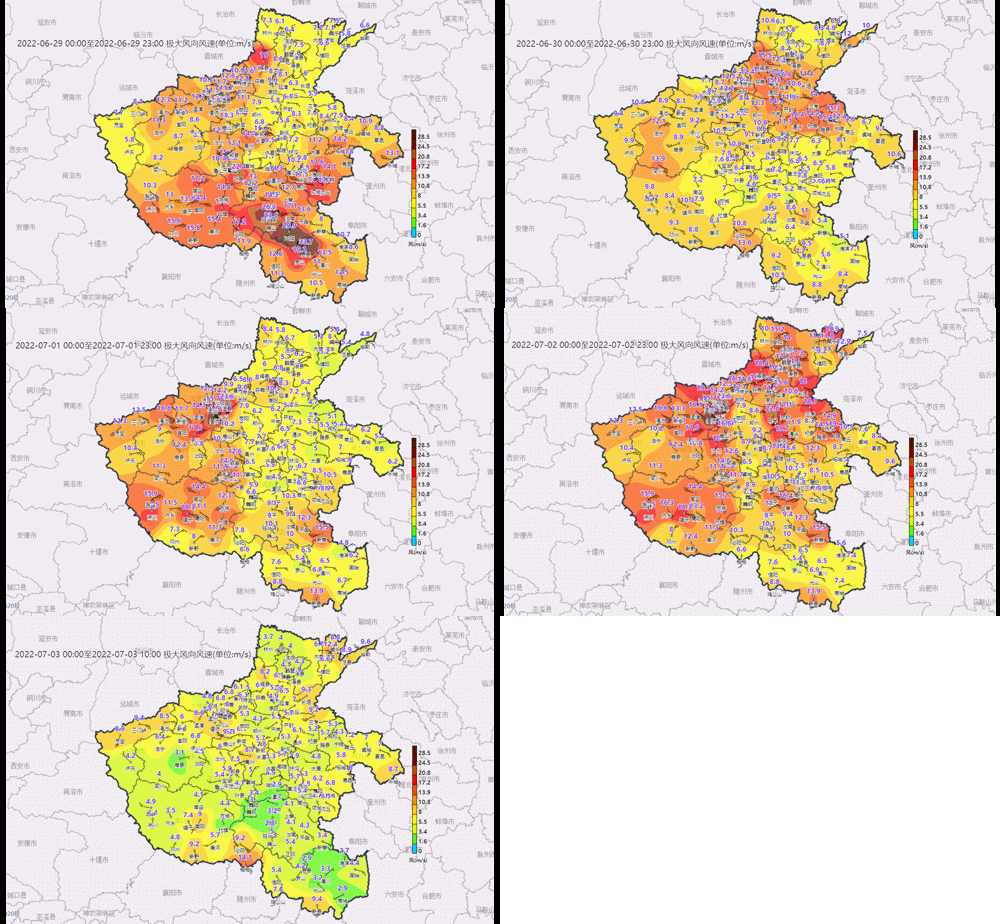
Strong wind
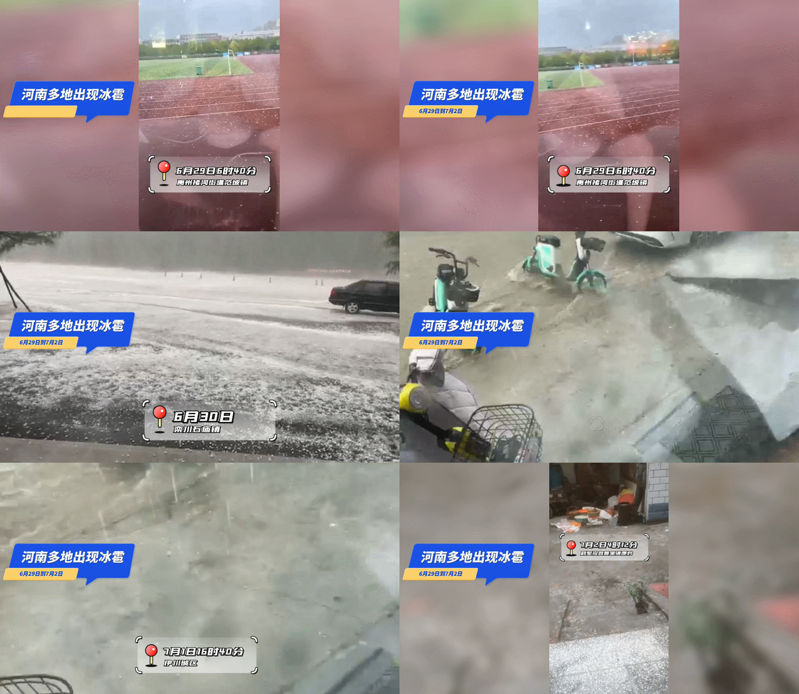
hail
(Click to zoom in above)
Three days in the future
Henan is still the weather of "rain and rain"
Divided into two stages:
The first stage: 3 days
Mainly on divergence rainfall
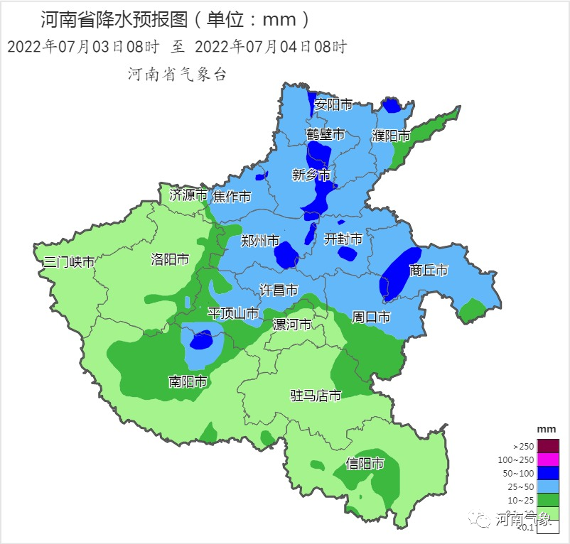
Strongly drop the rain fall area: central, east, and southwest
Meaning rainfall: heavy to heavy rain, local heavy rainstorm
(North of the Yellow River and Zhengzhou, Kaifeng, Shangqiu, Zhoukou, Xuchang,
Pingding Shanxi, northern Nanyang)
Key prevention:
Short -term heavy rainfall (the minimum hour rain is 50-80 mm)
Landmines (level 8 ~ 10)
Strong convection weather forecast
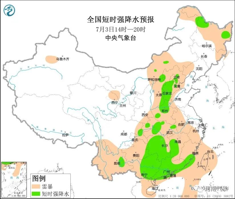
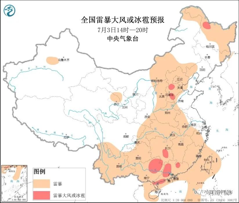
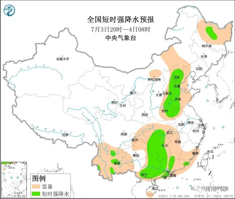
Second stage: 4-5 days
Strongly drop the rain fall area:
Affected by the low pressure of the typhoon
Strongly drop the rain and fall to the east to the east and southeast
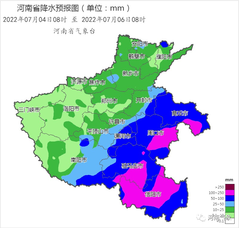
Meaning rainfall: heavy to heavy rain, local heavy rainstorm
(Shangqiu, Zhoukou, Luohe, Zhumadian, Xinyang, Kaifeng East,
Southern Xuchang, East Pingdingshan, eastern Nanyang))
Key prevention:
Short -term heavy rainfall (60-90 mm stronger rain stronger rain)
Landmines (level 8 ~ 10)
Weather impact prompt
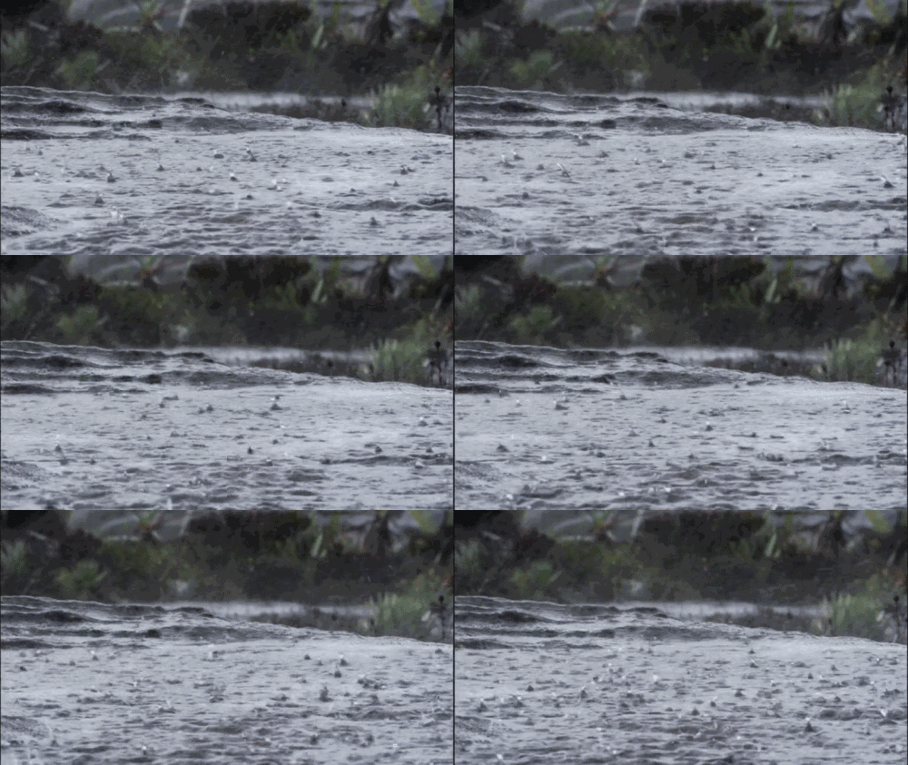
It is necessary to pay close attention to urban waterlogging, floods, geological disasters and small and medium -sized flood meteorological risks caused by the recent two -round precipitation process, and pay attention to the risk investigation of hidden dangers such as scenic spots and tailings.

Forecast source: Henan Meteorological Observatory on July 3, 2022 at 12:00 forecast
Weather forecast in the next week
This afternoon to night
From this afternoon to the night, most of the provinces have shower and thunderstorms. Among them, there are middle to some counties and cities in the Yellow River and Zhengzhou, Kaifeng, Xuchang, Zhoukou, Shangqiu, Pingdingshan, and some counties and cities in northern Nanyang. There are strong convective weather such as short -term heavy precipitation and thunderstorms.
Tomorrow -9th
Tomorrow day, the whole province is overcast, and most of them have shower and thunderstorms.
From tomorrow evening to the night, most of the provinces have shower and thunderstorms. Some counties and cities in the south will be as heavy as heavy rain, accompanied by short -term heavy precipitation, thunderstorms and other strong convective weather.
On the 5th, most of the provinces had shower and thunderstorms. There were heavy rains in the east and southeast.
On the 6th, the east and south were cloudy, and some counties and cities had shower and thunderstorms; other counties and cities were cloudy to sunny.
On the 7th to 8th, there are cloudy and decentralized rain and thunderstorms in the east and south; the sunny days in other counties and cities are cloudy. The maximum temperature of some counties and cities in the north will rise to above 37 ° C.
On the 9th, cloudy days in the northern and western clouds, some counties and cities had shower and thunderstorms; other counties and cities were cloudy, with local showers and thunderstorms.

Provincial capital Zhengzhou

From this afternoon to the night, there were small rainy days, with local heavy rain, accompanied by strong convection weather such as short -term heavy precipitation and thunderstorms. East wind 2 to 3. Tomorrow, there will be shower and thunder.
The highest temperature: 30 to 31 ° C; minimum temperature: 24 to 25 ° C.
On the 5th, there were showers and thunderstorms.
————————————————————————
Source: Henan Meteorological
- END -
Come on Tongwei!Nanshan Ecological Park glass boardwalk Observation platform takes you a different summer summer scenery
Recently, I went to Tongwei County Nanshan Park glass plank and viewing platform t...
Longjiang Entrepreneurship Innovation Competition: the trend of the waves and waves high

Innovative sparks, entrepreneurial opportunities are prominent. On July 7, the Fif...