"Siaba" will be vigilant to land in Guangdong's extreme continuous rainfall today!
Author:China Meteorological Administr Time:2022.07.02

This morning, the Central Meteorological Observatory was released at the same time
Typhoon orange warning and heavy rain yellow warning
Typhoon Siaba No. 3 this year
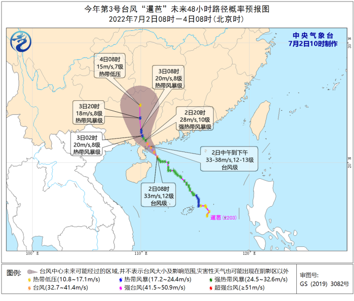
It has been strengthened into a typhoon level at 8 am this morning
"Siaba" will be around 15 kilometers per hour
Move north to the west
It's about to be from noon today to afternoon
Laying along the coast of Wuchuan in Yangxi, Guangdong
(Typhoon level, level 12-13, 33-38 meters/second)
After landing, it will gradually move northward to move
The intensity gradually weakened
Around the 4th, weakened and dissipated in Guangxi
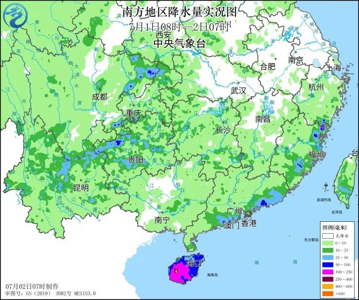
Yesterday, affected by the periphery of the "Siam", there have been large rainstorms in Hainan Island, the coast of southern Guangdong, and eastern Fujian. Millimeters; 7-9 gusts of gusts of 7-9 gusts on the coast of Guangdong and the coast of Hainan Island and 10-11 areas.

On July 1, in the face of the upcoming typhoon, the fishing boat of Hailing Island, Yangjiang City, Guangdong Province returned to Hong Kong to avoid wind/Zeng Bo
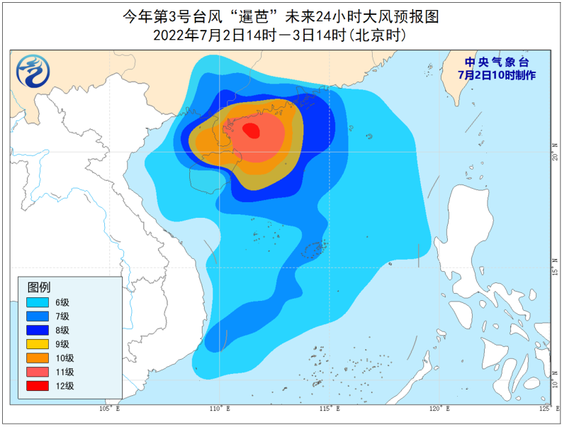
Dafeng forecast: It is expected that from 14:00 on July 2nd to 14:00, most of the South China Sea, the southern parts of the central and western Guangdong and the coast, the majority of Hainan Island, the southern part of Guangxi and the coast, the waters of the Xisha and the Zhongsha Islands The Bay and Qiongzhou Strait will have 6-8 strong winds, and the wind of some sea areas or regions will have 9-11 levels. The wind power of the nearby waters or regions passed by the Typhoon Center can reach level 12-13, and the gusts are 14-16.
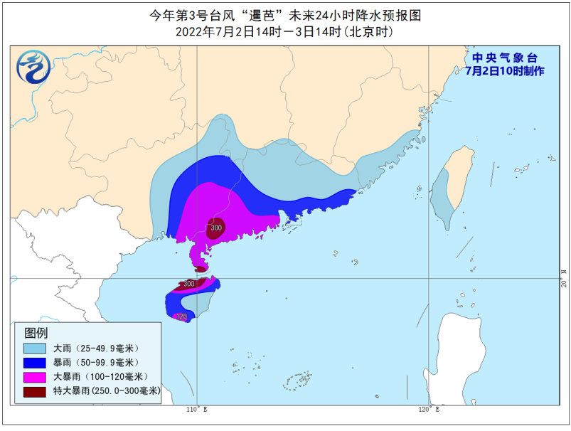
Precipitation forecast: From 14:00 on July 2nd to 14:00, most of Guangdong, the central and eastern Guangxi, Hainan Island, southeast Fujian, southern Hunan, and Taiwan Island will be as large as heavy rains. Among them, southwestern Guangdong, Guangxi, Guangxi, Guangxi There are heavy rains in the southeast, Hainan Island and other places, and there are heavy rainstorms (250-300 mm).

In the early July 2nd, under the influence of the typhoon "Siaba", the road tree collapsed by the road of Yangjiang City/Guo Zeyong
Defense guide:
1. Government and relevant departments do a good job of preventing typhoon rescue emergency in accordance with their duties.
2. Related water operations and past ships should return to the port to avoid wind, strengthen port facilities, and prevent the ship's anchor, stranding and collision.
3. Stop outdoor dangerous operations such as large -scale rally indoor and outdoor and high altitude.
4. Reinforcement or removal of the buildings that are easily blown by the wind. Do not go out at will. You should stay as safe as possible to ensure that the elderly and children stay at home the safest place, and dangerous house personnel transfer it in a timely manner. When the typhoon center passes through the time, the wind will decrease or stand still for a period of time. Remember that the strong wind will suddenly blow. It should continue to stay in a safe place to avoid wind and dangerous houses to transfer in time.
5. Related areas should pay attention to preventing mountain floods and geological disasters caused by precipitation.
How to avoid danger when typhoons come? Typhoon defense guidelines, please collect!
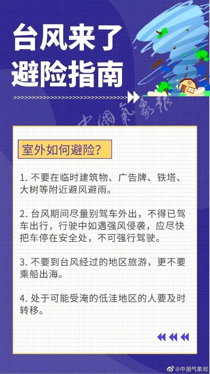
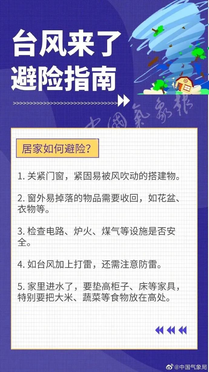
Produced by China Meteorological Administration Xuanke Center (China Meteorological News Agency)
Source: Central Meteorological Observatory
Edit: Daya Miao
Audit: Zhang Ge Miao

- END -
Fujian Zi'an: Deepen the "Four Zero" service and enhance the happiness of residents

In order to deeply implement the people -centered development ideas, further optim...
“家: Agricultural technical experts" move the pulse "to do the prevention and treatment of pests and insect pests after the rain
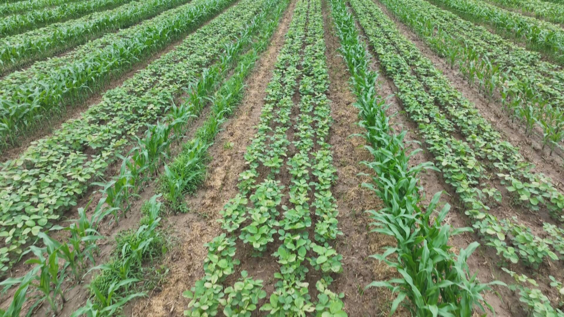
Recently, the Ping Ping District has encountered continuous heavy rainfall. After ...