In the next week, there will be more than a week in Henan, and strong convection weather will occur in June -August
Author:Mammoth video Time:2022.06.30
Elephant News reporter Wu Ziyi
Since 12 noon on June 29, most of the strong convective weather in Henan Province has the characteristics of strong convection intensity, a wide range of short -term precipitation range, and long time span. On June 30, Elephant Journalists learned from the Meteorological Bureau of Henan Province that 233 meteorological observation sites in 60 counties (cities, districts) in Henan Province appeared at level 8 or more. County Huji 41.6 meters/second (level 14). 63 counties (cities, districts) 204 stations appeared short-term precipitation with a small rain than 20 mm in 20 mm. The smallest rain appeared at 104.6 mm in Hongmen, Hongqi District, Xinxiang (01-02 on the 30th).

Wang Chao, director of the Science and Technology and Forecast Division of the Henan Provincial Meteorological Bureau, introduced that in June to August, Henan Province is prone to strong convection weather, and short -term heavy precipitation is produced.
In mid -June, the high -altitude cold vortex appeared frequently. The water vapor supply was mainly concentrated in the Jianghuai area, which was conducive to the occurrence of strong convective weather. The average vice -high high high in the Western Pacific occurred in the second half of July. The second quarterly northern jump was affected by the subtropical and tropical warm and humid air flow. In August, with the deputy high ridge line to the north, the short -wave slot activities were frequent, and the rainfall in North China and Northeast China entered a concentrated rainfall.
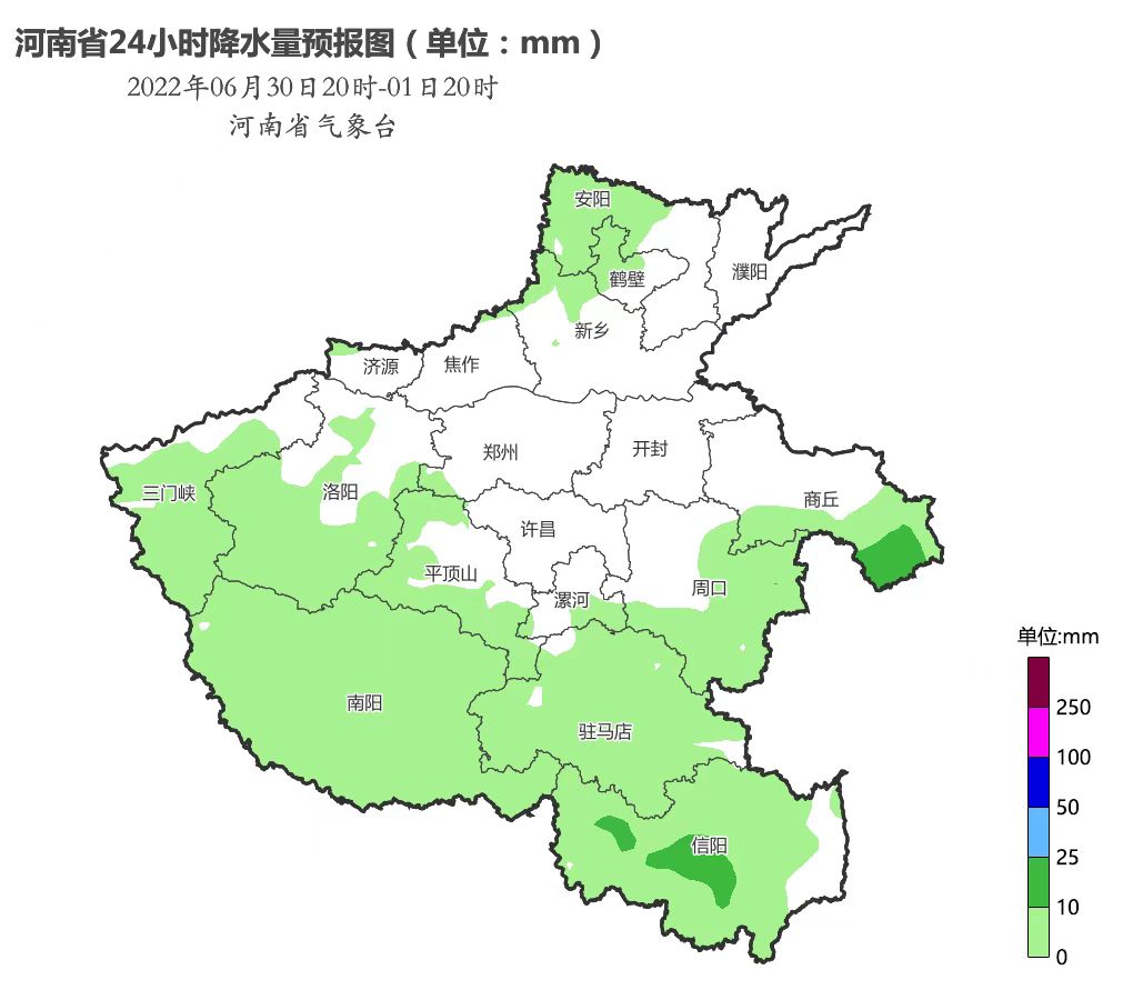
Elephant reporters learned from the Henan Provincial Meteorological Observatory that at present, there is still a new development of precipitation cloud groups in Anyang, Hebi, and Xinxiang. It is expected that there are still decentralized showers and thunderstorms in the north of Huaihe River in Henan Province. , And accompanied by thunderstorms, short -term precipitation, hail, etc.
In response to this round of strong convection weather, on the afternoon of June 29, Henan Province launched a major meteorological disaster (strong convection) level IV emergency response. In the next week, Henan will have many showers and thunderstorms.
Specific weather forecast:
On July 1, the province was cloudy, with decentralized showers and thunderstorms.
On July 2nd, the whole province was overcast, and most of them were as small as middle shower and thunderstorms.
On July 3rd, there were shower and thunderstorms in the province. There were mid -heavy rain in some counties and cities in the north and central and eastern parts, and there were some heavy rain.
On July 4th and 5th, the whole province had a shower and thunderstorms in most counties and cities.
On July 6, there were showers and thunderstorms in the central and eastern parts of the province, and there were mid -to -heavy rain in some counties and cities in the southeast; other counties and cities had partial shower.
- END -
The Meteorological Orange Early Warning of the Yingdong Yi Autonomous County Meteorological Orange E
Jingdong County Meteorological Observatory issued a heavy rain orange warning signal at 07:15 on June 8, 2022: In the past 2 hours, the rainfall in Black Snake Village, Dai Shao Town, Daizheng, Jingdo
Members of the united front of Neijiang Vocational and Technical College launched the "Big Study, Grand Training and Grand Investigation" activity

2022 is the year of the 20th National Congress of the Communist Party of China, an...