"The country needs is our research direction."
Author:China University of Geoscience Time:2022.06.29
One soil and a stone moved from the scene to the laboratory, and there was no difference in the eyes of others. In Tan Qinwen's eyes, there was a lot of difference.
Li Changdong is a professor of China University of Geosciences (Wuhan). He and Tan Qinwen are colleagues of the Geo, and are also members of Tang Huiming's scientific research team of Tang Huiming, chief professor of geological engineering. The subjects studied by Li Changdong and Tan Qinwen are called "geological disaster evolution mechanisms and prevention". Simply put, they hope to predict landslide geological disasters like a forecast of weather.
*1
Diamond deep mountains to eat pickles, wild monitoring for half a year
A few days ago, in a large mountain belly in Badong County, Hubei Province, in the 908 -meter deep tunnel group of artificial excavation, Tan Qinwen carefully cut the soil on the slope of a landslide to cut 0.5 meters × 0.5 meters × 1 meters of cubes and install it. Various instruments began to measure the stress structure of the soil. "One soil moves from the observation point to the laboratory. As soon as the environment changes, its stress structure is completely different. If you want to get a more realistic situation, you must observe it in situ." Say. Compared with laboratory observations, in -situ observation measures the objects in the most restored way.
Sliding soil in the original flow of the soil, the machine was opened for 24 hours, and the person kept away. Tan Qinwen and his companion monitored the 0.25 cubic meters of soil blocks for up to 180 days. At 7 o'clock in the morning, I took the morning and two meals of dried and pickled into the hole. The holes came out at 7 pm and caught a hot dinner. Their "in -situ observation" life was repeated.
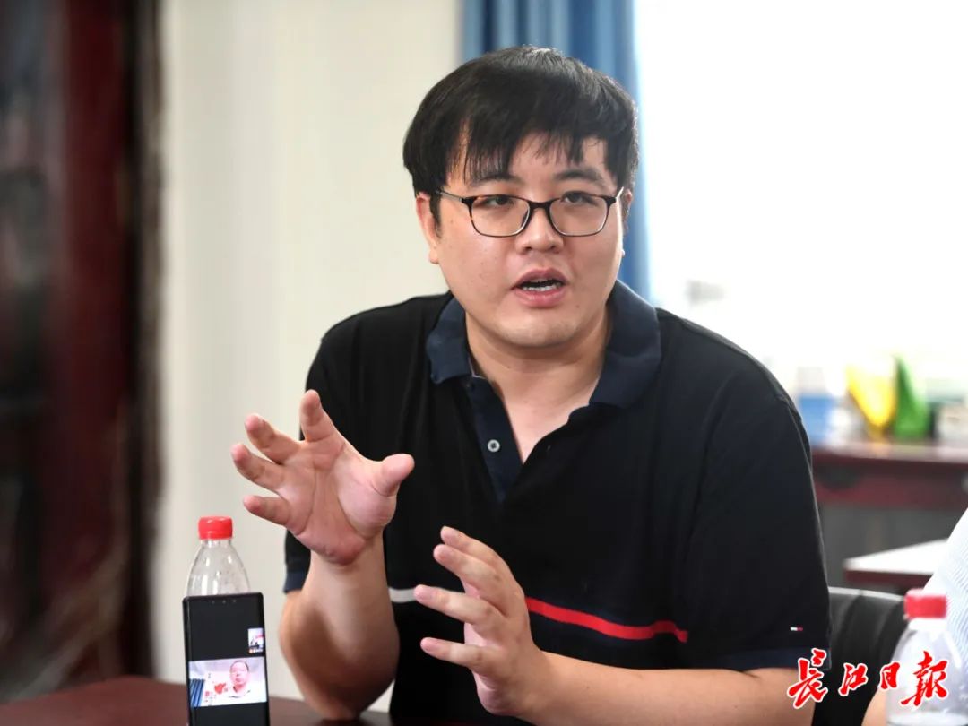
Associate Researcher Tan Qinwen tells the story of the on -site test of the Lado Landscape Tunnel Group of Badong. Photo by Gao Yong, a reporter from the Yangtze River Daily
This experimental site built in the landslide is the National Wild Scientific Outdoor Research Station, which was led by the China University of Geosciences (Wuhan). The ancient sloping slope — the landslide of the loess slope is also the only large field comprehensive “underground laboratory” in the world that focuses on landslide disasters.
With it, the four -dimensional observation of the four -dimensional three -dimensional observation of empty, heaven, earth, and underground for the geological disasters such as landslides; and the large difference between the in situ observation and the data of the laboratory also refreshed the human understanding of the most important geological disaster of the landslide. This is also the first time in the world to obtain relevant data through in -situ observation, which effectively expose the characteristics and structural characteristics of the original position of the soil, and provides important theoretical and data support for major landslide forecasting and forecasting.
Li Changdong said that to understand how to form a landslide disaster, you must go to the disaster. For the study of landslide disasters, it is very important and necessary to carry out the in -situ experiment in the ancient slippery slope. The precious first -hand data obtained. and". Relying on the observation conditions provided by the tunnel group, Tan Qinwen and others completed a number of complex experiments in the landslide and achieved many important scientific research results.
"In -situ observation is the original nature of we often say that we are out of the field. Our team members work in the wild for a long time, drill deep mountains, climb the steep slope, take cool heat, and eat pickles," Li Changdong said. "Fortunately Friends are also learning geology. She can understand it for half a year out of the wild. "
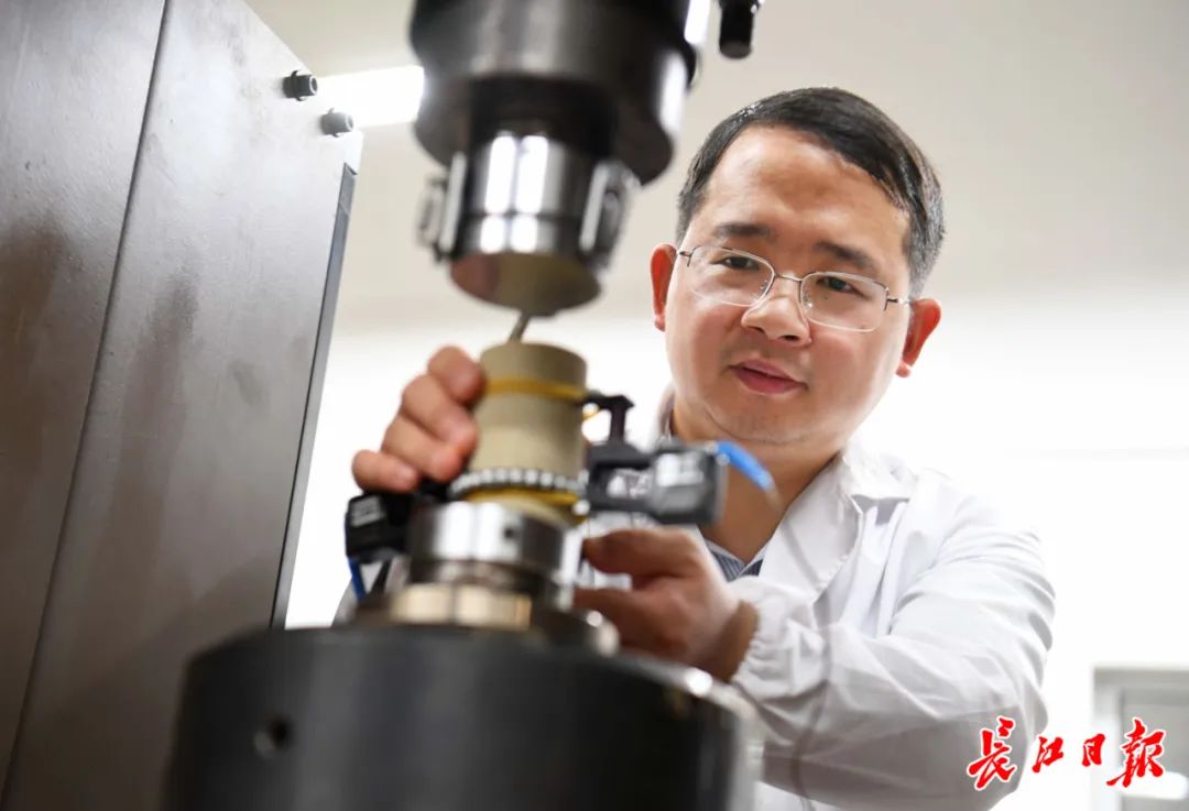
Professor Li Changdong conducts MTS test machine rock mechanics test. Photo by Gao Yong, a reporter from the Yangtze River Daily
*2
Others can study, China must study
Geological disaster predictions are a century -old problem in the past century. The geological structure is extremely complicated, and there are various factors that cause geological disasters. Therefore, the predictions of geological disasters in the past can only be roughly estimated based on historical experience.
"my country is one of the most serious geological disasters in the world, and none of them; Hubei Province is one of the most frequent and strong areas of geological disasters in my country." "In the annual geological disaster report released by China, the landslide disaster is the most important, accounting for more than 70%. Hubei Province's geological disasters threatened the population of 660,000 and threatened property of 49.4 billion yuan.
Tang Huiming is the chief professor of the Geological Engineering Discipline of China University of Geosciences (Wuhan). He has taken root in major landslide evolution and process control for more than 30 years. He is also the heads of the "landslide disaster evolution mechanism and governance" subject team. Li Changdong and Tan Qinwen are members of this team. The big team of dozens of teachers and students covers many discipline talents such as engineering geology, hydrology, mechanical and electrical, computer, etc. They use disciplines to cross -integration and are committed to organized large scientific research.
A rainstorm may cause a landslide and annihilate a village; a mountain movement may also cause a landslide, blocking the river channel, and breaking the highway and railway ... The most important thing to study geological disasters is to study the landslide. For most countries in the world, landslides are just a geological disaster; for a few countries, landslides are an imminent geological disaster. China is one of these minority countries. Others can study landslides, and China must study landslides.
"We have witnessed too many landslides. As researchers, we are very heartbroken and anxious." Tang Huiming said that with the implementation of my country's major strategy, the contradictions between engineering activities and geological environment are becoming increasingly prominent. It is important to prevent control and extremely urgent. "
In addition to being limited by technical means, it is difficult for humans to predict and forecast the landslides. It is not that it has not fully found the laws of landslide and the mechanism of landslide formation. Starting from the most basic landslide mechanism, Tang Huiming was required to start from the most difficult place at the beginning. "This is a very difficult research. We have encountered bottlenecks many times, but there are often difficulties, but I have never lost confidence. Our goal is clear: if you do n’t do it, do it as well as the world. First! "In order to collect data, they did monitoring tools such as sensing unit chips, manufacturing sensors, etc., and independently developed a set of landslides multiple associated monitoring systems, using satellite remote sensing, drone shooting, multiple sensor monitoring and other modern technology Means, three -dimensional tracking of many evolutionary characteristics of the landslide.
"Various data is clear at a glance." Li Changdong pointed at a laptop and said that the computer's screen was constantly refreshing the data from a monitoring system far away from Zhejiang. Will be marked automatically. "
With massive data, they started modeling, analyzed the mechanism, and classified the mechanism of landslides again. "There are many teams studying landslide forecasting all over the world, but landslide prediction research based on physical mechanical processes is our characteristics and innovation. it is good."
They re -divided the landslide into three categories with the opening process of the occurrence, and studied the corresponding opening sliding mechanism according to each type of mechanism. "Don't look at the simple classification, it means that our understanding of landslides has entered a brand new state." Tang Huiming, who was full of energy.
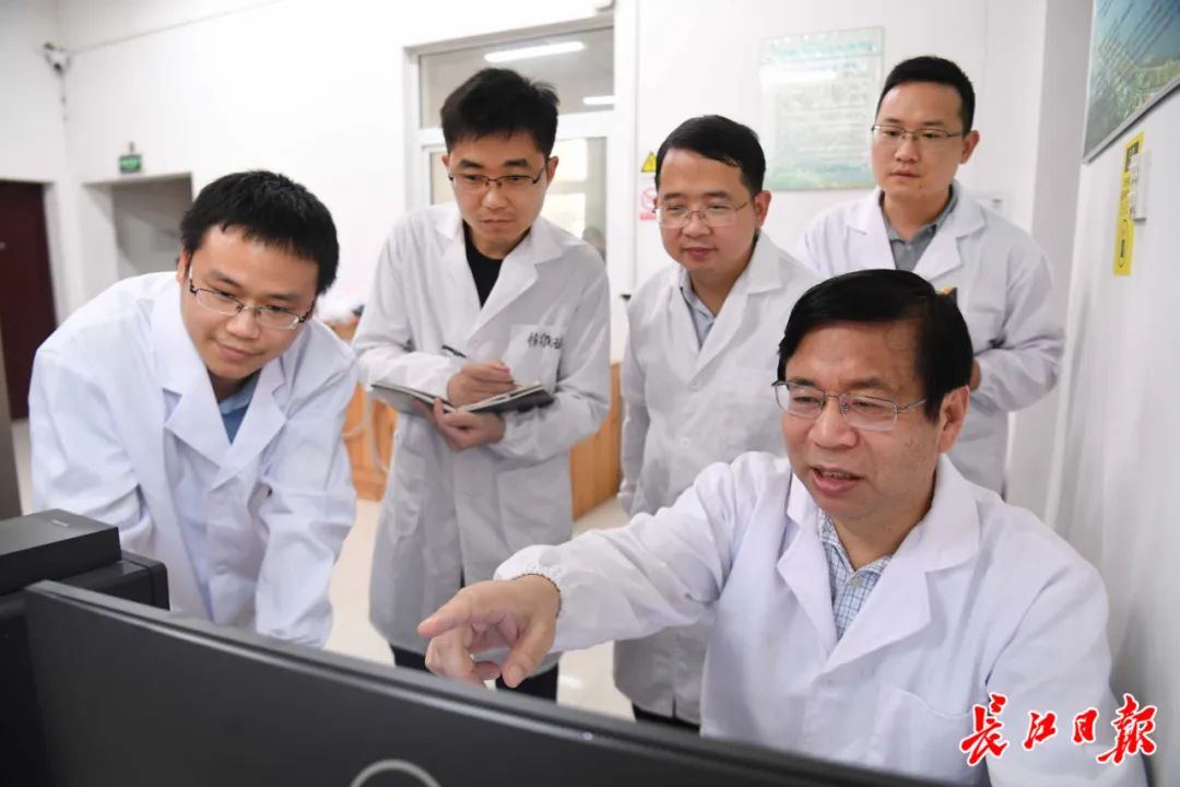
Professor Tang Huiming guides the processing data processing data. Photo by Gao Yong, a reporter from the Yangtze River Daily
*3
The efforts of the five generations
Li Changdong told a prediction story: more than ten years ago, they monitored the high -side slope on the spot in Badong and found that some data changes were fierce. In the mechanism, the landslide entered a period of rapid development. They quickly contacted the local government and submitted an emergency plan. The local government quickly adopted and promptly reinforced the slope body, which successfully avoided the occurrence of landslide disasters.
From predicting the landslide, to the landslide, it did not occur, just like doctors cure diseases, not diseased rather than disease. "I think our prediction is not to verify how accurate it has happened, but not letting it happen. The disaster is invisible. The earlier the forecast, the smaller the loss." Li Changdong said.
Since the establishment of China University of Geosciences in 1952, the study of geological disasters has continued to this day. China University of Geosciences moved from Beijing to Wuhan, and this discipline has been completely moved to Wuhan. Tang Huiming had a little bit, and Professor Yan Tongzhen, the founder of the Grand Geological Discipline, has now been inherited for the five generations of landslides. For decades, from the long -term field observation data accumulated by the older generation to the data collected by high -end instruments today, Tang Huiming said that the prediction and prevention of the landslide disaster are the desires and efforts of several generations.
Tan Qinwen's colleague Gong Wenping was born in 1989. He is currently a professor and doctoral supervisor of the School of Engineering. He is also the young backbone of the landslide geological disaster research team. He had to obtain a doctoral degree in the United States for less than two and a half years and stayed in school to teach, but he resolutely gave up his overseas superior conditions to return to China because he was determined to report to the country, and he devoted himself to the disaster prevention and reduction of geological disasters and talent training of geological disasters.
"I am in the northeast mountainous area of Sichuan, and I know the harmfulness of geological disasters since childhood." In May 12, the Wenchuan earthquake induced a large number of secondary geological disasters. Disaster research.
After coming to the Earth University, in order to obtain the key scene data of geological disasters, he overcome difficulties, turning over the mountains, often eating and living in the wild, and traveled to Hubei, Sichuan, Chongqing, Guizhou, Yunnan and other high -incidence areas. The original scientific research results.
Like Gong Wenping, in the past ten years, the Master of the Earth Masters has taken turns to station for a long time, providing basic long -term observation materials for the prevention and control of geological disasters in the Three Gorges Reservoir, especially the prevention and control of landslides. Today, their scientific research results have been widely used in large projects such as the Three Gorges Reservoir, Baihetan Hydropower Station, and Sichuan -Tibet Railway. "The country needs is our research direction." Gong Wenping said.
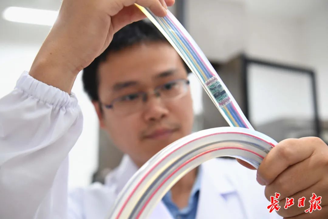
Associate researcher Zhang Yongquan showed the independently developed landslide large deformed flexible diagonalist sensor unit. Photo by Gao Yong, a reporter from the Yangtze River Daily
Source | Changjiang Daily
Wen | Chen Xiaotong Wei Haiyong Wang Junfang
Picture | Gao Yong
WeChat Edit | Cheng Xiaolong
Review | Wei Haiyong Wang Junfang
- END -
The environmental value behind "one net"
As a province and cities that develop agricultural film recycling earlier nationwi...
Summer ink pen draws a fresh dragon

The intersection of rain dew and sunlight draws a colorful and fresh dragon. Explo...