How does this round of rain develop?What impact will it bring?Expert analysis
Author:Changjiang Daily Time:2022.06.26
According to the forecast, this round of rainfall will be the strongest rainfall process since the flood in the northern region this year. At present, the northern region has not yet entered the main flood season. In June, such a large range of heavy rainfall weather is relatively rare. How does this round of rain develop? Which places are more rainy? What impact will it bring? Come to listen to the introduction of the Central Meteorological Observatory experts.
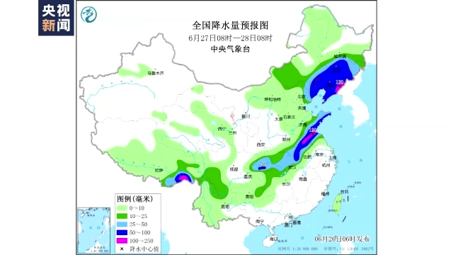
Yu Chao, chief forecast at the Central Meteorological Observatory: This time the precipitation was developed from west to east. On the 26th, precipitation was mainly concentrated in southeast Shaanxi, eastern and southern Sichuan Basin, and northwest of Hubei, Henan, Shandong, eastern Tianjin, Tianjin, Tianjin, Tianjin In eastern Beijing, central and southern Liaoning, there will generally have heavy rain in these areas, like the eastern part of Henan, and heavy rain in Shandong. The rainfall is generally 50 to 70 mm, and the local area may reach 100 to 150 mm.

Yu Chao, chief forecast at the Central Meteorological Observatory: On the 27th, precipitation was mainly concentrated in Liaoning, the central and eastern Jilin, and southern Shandong and northern Jiangsu and Anhui. These areas will also occur to heavy rains. Some adverse effects of urban operation guarantee and epidemic prevention and control.
Cold and cold air brings a large range of rainfall in the northern intersection

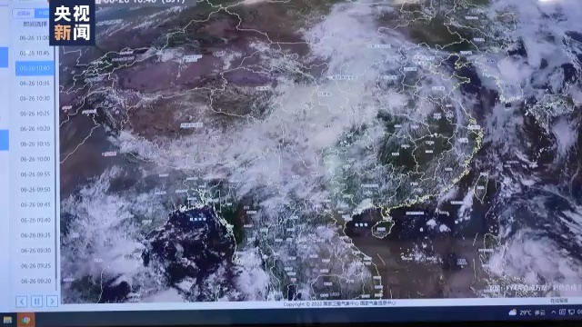
Yu Chao, chief forecaster of the Central Meteorological Observatory: This precipitation process can be said to be the strongest precipitation process in the northern region since the flood this year, and the cumulative precipitation in some areas may exceed the extreme value of the same period of history. We know that the main precipitation period in the north is from mid -to -late July to early August. This precipitation time is slightly earlier than the historically North China, including the main precipitation period in the Northeast. The main reason is that this time the Western Pacific subtropical high pressure has a process of retreating eastward and retreated to the sea. At the same time, the southwest monsoon of the South China Sea also carried a sufficient southwest heating and humidity flow, which has been delivered to the north to the north. In addition, the northern region is at the bottom of the cold vortex in the northeast. It caused a large -scale process of precipitation.
The high temperature in the central and eastern parts in the next week is significantly relieved

Yu Chao, chief forecast at the Central Meteorological Observatory: This time, there will be a clear relief for the early high temperature in the early stage. It is expected that in the next week, there will be no large -scale high temperature weather in the middle and eastern regions, but some areas of Huanghuai and Jiangnan may occur. Intermittent, the maximum temperature may reach 32 to 35 degrees Celsius.
(Source: CCTV News Client)
【Edit: Yao Hao】
- END -
The Sichuan Fire Mountain Rescue Team gathered in Emei's "Friends of Martial Arts"

From June 16th to 17th, the Sichuan Provincial Fire Rescue Corps held the first Go...
"Announcement Supermarket" in Zhanhua created a new service model for the demand subject
Recently, the person in charge of the project of the Development and Reform Bureau of Zhanhua District, the telephone consultation, how to select intermediary agencies for the Complete Pedist of the