National Park Forum 丨 Shen Yongping, a researcher at the Northwest Ecological Environment Resources Research Institute of the Chinese Academy of Sciences: "Each glacier has its own personality"
Author:Red Star News Time:2022.09.26
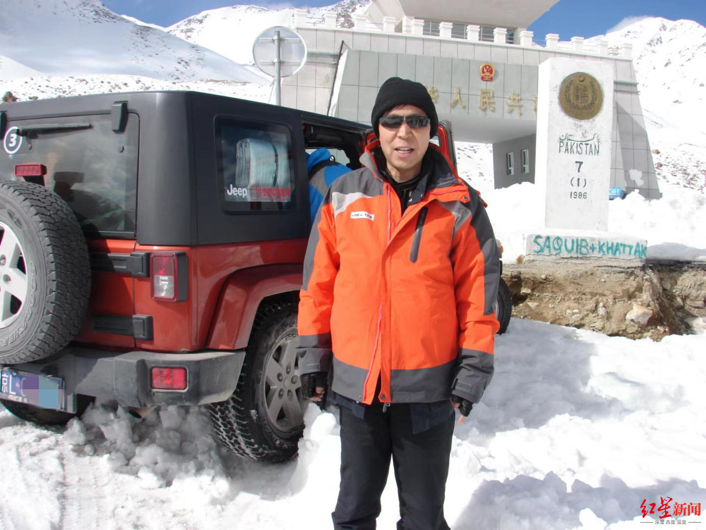
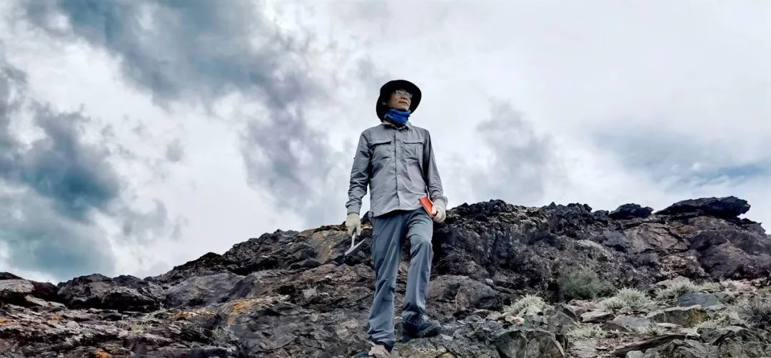
↑ Shen Yongping, who is conducting glaciers in the wild
Red Star News reporter 丨 Cai Xiaoyi
Responsible editor 丨 Editor Deng Yiguang 丨 Pengjiang
The Sanjiang source is located in the "third pole" Qinghai -Tibet Plateau hinterland in the world. It is known as the "China Water Tower" and is the birthplace of the Yangtze River, the Yellow River, and Lancang River. Here, the snowfield is vast, and there are many glaciers wetlands. It is a sensitive area and an important startup area for global wetland climate change. It is also a meteorological whistle for climate change, which has an important role in resisting global warming.
On the top of the glacier, a group of glaciers frozen researchers were active. They went deep into the front line all year round and obtained valuable data for the study of the altitude frozen circle. Since 1984, Shen Yongping, a researcher at the Northwest Ecological Environmental Resources Research Institute of the Chinese Academy of Sciences, has conducted glacier scientific examinations in the Qinghai -Tibet Plateau. In the past 40 years, he has witnessed the changes in glaciers and environment in the Sanjiangyuan area, and also witnessed the strengthening of the ecological protection of the China Water Tower step by step. Red Star reporter interviewed Shen Yongping. The following is a conversation with his interview.
Plateau complex:
Every time I go to the glacier, it's like going home
Tie into the Qinghai -Tibet Plateau for scientific examinations
Red Star News: Why do you choose glacier research as your life?
Shen Yongping: I am from Shaanxi and grew up in the countryside. After graduating from high school, affected by the uncle as a geological player, I secretly fell in love with work in the wild. After the college entrance examination in 1978, I did not want to fill in the Academy of Geological. During the college graduation internship, I watched a movie documentary about the Sino -German -Tibetan Plateau Glacier Scientific Examination, which was fascinated by the glacier.
The first time I went to the Qinghai -Tibet Plateau to do the glacier scientific examination in 1984, when I was still a graduate student in the Chinese Academy of Sciences. In the wild surgery test, I really understood what is ice and snow and frozen soil science. I wrote in the scientific examination notes, "The glaciers in imagination are indeed different from the real glacier. Stepping through the difficulty, I am in the glacier, live in the glacier, and truly understand its meaning and function. You You will like the Qinghai -Tibet Plateau, and you have the plateau complex. "
The frozen soil in the Qinghai -Tibet Plateau is like a mattress on the plateau land. On the surface, the river lakes, wetland swamps, and grassland meadows are like flowers covered on the ground. It is difficult for you to think that under this flower quilt, a hard frozen soil layer is its mattress, which gives the earth flowers a hard support, so that the landscape on the surface of the earth is so dazzling and colorful.
Maybe many people think that the ice frozen soil is sleepy and cold, but in my eyes, nature is fair and magical. The seemingly stiff years of frozen soil and glaciers are the source of living water of the Greater River, which enables the Sanjiangyuan area of the Qinghai -Tibet Plateau to win the reputation of the "China Water Tower". Every time I go to the iceberg, my mood is always peaceful, just like returning home.
Red Star News: The Qinghai -Tibet Plateau froze, extremely hypoxia. Have you encountered danger during the scientific examination?
Shen Yongping: In 1998, I have entered the Lanzhou Glacier Frozen Research Institute of the Chinese Academy of Sciences. At that time, our scientific test team left from Lanzhou in early April to prepare to perform scientific experiments in the Qinghai -Tibet Plateau. Along the way, the Qinghai Lake and the Chaidama Basin arrived at Gelima, and then went to the west beach at an altitude of more than 4,000 meters. In the deserted west beach, we have adopted the test of life and death. In the cold cold, we don't pay attention to we are young, we don't pay attention to sleeping and eating. I did n’t get dysentery, and I pulled dysentery seven or eight times in half a day.
According to the plan, the inspection team will set off to the side of the Langhe River at the source of the Yangtze River the next day. In order not to lose precious investigation opportunities, I can only go down the mountain to more than 100 kilometers away from the city of Golmud for infusion treatment that day. After lying at Gelmud Hospital for a long time, I was anxious to return to the West Dalin Base Camp and the big team. The doctor was in a hurry and said that I was dead. In the end, I still carried a pack of medicine on the plateau glacier.
In fact, at that time, in order to obtain more observation data, many scientific research players were so lifey. In that year for five consecutive months, we tied on the northern Tibetan Plateau in the Qinghai -Tibet Plateau. From the Kunlun Mountain in the north, the Nianqing Tanggula Mountain was measured along the Qinghai -Tibet Highway to observe the water and temperature of frozen soil within 1,000 kilometers. Make hydrological measurement, remote sensing field measurement, etc.
global warming:
Glacier cloid found that the overall retreat
Rongshui "increase first, then decrease", or the inflection point may appear
Red Star News: The decades of your inspection of glaciers are decades that have developed rapidly in the field of glacial research in my country. What is the glacier overview of the entire Qinghai -Tibet Plateau?
Shen Yongping: Our scientific research found that with the warming of global climate, the overall glacier of the Qinghai -Tibet Plateau is actually shrinking. In the 1970s and 1980s, Shi Yafeng, the director of the Lanzhou Frozen Earth Institute of the Chinese Academy of Sciences, led a group. The first glacier catalog in China passed the data to register each glacier in China through artificial methods and satellite images and topographic maps. Each glaciers include more than 20 parameters, such as eloquisite, high, length, width, area, slope and other geographical parameters. This initially records the "household registration" of glaciers.
China is the country with the largest glacier area of mid- and low latitudes. It is the core glacier distribution area of Asia. The total glacier area accounts for more than 50%of the Asian alpine areas. my country ’s investigation and catalogs on glaciers are a significant basic work for my country and the world.
Later, the Ministry of Science and Technology launched a base survey of glaciers. It mainly surveyed most glaciers through satellite images. In 2014, the second glacier catalog was released. my country has also become the first country for the first glacier category. In this survey, people found that China's glaciers have shrunk by about 18%. Today, nearly 20%of China's glaciers have disappeared. We clearly felt during the scientific examination that some small glaciers on the aerial maps were disappeared when we went to investigate.
Red Star News: Sanjiangyuan supply nearly 60 billion cubic meters of water to the middle and lower reaches of 3 rivers each year, providing 25%of the total water volume of the Yangtze River, 49%of the total water of the Yellow River, and 15%of the total water volume of the Lancang River, which provides nearly 800 million people in my country. The source of life. With the warming of global climate in recent years, what impact of the retreat of glaciers will have on downstream water resources?
Shen Yongping: Glacier, frozen soil, and lakes widely distributed in the Sanjiang Yuanliu District are natural reservoirs, which have ecological service functions that storage and regulating river flow. Glacier, frozen soil and snow melting water are important sources of riverside runoff supply. Climate warming causes glaciers to reduce the degeneration of frozen soil. As a result, changes in the runoff of the river will spread downward, affecting water supply safety, flood prevention safety, and flood prevention safety in downstream areas. Ecological safety.
The water sources of the Dajiang River such as the Yangtze River, the Yellow River, and the Lancang River mostly come from the melting water of the frozen circle. The snowy mountains and glaciers in the Sanjiang source area are about 2,400 square kilometers. Among them, the glacier area is 1812 square kilometers, and the value of glacier resources reaches 200 billion cubic cubic cubic cubic cubic cubic cubic meters. Meter. We know that glaciers are a "solid reservoir", which plays an important supplement and regulation role in riverside runoff. In the Sanjiangyuan area, the amount of water melting of glaciers accounted for about 12%of the average annual runoff of the Yangtze River, accounting for about 2%of the annual runoff of the Yellow River. Essence
Due to global warming, glaciers are exacerbated, and the rapid changes in frozen rings will lead to changes in the runoff of the basin. The inflection point of "increased first and then decrease" in glaciers has already appeared or is about to appear in the Sanjiangyuan area. In the future, the melting water of glaciers will be significantly reduced, which will lead to some rivers with small rivers and glaciers as the main supply, the underwriting of the downstream river runoffs is obvious, and the local floods and drought disasters will intensify. A regional water crisis may occur.
It is more obvious that after the melting of glaciers, the distribution of downstream river runoffs has changed during the year, increasing the risk of flood disasters during the flood season and the lack of water in the dry season. Many herdsmen reported to us that many rivers have found that the rivers have dried up due to lack of water, affecting the grassland and grazing. The principle is that with the changes in climate, the snow may only be merged in June and July before, and now it has begun to become in April and May. However, when the snow melts in April and May, the grass in the grass field has not grown, and the melting water can only flow away in vain, which can easily cause the downstream spring snow and floods. When the grass grows in June, the water melting water has been finished, which will cause snow melting, which will cause snow melting. Time is not matched with vegetation growth season, and vegetation is short of water.
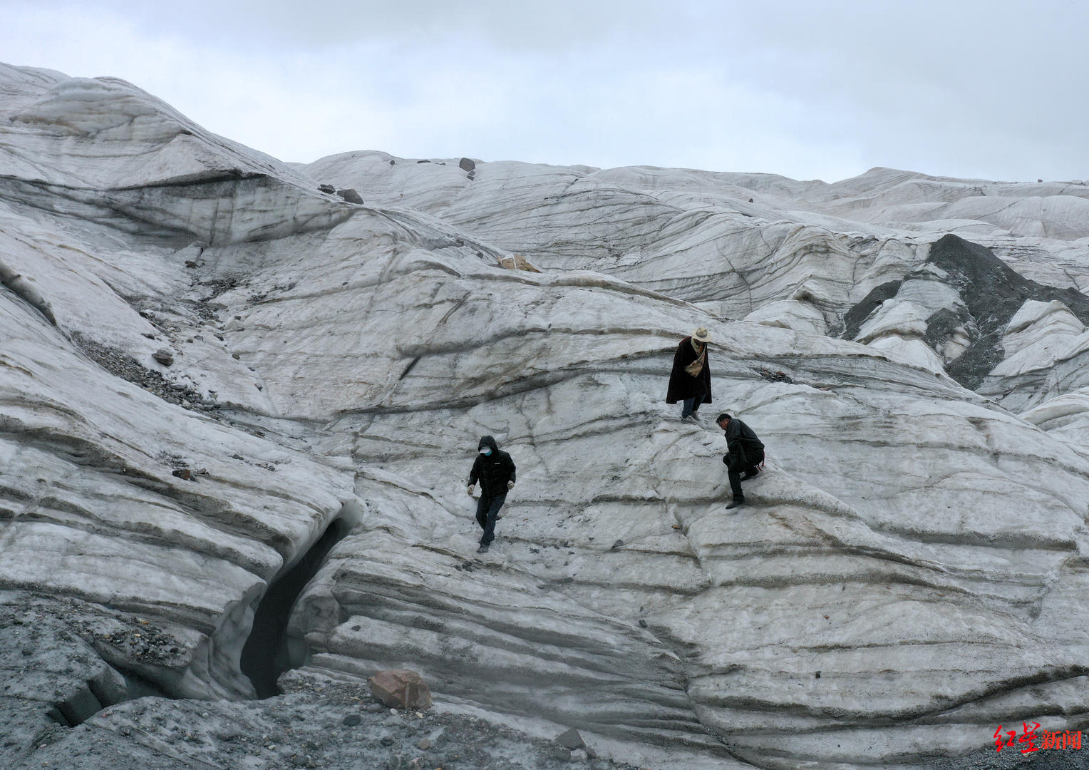
↑ Yinke Village Herders spontaneously conduct a snow line inspection.
Glacier disaster:
Bing collapse may become a normal disaster
Difficulty on site monitoring
Red Star News: In recent years, the global ice and snow disaster, including the Qinghai -Tibet Plateau, seems to be more and more frequent. How can this affect our lives?
Shen Yongping: Overall, after strengthening ecological protection in recent years, basically the ecological recovery of grassland and water resources is high. However, global climate changes are still strengthening, and glacier disaster risks have intensified. Common disasters include ice collapse, glacier leaps, and ice lake collapse.
The global frozen circle is in a hurry. For example, a large -scale snow disaster occurs in the Yangtze River source and Huangheyuan every few years, killing millions of livestock and other ecological and economic sources in the snow disaster incident, which has a devastating impact on the livelihood of herders. Even threatening their lives. Most of the Qinghai -Tibet Plateau is in the frozen soil area for many years, and the frozen soil as the lower part of the surface can effectively store the moisture required for the growth of plant growth. It may be only 70 to 80 cm underground frozen soil each year. , Even some frozen soil disappeared directly.
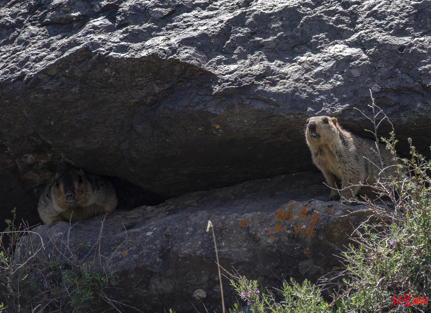
↑ Photographed by a marmium under the snow mountain of Anima Qing Snow Mountain
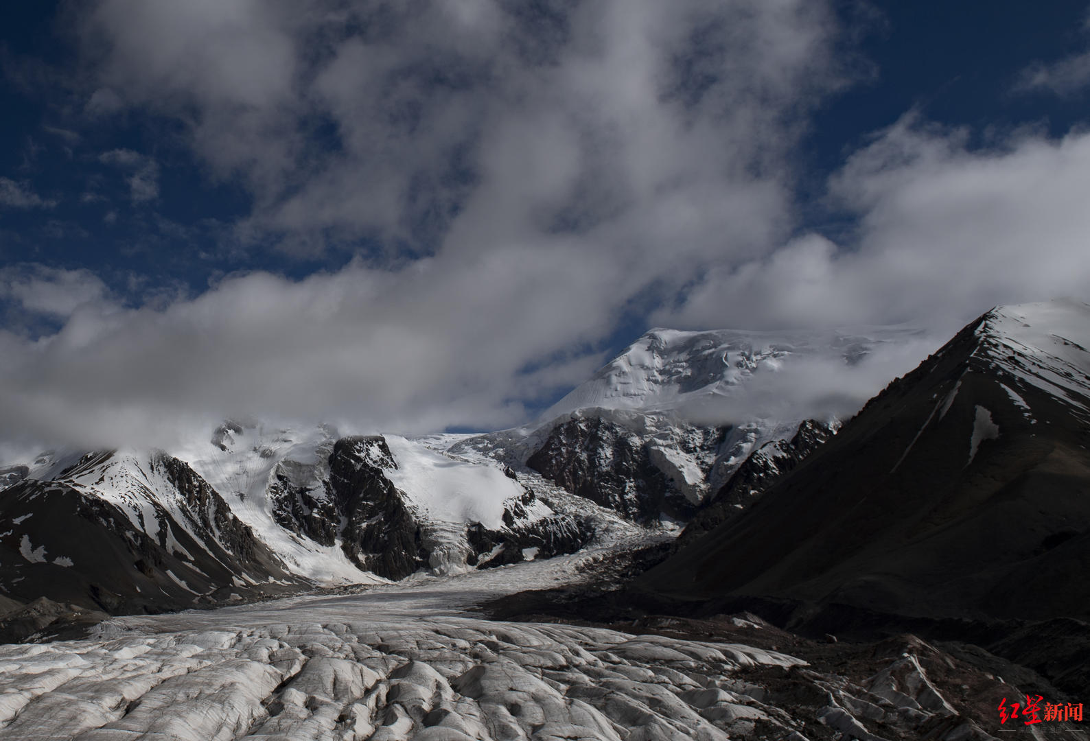
Glacier disasters also frequently occur. Since the 21st century, the frequency of glacier disasters in my country has continued to increase. In 2004, the Shenshan Anima -Qing Snow Mountain Maqing Gangli of Huangheyuan District, the modern glacier of modern glaciers, and a large -scale ice collapse disaster and the formation of dammed lakes caused the flood, causing downstream pasture, roads, and bridges to be destroyed; in the later 10 years Among them, two other large -scale ice collapse occurred in Anima Qing Snow Mountain, which directly led to nearly 3,000 acres of grass fields under the mountain at the foot of the mountain with an altitude of 4,430 meters. The thickness was 20 meters thick, and there was potential hidden dangers to the lives of downstream herders.
↑ Anima Qing under the Snow Mountain, Wei Delle is a male glacier, a pottery photographed
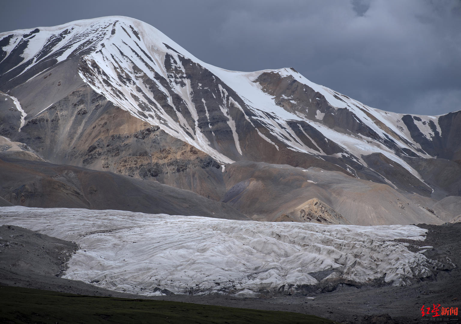
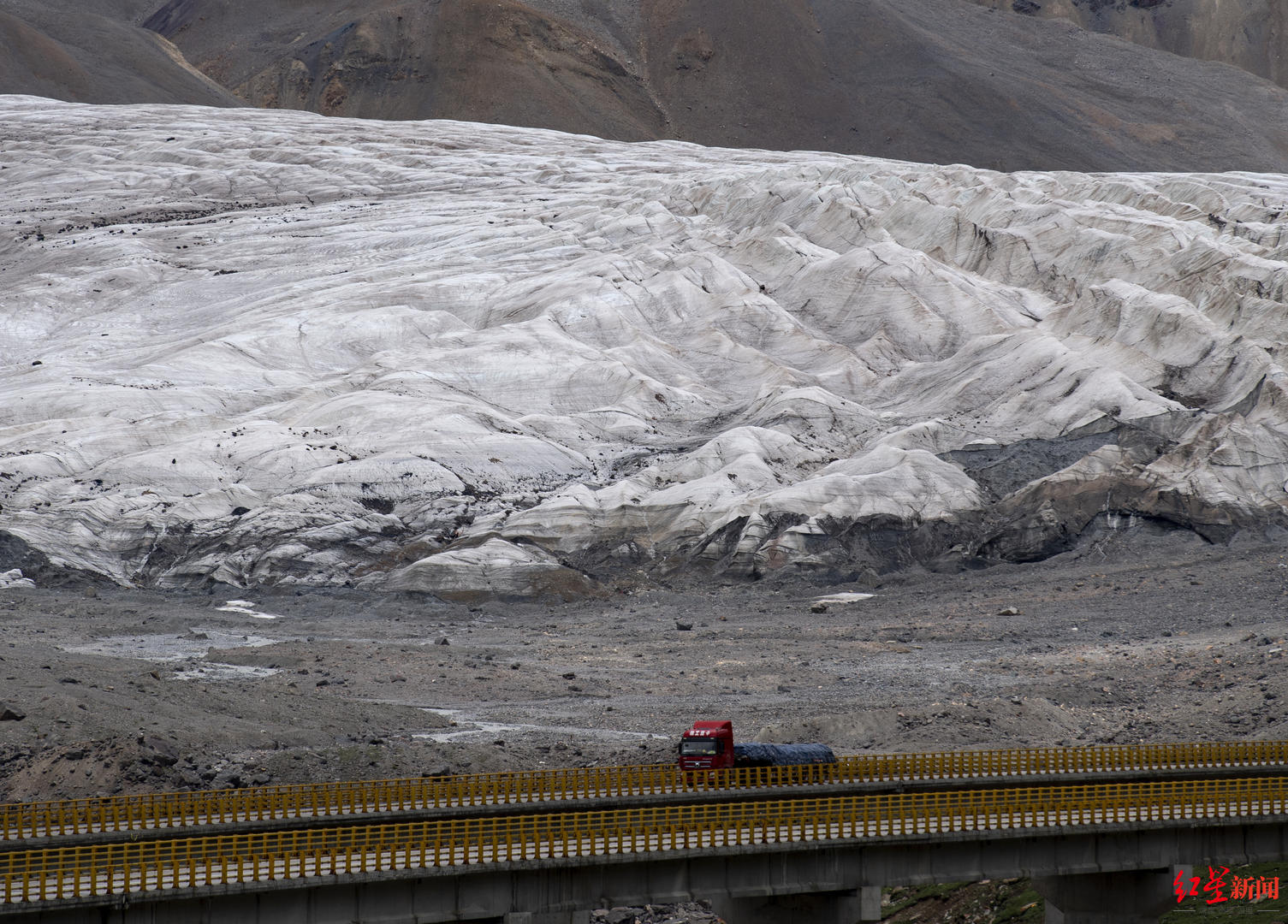
In the context of continuous warming of temperature, the frequency of glacier disaster explosion is likely to accelerate further, and glacier disaster prevention and control situation is severe. Disasters often do not simply occur. It is easy to induce multiple secondary disasters and form a disaster chain, thereby extending the time of disaster and amplifying disaster consequences.
Red Star News: Can this monitor in advance?
Shen Yongping: In February 2021, the glaciers in northern India were broken. The snow -capped mountains collapsed caused mudslides, which broke down the downstream Higga Hydropower Station and bridge. More than 100 herders and workers were trapped. Subsequently, my country's emergency department held an emergency meeting and officially regarded Binglu as one of the main disasters.
With the intensification of climate warming, I think that in the future, the probability of the ice -collapsed disaster will become a normal disaster. Although the chance of Bingnu has a low probability, it is often the source of a series of disaster chains, which will induce a series of secondary disasters, thereby prolonging and amplifying the consequences of disaster. , Flood, mudslides, etc. However, it is difficult for Bingnu disaster to be paid attention and prevention in advance. Because most of the ice collapse, it is often started from a piece of ice on the top of the mountain, and it is difficult for people under the mountain to pay attention to the looseness of the glacier. Secondly, the prediction and early warning of glacier disasters needs to be based on systemic disaster formation and evolution theory. However, due to the rare area of glacier disasters, inconvenient transportation, and difficulty in field monitoring in the wild, the research needs on -site data collection difficulties.
Policy release:
Transition from natural adjustment to manual adjustment
All parties plan to start ice and snow monitoring
Red Star News: As a researcher on the front line of the glacier for decades, do you have any suggestions for the water ecological protection of the Sanjiangyuan Zhonghua Water Tower?
Shen Yongping: At the end of 2021, the Qinghai Provincial Government issued the implementation of the "China Water Tower Water Ecological Protection Plan", marking that the ecological protection of the Chinese water tower water in Sanjiangyuan will follow. It mentioned "improving the basic public service level of water conservancy".
In my opinion, under the trend of warming globally, in response to the basic public service level of water conservancy, we can vigorously build a reservoir dedicated to the agricultural and animal husbandry in Gaoshan District, store the snow -melted snow in spring, and slowly transition from natural regulation to manual artificially to artificial artific In addition, the planting structure of the plateau also needs to be adjusted, and the pastoral grass that is matched with the current climate, with the adaptability of climate change to slow down the impact of the environment on herders and ecology.
↑ Next to the Chaka Salt Lake, a herdsmen who have been packed under the wind generator Tao Tao Tao Tao
Red Star News: Since the launch of the Sanjiangyuan National Park in 2021, ecological functions have been continuously strengthened, and the amount of water resources has also increased. The average increase is more than 6%. How do you think of the relationship between glacier water sources and us?
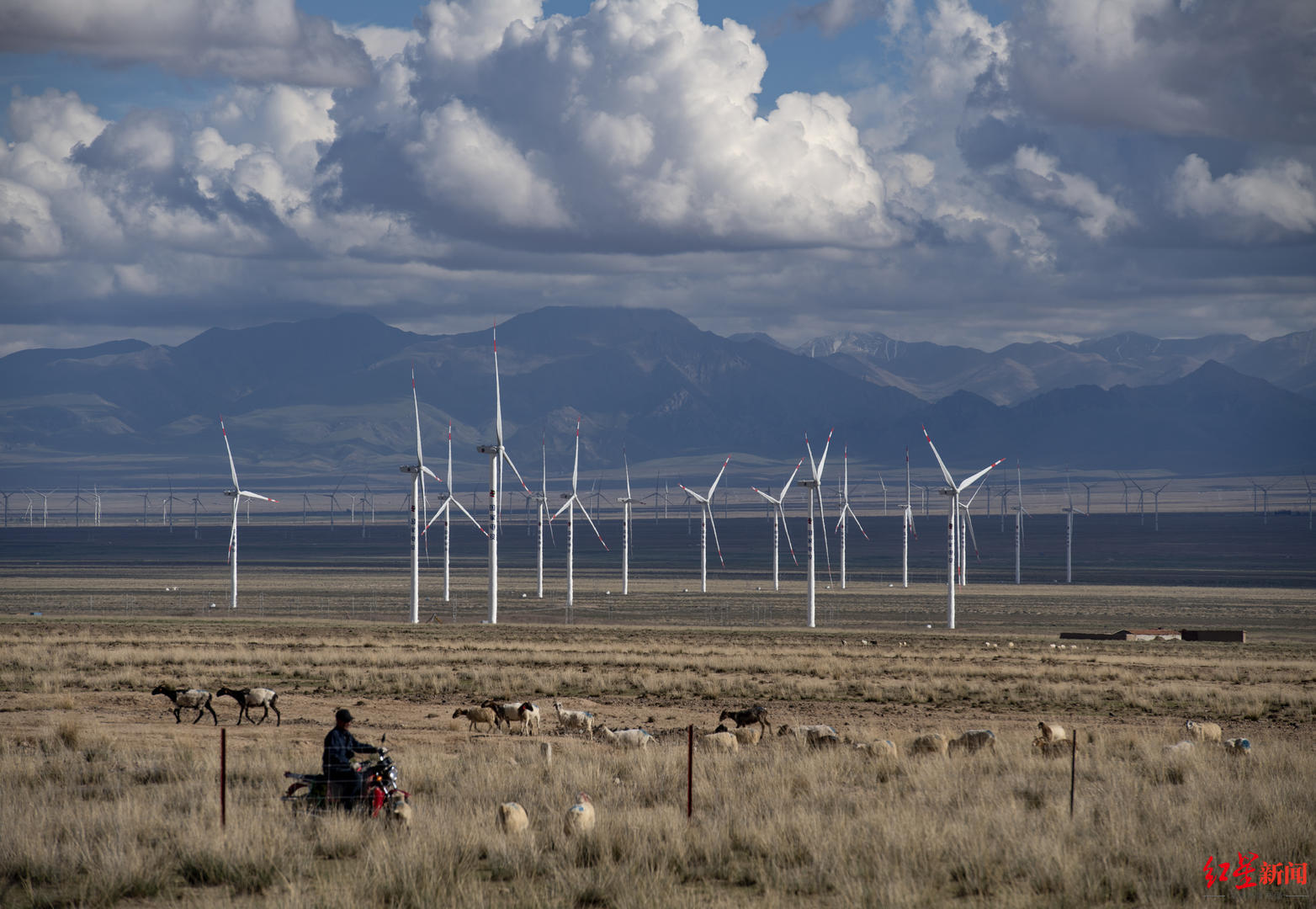
Shen Yongping: The Tibetans living deep in the glacier believe that every snow -capped mountain is a god, and it cares for thousands of people. It is precisely because of this world view of all things that the glaciers of the Qinghai -Tibet Plateau can be well protected. In fact, for so many years, I found that each glacier has its own personality. After working on glaciers for a long time, you will understand its language and feel its breathing.
↑ Next to the protection station of Cocoic Silo Nonal, Tibetan Antelope Tao Tao, who is eating grass
At present, the country is also vigorously advocating the high -quality development of the Yellow River Basin. Only by protecting the upstream environmental protection can the water resources be kept, the grassland can not degenerate, the wetland can continue to exist, and the frozen soil and glaciers can be further formed. If the ecological environment is destroyed, the upstream becomes a desert, and there will be no water downstream.
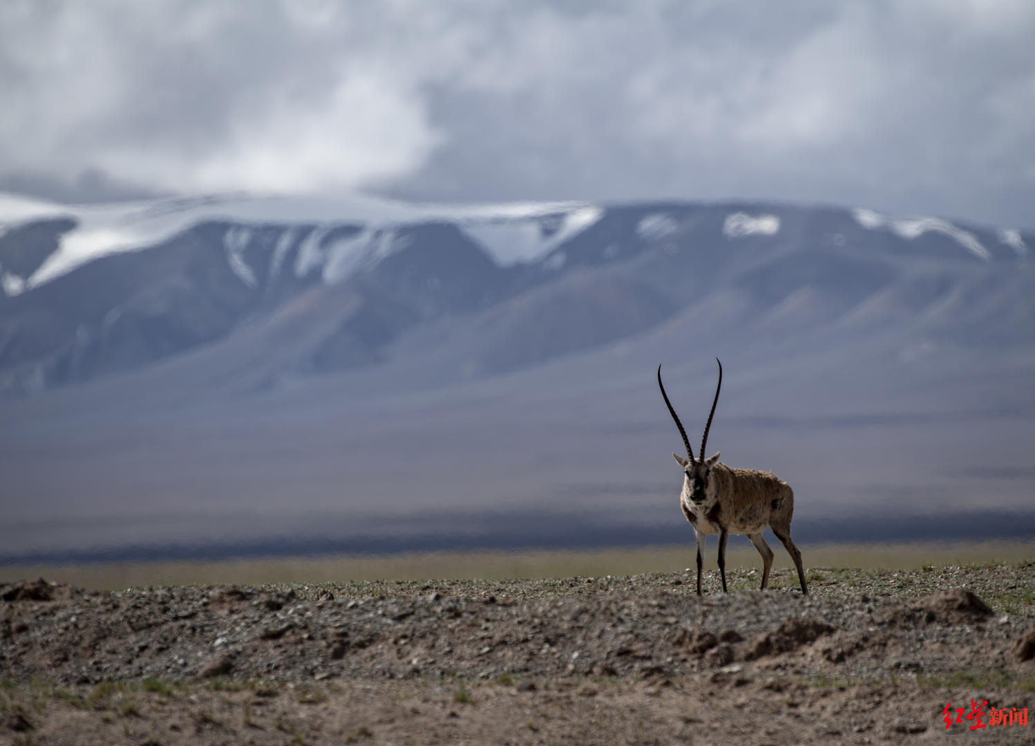
In recent years, the effectiveness of water ecological governance has been written in the Great River in Sanjiangyuan. After the release of the "China Water Tower Water Ecological Protection Plan", I also found that from last year to this year, all parties are planning to start the ice and snow monitoring plan. Our team is also planning to determine which glaciers and snow mountains are determined according to the distribution of glaciers in the Yellow River source and the Yangtze River source, which are the insufficient and improvement of the existing monitoring, etc. There is a more intuitive understanding of the overall situation, and recognizing that the distant snow mountain has something to do with everyone.
In the future, my country should build a high -risk zone glacier disaster monitoring and early warning and emergency management system, integrate glacier disaster remote sensing monitoring and group testing technology, realize the dynamics of glacier disaster development in various high -risk areas in real time, and achieve short -term predictions and potential disasters of glacier disaster evolution. Early discovery. At the same time, integrate the above -mentioned disaster warning mechanisms and risk management and control plans, realize early warning and risk disposal of glacier disasters across departments, multi -fields, and full coverage, and strive to minimize the dangers of glacier disasters.
-End
- END -
Xiao Wenjiao was elected academician of the European Academy of Sciences
Recently, Marja Makarow, Dean of the Academy Academy of Sciences (Academia Europae...
Reminder: The prevention and control of the epidemic and the implementation of the "Quartet responsibility", what are the responsibilities of the unit ...

Places where viruses are in virtuality are often places where responsibility is no...