Fall to 17 ° C!Cold air will arrive tomorrow, long sleeves are prepared!In the autumn, Hangzhou people love the most, it finally comes ...
Author:Daily Business Daily Time:2022.09.18

I was beckoning to Hangzhou in autumn
Beautiful baby autumn dress is ready
Can use it soon
Friends who like osmanthus are also ready
The city is full of osmanthus fragrance.
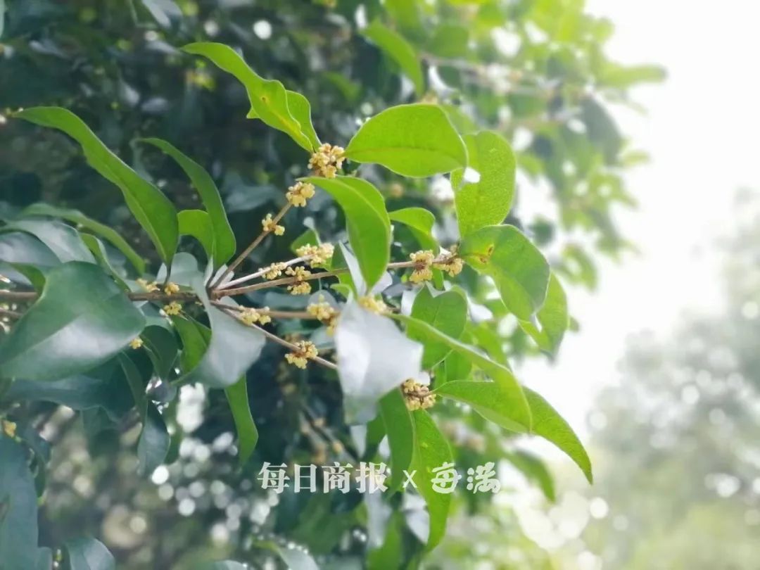
At present, Bai Lu's vitality is daily. However, the temperature of the three -character head during the day is still regular visitor during the day.
In this season, the "Autumn Tiger" is indeed waiting for the opportunity. However, everyone does not have to worry about it next week, because cold air is used as a "autumn tiger nemesis", but it will come to call everyone to wear long sleeves.
Just now, the Hangzhou Meteorological Observatory announced that the cold air will go to Hangzhou around noon tomorrow. The highest temperature tomorrow may still be 29 ° C, but the lowest temperature the next morning is only about 17 ° C. Friends who get up early need to wear a thin coat.
Today, Hangzhou was the lowest at 23.4 ° C, which was 2 ° C higher than yesterday, but today the highest temperature is only 29.8 ° C, which is nearly 2 ° C than yesterday. It is expected to be cloudy from the middle of the evening to the morning, and the cloud will be cloudy at noon in the middle of the night, and there will be small showers in some urban areas; it will be cloudy tomorrow afternoon to night, sometimes shade;
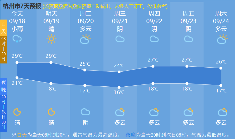
This time, the cold air performance is quite good. It is only responsible for cooling down and not carrying wind and rain. Most of the good weather in our province is accompanied by the "autumn high and refreshing" sincerity has been sent in advance!

Xia Qiu is pulling, the cold air is getting more powerful, will autumn be far away?
What impact does the strong typhoon "Nanma" on our province?
After the autumn typhoon was pushed, at present, the typhoon of the sea event is only Typhoon No. 14 this year "Nanda Metropolis" (strong typhoon level).
According to the Central Meteorological Observatory, the center of Typhoon No. 14 this year's Typhoon "South Maru" this year (18th) is located on the south of Japan, about 365 kilometers south of Kyushu Island, Japan today, The maximum wind power near the center (48 meters/second), the lowest air pressure of the center is 945 hundred Pache, the seventh-level wind ring radius is 250-360 kilometers, the 10th wind ring radius is 110 kilometers, and the twelve-level wind ring radius is 60 kilometers.
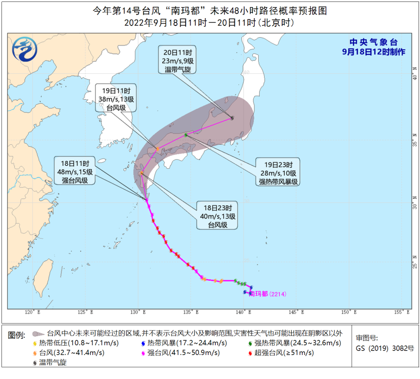
It is expected that "Nanma Du" will move north to west at a speed of 25-30 kilometers per hour, and gradually approach the coast of the southwest of Kyushu Island, Japan. On the 19th, it will move in the northeast of Kyushu Island, Japan. The intensity gradually weakened.
Affected by the "Nanma Metropolis" and the peripheral circulation, at 14-19 on the 18th, most of the Bohai, Bohai Strait, Most of the Yellow Sea, Most of the East China Sea, and the Korean Strait have 7-8 Grand Winds, gusts 9-11 Level, the wind power of the northeast of the East China Sea is 9-11.
According to the analysis of the Provincial Meteorological Observatory, when this path, "Nanma" will not land in my country, but the impact on our province is mainly manifested in the coastal wind. Today, there are 8 to 9 storms on the coast of the north and north of the Ming and Zhejiang.
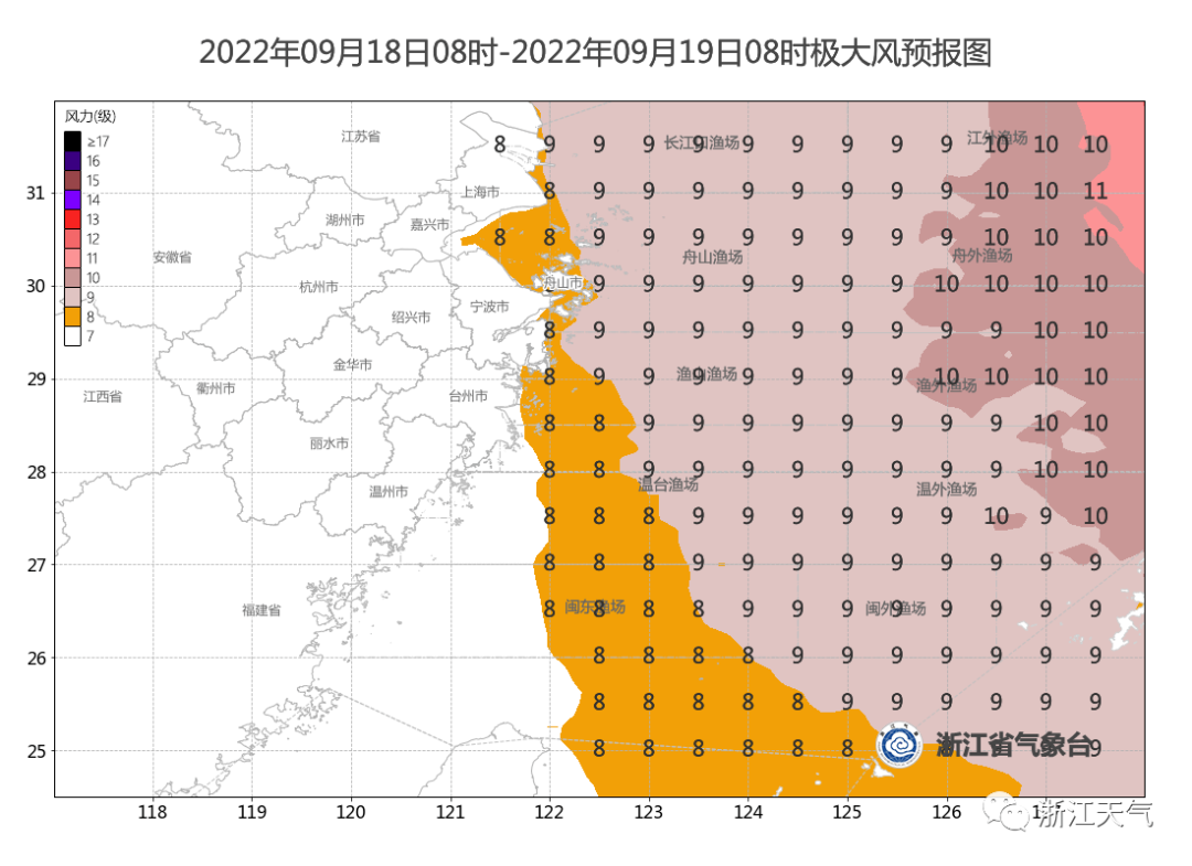
It is particularly needed to remind that all kinds of vessels that have just been caught in sea, please always pay attention to the weather trends and pay attention to sailing safety.

Photography Fang Wei
Some integrated Central Meteorological Observatory, Hangzhou Weather, Zhejiang Weather
- END -
President Yu Jianxing attended the "Informatization Symposium on High -quality Development" and made a theme report

From July 9th to 10th, the Informatization Symposium on High -quality Education wa...
Shi Xiaolin will meet with the party and government delegation of Hefei City

On July 15, Shi Xiaolin, member of the Standing Committee of the Provincial Party ...