Will the typhoon "plum blossom" affect Henan?The answer is →
Author:Henan News Radio Time:2022.09.13

This is a title
On the first day after the holiday
Most of Henan is clear and good, continuous online
Good morning and evening
The most pleasant light autumn

But look at the whole country
As the typhoon "plum blossoms" continue to approach
A large -scale storm is also staged
From the perspective:
The main impact is "Free Shipping Area" -1 Jiangsu, Zhejiang and Shanghai
It is expected that the typhoon "Plum Blossom" will log in tomorrow (14th)
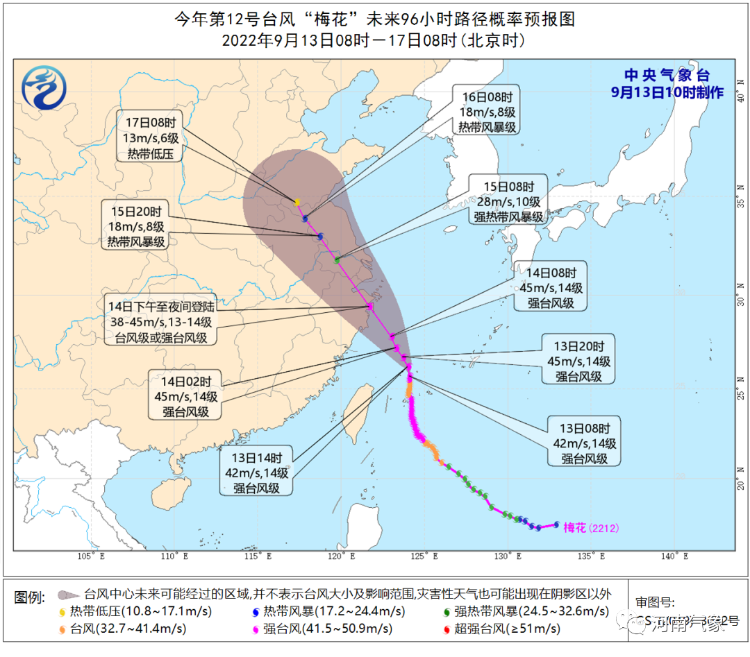
Typhoon "Plum Blossom" this year has moved into the south of the East China Sea in the early morning of today (13th). It will be strengthened to a strong typhoon level at 5 o'clock in the morning. It is expected that the intensity is typhoon or strong typhoon (38-45 meters/s, level 13-14). The Central Meteorological Observatory has raised the typhoon warning to an orange warning this morning. In the next three days, with the approaching and landing of "plum blossoms", the wind and rain in East China and other places will grow stronger.
Will the typhoon "plum blossom" affect Henan?
The answer is yes!
For Henan
Main impact areas: Beijing -Guangzhou Line and East East
Main impact time: 14-16
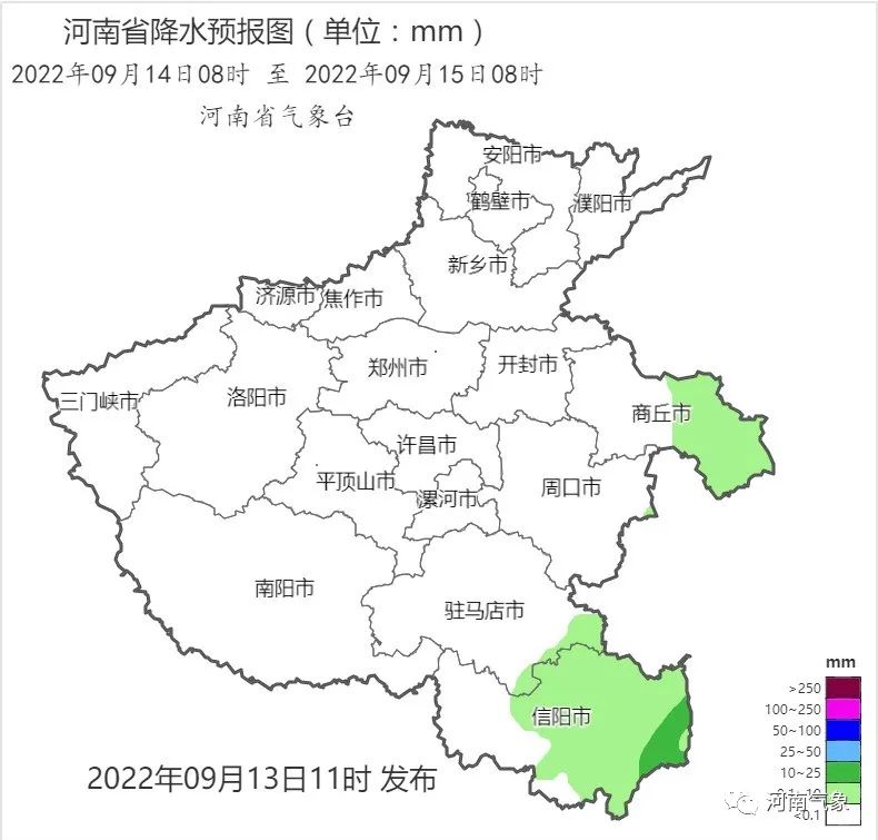
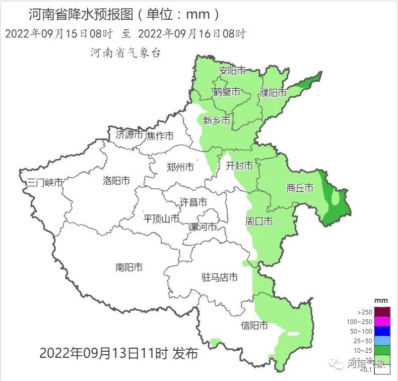
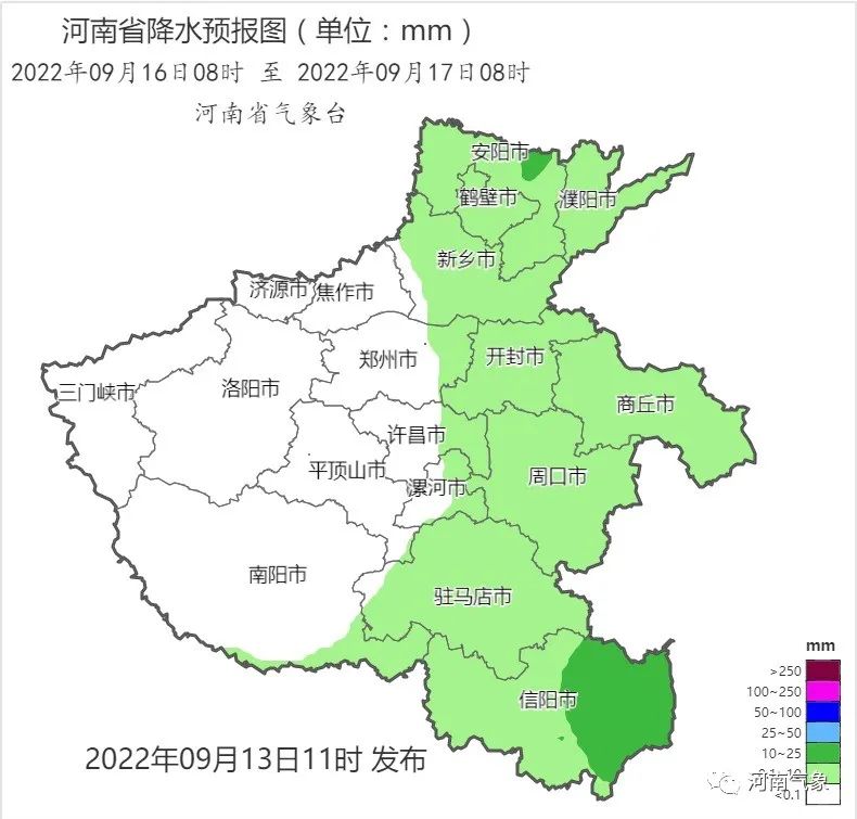
Xiaoyu is the main, partially to heavy rain
Affected by typhoon "Plum Blossoms" outer cloud system
Tomorrow rainfall starts with the eastern and southeast of the province
On 15-16, there is a gradual expansion
The overall process of this round is mainly small rain
There are parts to heavy rain in the northern, central and eastern parts, and southeast
Level 4 Gafeng, gust -level level 7
Compared to the "half sunny and half rain" of the sky condition
Great wind and cooling are all province
But the more obvious impact is still the Beijing -Guangzhou Line and the East East area

It is expected to be day -to -16 to the 16th
Most northern winds in the province around 4 levels 4
The Beijing -Guangzhou Line and East East Gust of Gust 7
at the same time
The highest temperature also dropped to less than 30 ° C
The wind and rain are cool again!
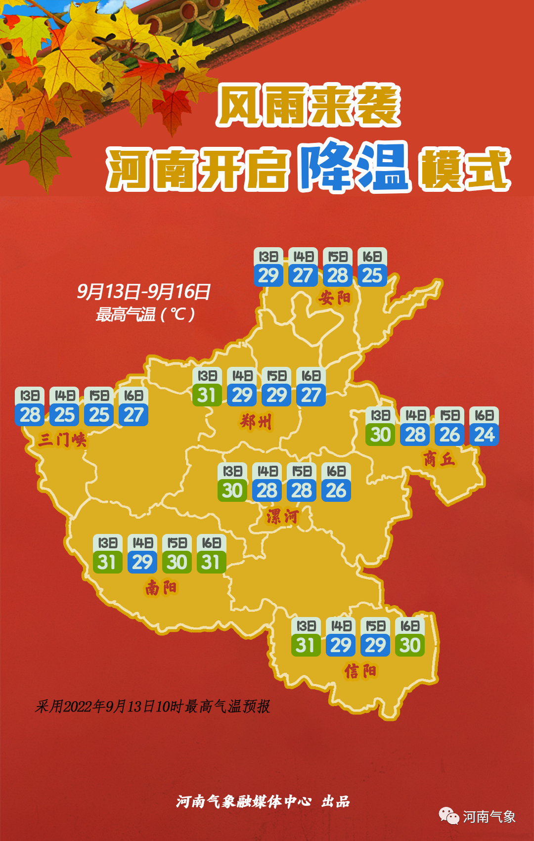

Forecast source: Henan Meteorological Observatory on September 13, 2022 at 12:00 forecast
Weather forecast in the next week
Tomorrow, there are cloudy days in the east and southeast, and some counties and cities have shower; other counties and cities are cloudy in sunny days.
On the 15th, cloudy days in the north, east, and southeast were cloudy, and some counties and cities had shower and thunderstorms, and it was in the middle to heavy rain. Other counties and cities were cloudy to cloudy.
On the 16th, there were cloudy days in the northern, central and eastern regions, and southeast. Some counties and cities had shower and thunderstorms. It was in the middle to heavy rain; other counties and cities were cloudy.
Affected by typhoons, during the day of the 16th from the 16th, most northern winds in the province are about 4 levels, and the Beijing -Guangzhou Line and East East areas are about 7.
On the 17th, the east, southeast, and northeast were cloudy, and some counties and cities had shower; other counties and cities were cloudy.
From 18th to 19th, there were shower in most counties and cities in the province. Among them, there were medium rain in the western and eastern counties and cities.
Source: Henan Meteorological
- END -
[Focus] Open for 8 months!The delivery of the Chinese and Lao Lao Railway exceeds 6 million tons

August 3The opening of the Lao and Lao Lao Railway for 8 monthsAccording to China ...
Typhoon Sanda (tropical storm) dynamics No. 5 this year
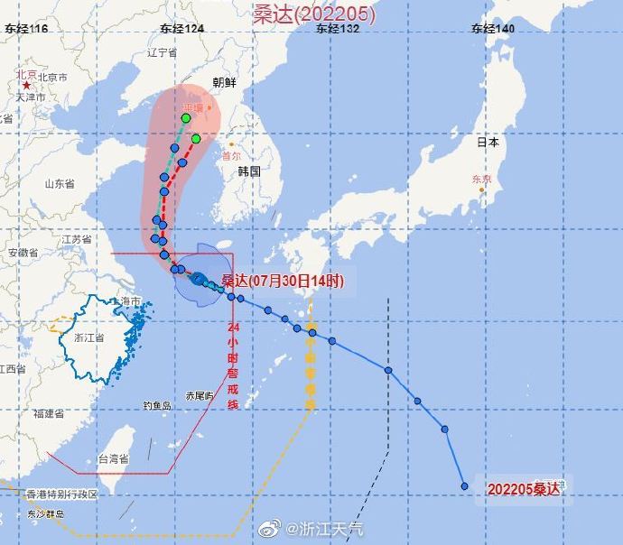
##Typhoon News: Typhoon Sanda (tropical storm) this year, today (30th) at 14 o'clo...