Luding earthquake to the main peak of Gongga Mountain on the east side of the glacial shape of the glacier becomes significant
Author:Sichuan Observation Time:2022.09.13

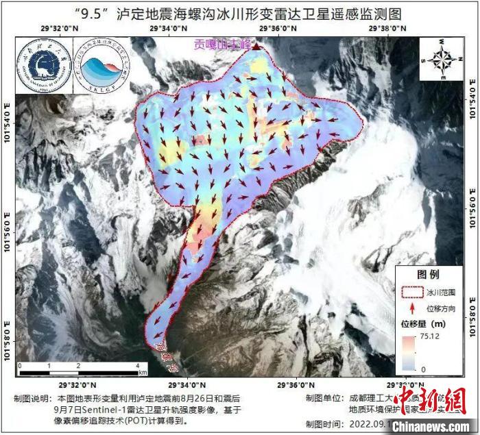
Luding earthquake -shaped glacier -shaped radar satellite remote sensing monitoring diagram. Photo by the Disaster State Research Laboratory
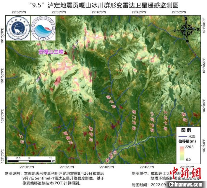
On the 13th, the reporter learned from the National Key Laboratory of Land Disaster Prevention and Geological Environmental Protection of Chengdu University of Science and Technology that the surveillance of radar satellite remote sensing monitoring shows that the earthquake leads to Hailuogou, Mozigou, Yanzigou, and Nanmen Pass on the east side of Gongga Mountain. The guts and other glaciers and the subsequent fate of the fate are monitored to have a significant deformation signal. The glaciers on the west side of the main peak are relatively small due to the earthquake.
On September 5, a magnitude 6.8 earthquake occurred in Luding County, Sichuan. The earthquake is located in the Gangga Mountain Conchgug Glacier Park. The glacier near the main peak of Gongga Mountain was widely concerned by the earthquake affected by the earthquake.

Luding Earthquake Gongga Mountain Glacier Group Transformer Satellite Remote Sensing Monitoring Monitor. Photo by the Disaster State Research Laboratory
The Disaster State Research Laboratory uses the Luding Earthquake August 26, 2022 and September 7th, September 7th, Sentinel-1 radar satellite-littering strength image based on pixel offset tracking technology (POT) The results of the glacier deformation around the main peak of the Gongga Mountain.
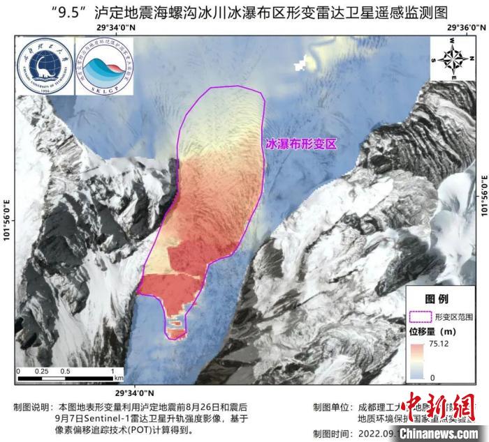
The variant results show that the Hailou Glacier is the most obvious affected by this earthquake, especially in the position of the front edge ice waterfall, which monitors a large range of continuous variable regions, with an area of about 2 square kilometers and a displacement of about 30 meters.

Luding Earthquake Hailu Glacier Ice Waterfall area -shaped radar satellite remote sensing monitoring diagram. Photo by the Disaster State Research Laboratory
In addition, the Head of the Disaster Disaster State Disaster also found out that the number of geological disasters near Caoke Township, Ashadian County totaled 441. The drone image covered 12.8 square kilometers of Caoke Township area of Shimon County. According to the results of remote sensing, a total of 441 seismic landslides occurred in the range, with a total area of about 0.88 square kilometers and a maximum of 53,441 square meters of single landslides.
- END -
The General Administration of Market Supervision exposes typical cases of food safety
Xinhua News Agency, Beijing, July 13th.Xinhua News Agency reporter Zhao WenjunImported frozen fish fake domestic labels, cake surfaces inlaid non -food raw material gold foil, and illegal adding drugs
Hai, land, air and iron, "Daqianhai"

Ascended Dasan Mountain, looking at the two sides of the Pearl River Estuary, a gl...