Dajie ҈ Rain!= =17 = = ͟͟͞͞ ͟͟͞͞ = ͟͟͞ ͟͟͞!Emergency response starts!Strong typhoon "Plum Blossom" is about to land, these places will be affected →
Author:CCTV Finance Time:2022.09.12

From September 12th to 14th, the southwestern region is still frequent rainstorm. There are medium to heavy rain in the Sichuan Basin and other places. Local rain or heavy rains should be paid to prevent the occurrence of secondary disasters. At the same time, as the typhoon "plum blossoms" continue, there will be strong rainfall in some areas of the coast of East China. In terms of temperature, high temperatures are frequent this week in Jiangnan and South China, and the temperature difference between most day and night in the north is large.
Frequent rainwater in the southwest
Typhoon "Plum Blossom" East China coastal storm
Yesterday, strong rainfall in my country mainly appeared in the southwest, South China and other places. Monitoring showed that yesterday from 08:00 to today at 06:00, southern Sichuan, Yunnan, west of Guizhou, central and southern Guangxi and central Jilin, western Hubei, northern Hunan and other areas During heavy rain or rainstorm, heavy rain in Chuxiong and Pu'er, Guangxi Baise and Hechi, Hunan and other local heavy rain in Yunnan. In addition, affected by the outer cloud system of the typhoon "plum blossoms", there were heavy rain to heavy rain in northern Taiwan Island, and the local heavy rain.
In the next three days, there will still be frequent rainfall in the Southwest region, western parts of South China, and the Sichuan Basin, including the earthquake areas, and heavy rain in the southern parts of the Sichuan Basin.
At the same time, Typhoon "Plum Blossom" this year will bring strong rainfall to parts of East China and other areas. At 5 am this morning, the center of Typhoon "Plum Blossom" is located on the east of Taiwan, about 310 kilometers south of Taipei, Taiwan Province. It is expected that "Plum Blossom" will move north to west at a speed of 5-10 kilometers per hour, and the strength will be weakened slowly. It will enter the southern sea of the East China Sea from the night of the 12th to the early morning of the 13th. The coast is approaching and may land on the 15th or wipe the above coastal areas.
Affected by it, from 20:00 on September 11th to 20:00, the wind and regions passed by the "Plum Blossom" center were 12-16 levels, and the gusts could reach level 17. From 08:00 on September 12th to 08:00 on the 13th, the southern waters of the Yellow Sea, most of the East China Sea, Taiwan Strait, Taiwan East Ocean, Bus Strait, coastal coastal of Taiwan Province, waters near the Diaoyu Islands, Zhejiang -Fujian border coast, southeast Jiangsu coastal — Grade Grand Wind, Gust 8-9; the waters in the southeast of the East China Sea and some waters east of Taiwan have 8-11 Grade Winds, and the wind in the nearby sea and regions passed by the "Plum Blossom" center is 12-15. Level 16. There are heavy rain in southeast Jiangsu, Shanghai, northeast coast of Zhejiang, and northern Taiwan Island, and some areas have heavy rain or heavy rain.
Specifically, the Central Meteorological Observatory predicts that today, the Yili River Valley of Xinjiang, southeast Jiangsu, Shanghai, northeast Zhejiang, eastern Sichuan Basin, most of Yunnan, southwestern Guizhou, northwestern Guangxi, northern Taiwan Island, etc. David, there are rain or snow in the high -altitude mountainous area of Xinjiang. Among them, there are heavy rain or heavy rain in eastern Shanghai, northeast Zhejiang, southeast of Jiangsu, central and southern Yunnan, southwestern Guangxi, and northern Taiwan Island.
Tomorrow, southeastern Jiangsu, central Zhejiang, central Anhui, Shanghai, central Sichuan Basin, southern Yunnan, western Guangxi, eastern Gansu and other areas have middle to heavy rain. Among them, southeast Jiangsu, northeast Shanghai, northern Zhejiang, etc. There are heavy rain in part of the ground.
On the day after tomorrow, northeast Inner Mongolia, northern Heilongjiang, eastern Jilin, eastern Liaoning, eastern and southern Jiangsu, southern and northern Zhejiang, Shanghai, Sichuan Basin, southwestern Yunnan and other areas have middle to heavy rain. There are heavy rains or heavy rains in the eastern part of Shandong Peninsula, eastern Liaoning, southeast Jiangsu, Shanghai, northern Zhejiang, and southern Sichuan Basin.
Meteorological experts remind that the Southwest region has recently been frequent in precipitation, and Sichuan, Yunnan, Guizhou and other places need to pay attention to preventing rainfalls and geological disasters that may cause rainfall. In addition, the path, intensity and uncertainty of the typhoon "plum blossoms" in the later period must continue to pay attention to its development trends and the impact on the wind and rain caused by the waters of the eastern part of my country and the coast of East China.
All parts of Zhejiang do a good job of typhoon defense work
"Plum Blossom" influence at the beginning of Zhejiang Ningbo's coast to enter the Class III defense station emergency response
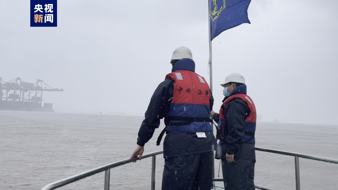
Typhoon "Plum Blossom" (strong typhoon "this year was located at 23.9 degrees north latitude at 8 o'clock on September 12th, 124.2 degrees east longitude, and 712 kilometers from Ningbo, north of the movement, and 9 kilometers per hour. According to the trend and development trend of typhoon, the Ningbo Maritime Safety Administration decided to start the emergency response of the III defense station from 9 o'clock on September 12 from 9:00 on September 12.

According to the forecast of the meteorological department, "plum blossoms" are likely to land on the coast of my country, and the typhoon in Ningbo's coastal waters directly affects significantly. The maritime department reminds all relevant units and ships to pay close attention to the typhoon dynamics and do a good job of anti -Taiwan work.
During the Mid -Autumn Festival holiday, the demand for returning passenger transport on the water travel is large. At present, there are 25 major passenger transport routes operated by Ningbo normally, and 5 passenger routes have been suspended. The remaining routes have also been prepared for shutdown. All at noon are returned.
The maritime department reminds that after entering the emergency response of the III -level station, each wading project and dangerous product operating units must make a good job of adjusting the production plan in time, and the shipment of ships and personnel in accordance with the Taiwan anti -prevention plan. Ensure that the key ships are left in time. At present, there are more than 1,100 ships in the Ningbo Maritime Bureau's jurisdiction in Hong Kong, and all staff of the bureau have returned to work to carry out anti -Taiwan work.
Taizhou, Zhejiang: Fishing vessels return to Hong Kong to avoid the wind and do a good job of defense typhoon. In order to ensure the lives and property safety of the masses, all parts of Zhejiang do a good job of typhoon defense.
△ CCTV Finance "First Time" column video
On the morning of the 11th, Yuhuan Maritime Law Enforcement officers boarded No. No. 6 non -power construction ship at Haihong 6, an anchor -shelter in the Grand Maiyu Port, to check the implementation of the ship's anti -Taiwan measures. At present, the staff on board have taken measures such as fixed anchoring chain and reinforcement on board. Taizhou's defense finger launched a sea -level emergency response to the typhoon prevention of the sea on the 11th, and 3586 ships on the ocean -faced fishing boat required all of them to go to Hong Kong to avoid wind before 12:00 on the 14th. At the same time, the Taizhou Maritime Passenger Transport Center issued a notice that starting from September 13, the Taizhou Jiaojiang -Dachen route was suspended.
Wenzhou, Zhejiang: Prevent typhoon "plum blossoms" multiple islands emergency evacuation more than a thousand people
In order to avoid a large number of tourists staying the island, Wenzhou in Zhejiang coordinates the passenger rounds and arranges tourists to evacuate and evacuate in advance.
△ CCTV Finance "First Time" column video
Affected by the typhoon "plum blossoms", from the 12th, all passenger ships from Aojiang -Nanji Islands, Ruian -Beiso, and Ruian -Beilong were all suspended. In order to avoid a large number of tourists staying the island, on the afternoon of the 10th, Wenzhou Maritime Department jointly launched an emergency plan with local governments to quickly organize the evacuation of island personnel. In order to ensure the safe evacuation of the personnel, law enforcement officers from the Wenzhou Maritime Affairs Bureau went to the evacuation site to maintain the order of the site. At the same time, the waters of passenger ships are carried out through the maritime intelligent control platform and other methods, and reminding past ships should be reminded in real time to avoid avoidance.
As of 19:40 on the 11th, the evacuation work has ended, and Nanji, Beiso, and Beilong have evacuated 1097 people.

"Autumn Tigers" in many places in Jiangnan and South China continues to make power
The warm and cold conversion of the central and northern parts of Xinjiang
In the next week, "Autumn Tigers" will frequently appear in the south. There will be phased high temperatures in Jiangnan and South China. Among the cities, Fuzhou and Guangzhou may continue to have high temperatures in the next 7 days. Fortunately, the high temperature is not large, and the air humidity is low, and the body sensation is mainly dry heat.
In the north, the temperature in the northeast, North China, Huanghuai and other places is mainly high, but the temperature difference between day and night is generally exceeded 10 ° C. Among them, the temperature difference between the east and northern parts of North China can reach 15 ° C, and the local area is even more than 20 ° C. Pay attention to adding clothing to prevent colds. The most severe temperature change is central and northern Xinjiang. It is expected to be affected by cold air today. There will be rain and snow and wind cooling weather in the central and northern parts of Xinjiang. —G level 6 northwest wind, gust of gust 7-9. For example, Urumqi, the highest temperature was about 34 ° C yesterday, and today it will drop to 17 ° C. The lowest temperature fell to only 8 ° C. The contrast of the cold and cold was obvious. The local public needed to prevent severe changes in the weather and add clothes to keep his clothes warm in time.
164+785 are added in the local area, of which Sichuan has added 81+62

The EU holds the Minister of Energy, or levies huge profits for energy companies! European natural gas prices have reached ...
Dangerous warning! If Russia is "broken", one -fifth of the industrial production may be "fatal" in this European country
urgent! Storm! = =15 = level = ͟͟͞͞ ͟͟͞͞ = ͟͟͞͞ ͟͟͞͞ = ͟͟͞͞! 10 meters crazy! "Plum Blossom" is promoted to a strong typhoon level! These places are highly vigilant →
Over 20 billion yuan, it is exempted! Buy "it", save money →
Source: CCTV Finance (ID: cctvyscj), CCTV News Client
Produced: Ke Chengyun
- END -
The Meteorological Bureau of Liaoning District issued a yellow fog yellow warning [Class III/heavier
Large fog yellow warning signal: It is expected that in the next 1 to 2 hours, there will be a large fog weather with a visibility of less than 500 meters in the middle of Liaoning District, and it wi
Xiangwan Community | "Preventing drowning" public welfare class!

Fingers follow the music ... On July 9th, more than a dozen children in the new er...