The highest temperature returns 37 ° C!Typhoon "Plum Blossom" strengthens, the impact on Guangdong is ...
Author:Southern Plus client Time:2022.09.11

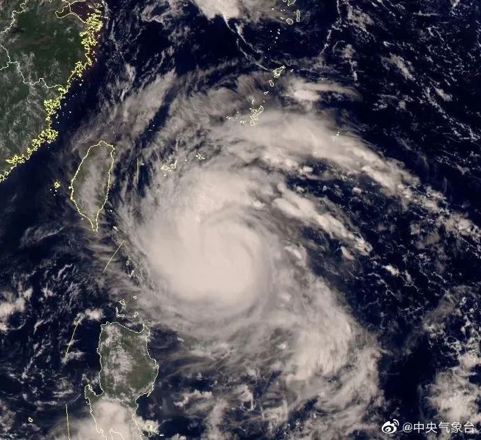
Typhoon "Plum Blossom" this morning
Strengthen again
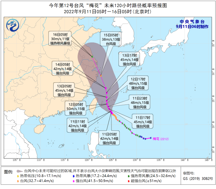
It is now a strong typhoon of level 14
Traveling to the northwest is stable

Central Meteorological Observatory released on September 11th
Typhoon blue warning

Based on the latest forecast
Although the typhoon will not land on the front of Guangdong
But it still affects Guangdong
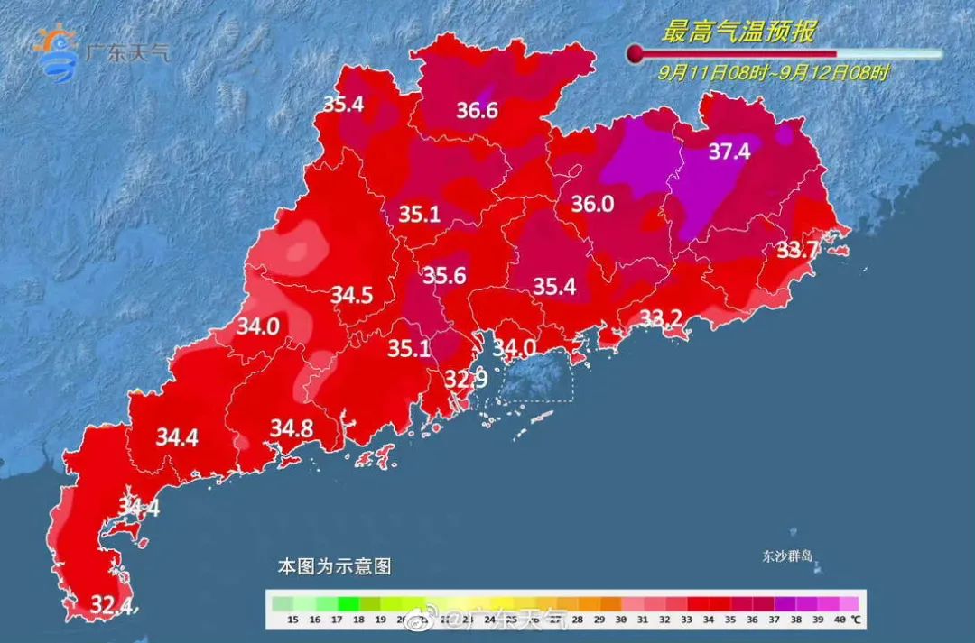
37 ℃! Guangdong high temperature again
According to@Guangdong weather
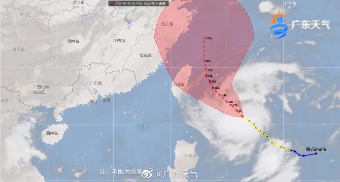
It is expected that the typhoon "Plum Blossom" is expected to go north from the 11th to 13th
The closest time to Guangdong
"Plum Blossoms" has a warming effect on Guangdong
Some sites do not rule out
The highest temperature can reach 36 ℃ ~ 37 ℃

This is really red ...
Holiday coastal tourism, maritime transportation and homework
be careful
Specific forecast:
From 11-13, there were scattered (thunder) rain in western Guangdong and counties; the temperature was generally stable. Most cities and counties were 31 ° C to 35 ° C. Among them, some cities and counties in the central and eastern region were 36 ° C to 37 ° C.
On the 11th, the cities and counties in Guangdong were cloudy, with scattered (thunder) showers, and local heavy rain. The highest temperature: 31 ° C to 34 ° C in the city and county of Guangdong.
On the 12th, there were clouds (thunder) in the northern and southwestern parts of cities, and there were scattered showers in the rest of the cities and counties.
Affected by the typhoon "Plum Blossom", from the night of the 11th to the night of the 12th, the Taiwan Strait, Taiwan's East Ocean, Bus Strait, and Southern East China Sea will have levels of 6 to 8 and gusts 9-10. It can reach levels 9 to 12, gusts 13-15 levels, and the wind power of the nearby waters passed by the Typhoon Center can reach level 13-14 and gusts 15-16 levels.
There are two typhoons may generate
According to the latest typhoon path forecast, "Plum Blossoms" will move northwest at a speed of 15-20 kilometers per hour, and the intensity will gradually increase, the strongest can reach 45-50 meters/s (14-15, strong typhoon). On the evening of the 12th, the intensity began to weaken slowly, and continued to move northwest. After passing through the Ryukyu Islands, entered the southern sea surface of the East China Sea. It gradually approached the coast of the eastern part of Zhejiang.

In addition to the "plum blossoms", the northwest Pacific mid -latitude ocean is also active on the two tropical disturbances of 92W and 93W. These two tropical disturbances will have a high probability to strengthen Typhoon No. 13 and 14 this year.
Especially the tropical disturbance of 92W, after ending the double typhoon interoperability effect with "plum blossoms", it has been wandering on an ocean surface nearly 1,500 kilometers from Japan. 92W will continue to move west within the next 3 days, and the strength will be gradually enhanced. In the later period, it needs to pay attention to its path and strength change, and the possible impact.
The Mid -Autumn Festival holiday is strong, accompanied by thunderstorms
out for a journey
Plasizable, sunscreen, etc.
Pay attention to timely water replenishment
Newss
Southern Selection
What? Mooncake speaks? Intersection
Su Bingtian, donate 1 million yuan
The tennis teenager of this backbille won the championship
Source | Guangdong Weather, China Weather Network,@来 Meteorological Observatory
Edit | Zhu Dan
School pair | Ju Weiqiang
- END -
The Standing Committee of the 13th Provincial People's Congress held a chairman meeting

On July 6, the Standing Committee of the 13th Provincial People's Congress held th...
Subsidies will be issued from August 1st, these people can receive

On July 13, the website of the Wuhan Development and Reform Commission forwarded t...