"Xuanlan Nuo" will be strengthened to super typhoon again!There are strong wind and rain in Zhejiang Shanghai and other places
Author:China Meteorological Administr Time:2022.09.04
With Typhoon Xuanlan Nuo No. 11 this year
Gradually approach the coastal areas of my country
Yesterday
Zhejiang, Shandong Peninsula, Taiwan and other areas
Obvious rainfall
in
Zhejiang Ningbo, Shaoxing, and parts of the central parts of Taiwan Island
Heavy rain

On September 3rd, the staff of the Lighthouse community of the Lighthouse community in Yumen Street, Zhejiang, after receiving the typhoon warning SMS, grabbed the time to carry out a reinforcement work map on the north of Yuli/Li Zhiyong/Li Hongming
Central Meteorological Observatory estimates
"Xuanlan Nuo" will be strengthened to super typhoon again today during the day
And gradually tend to the waters near Zhejiang
The next 36 hours will be "Xuan Lannuo"
The main influence of my country's land and offshore
Central Meteorological Observatory continues to issue typhoon yellow warnings
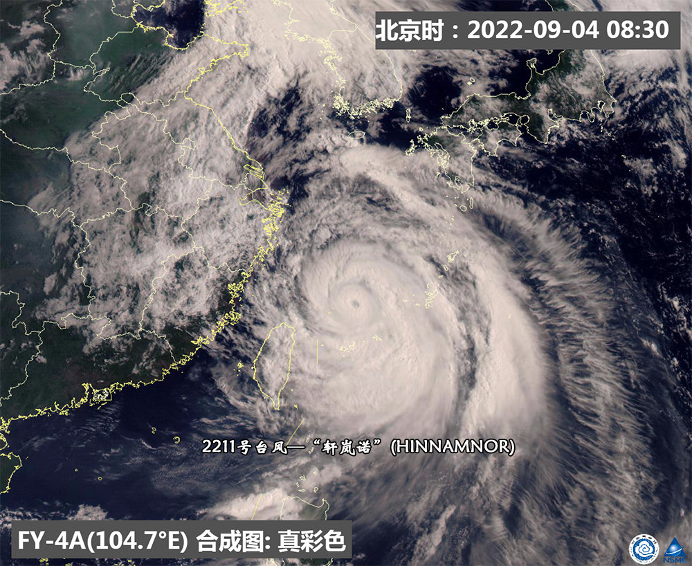
FY-4A Static Meteorological Satellite Visited Guangyun Map (September 4, 2022 08:30)
Today (September 4) 9 am
"Xuanlan Nuo" (strong typhoon level) center
Located in the east of the south of Zhujiajian Island, Zhejiang Province
About 460 kilometers of East China Sea Sea surface
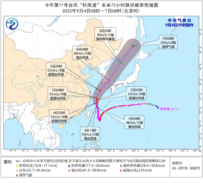
It is expected that it will be about 20 kilometers per hour
Move towards north
Strong gradually strengthened
The maximum strength can reach super typhoon level
(Level 16, 52-55 meters/s)
And gradually get closer to the coast of northeast Zhejiang
4th to the morning of the 5th
It will go north in Zhejiang's offshore sea
From the morning of the 5th to the northeast movement move
Trees towards the southern Korean Peninsula to the Korean Strait
Affected by it
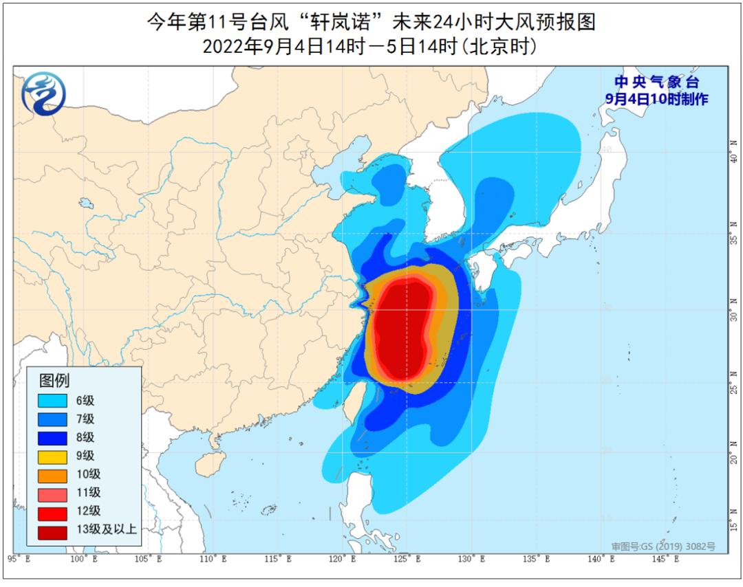
There will be a large impact on wind and rain in the coastal areas of East my country
It is expected to be in the next three days (4th to 6th)
The waters near the east, the East China Sea, and the Diaoyu Islands in Taiwan
Changjiangkou, Hangzhou Bay, Zhejiang coast, Shanghai coast
The southeastern coast of Jiangsu will have levels 9 ~ 12 high winds
The nearby sea surface of the "Xuanlan Nuo" center is 13 ~ 16 levels
Ge'm can reach level 17 or more
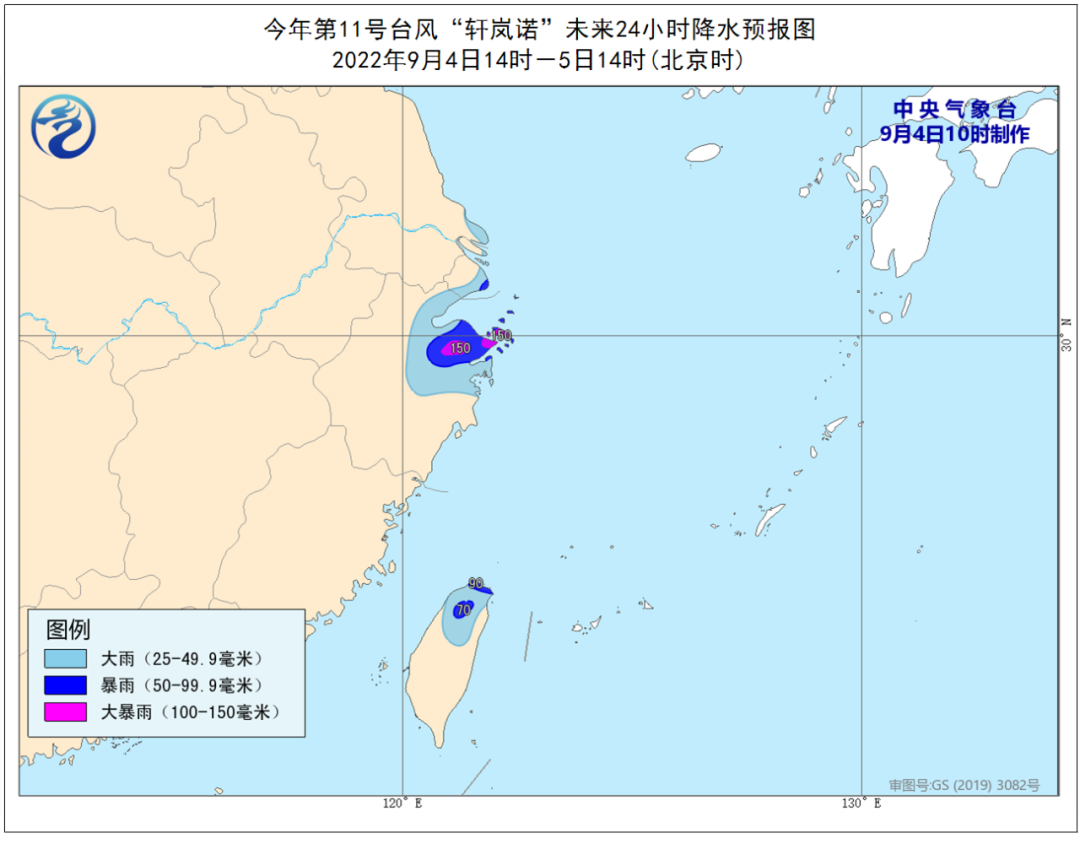
Aspect of rainfall
Today (4th)
Taiwan Island, Northeast Zhejiang, Shanghai and other places
There are heavy rain, heavy rain in the local area
5 days
Typhoon "Xuan Lannuo" turned to the northeast movement
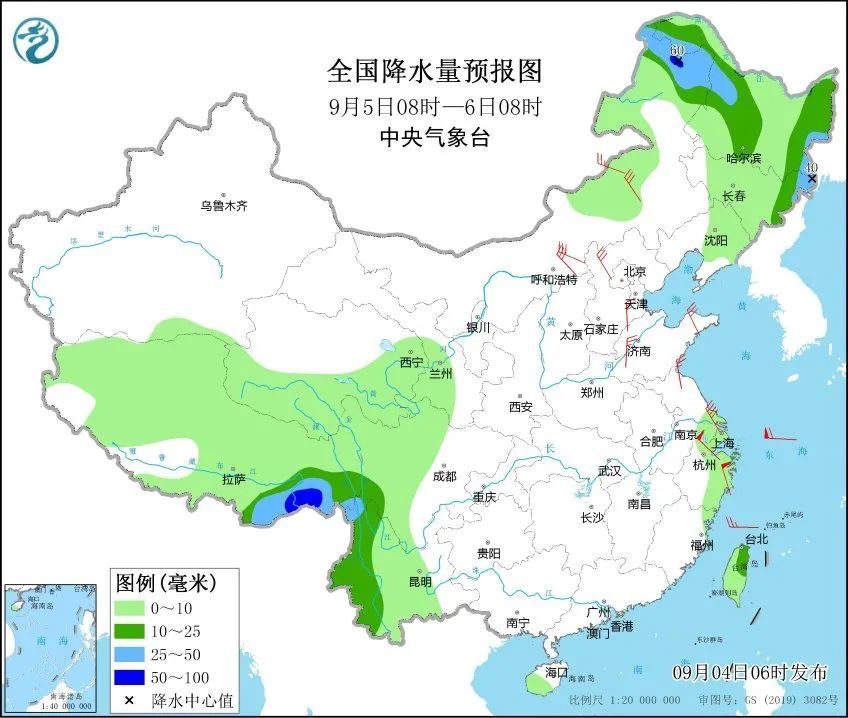
The impact on precipitation in the eastern coastal areas weakened
Because there is sufficient water vapor on the east side
Northeast Inner Mongolia, Heilongjiang, East Jilin and other areas
There will be medium to heavy rain and heavy rainstorm
at last
Send it for everyone
Typhoon Defense Guide
What should I do before the typhoon comes?

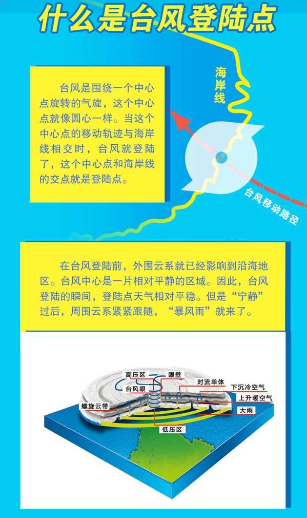
What is a typhoon landing point?
Typhoon landing point
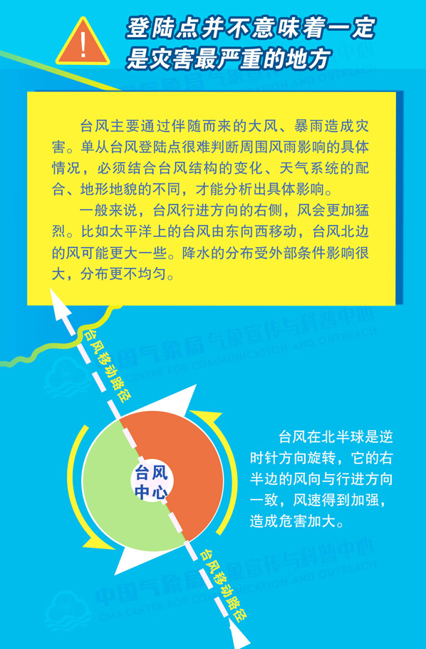
Will it be the worst disaster?
How to avoid the typhoon?

Central Meteorological Observatory and National Satellite Meteorological Center (Analysis and Treatment: Han Bowei Sun Mi Hongbo)
- END -
Notice!The calculation rules of Beijing Health Pokin Nuclear Nuclear Nucle

Recently, Beijing's Health Treasure released a new version, combined with the late...
Chongzhou "yellow -code" personnel nucleic acid samples and medical treatment here!

According to the current epidemic prevention and control situationTo ensure the ye...