Little to heavy rain to heavy rain!Affected by typhoons, Qingdao's near -sea surge increased!
Author:Peninsula Metropolis Daily Time:2022.09.03
According to the forecast of the Shandong Meteorological Observatory, Typhoon Xuanlan Nuo No. 11 this year (strong typhoon) The center is located on the 3rd on the 3rd on the 3rd on the 3rd. The wind is 14 levels, and the central air pressure is 950 Baipa.
It is expected that "Xuan Lannuo" will move north at a speed of about 15 kilometers per hour, move into the East China Sea on the 3rd on the 3rd, and gradually approach the coast of the northeast of Zhejiang. The sea turned to the northeast movement, tending to the coast of the southern Korean Peninsula to the southern part of Japan.
According to the current data analysis, "Xuan Lannuo" mainly affects the Peninsula area of our province. On the 3rd to 6th, the wind power in each sea area has increased. From the night of the 3rd to the 4th, there are heavy rainstorms in Weihai to heavy rain, and Yantai, Qingdao, and Rizhao have local rain or heavy rain.
At 16:20 on September 3 on September 3, Shandong Provincial Meteorological Observatory issued a large yellow warning of the sea winds at sea. Affected by the medium -scale vortex of the typhoon periphery, the 3rd of the north of the Yellow Sea and the southeast wind of the Yellow Sea was enhanced to the 6-7 gusts of the southeast wind in the middle of the Yellow Sea to 8 to 7. Grade 7 to 8 gusts 9 to 10, turn to the northeast wind from 7 to 8 in the morning of the 4th, levels of 9 to 10; Bohai South Wind is short -term north wind 5-6; Weihai North Wind level 6-7 gusts 8-9, Yantai and Qingdao North Wind 4-5 gusts 6. From the night of the 4th to the 6th, the north wind, the level 7 of the middle of the Yellow Sea 8-9, the Bohai Sea, the Bohai Strait and the north of the Yellow Sea level 6 to 7 gusts 8.
Because "Xuan Lannuo" is far away from our province, the movement is slow, the influencing factors are complicated, and its later movement path has certain uncertainty. The meteorological department will closely monitor the weather changes, strengthen tracking and judgment, and roll the typhoon information in a timely manner.
The reporter learned from the Municipal Meteorological Observatory that for Qingdao, the distance between the typhoon is far, which is mainly affected by the circulation of the periphery of the typhoon.
Qingdao Meteorological Station September 03, 2022 continues to release a large -wind blue warning signal at 16:35: It is expected to have a large wind and wind in the north of our city from this evening to tomorrow. Level 6 to 7 gusts level 8. Please pay attention to prevention.
Today, the number of clouds continues to increase; in the middle of the night to tomorrow morning, there are light rain in urban areas, Laoshan, and Jimo. There may be heavy rain to heavy rain in local areas in Laoshan Mountain and Eastern Jimo.
Tomorrow in the afternoon, the sky in the island city will become sunny, and the maximum temperature in each district and cities will be 25 ~ 26 ° C.
Next Monday and Tuesday, the island cities are mainly cloudy in Qingjian. The maximum temperature in each district and cities will rise to 27 ~ 30 ° C, and the lowest temperature will decrease slightly. In addition, in the next few days, the city's wind is large, and the surge in the sea will also increase. Please pay attention to prevention.
Qingdao Meteorological Observatory released at 16:00 on the 3rd:
[Qingdao City] Today, there will be light rain to the middle rain, there is light mist, and the north wind is 3 to 4 to level 4 to 5 gusts 6 to 7. Tomorrow day, the rain will turn sunny, and the north wind is 4 to 5 The level of gusts 6 to 7 to 3 to 4, the relative humidity is 60%-95%, the minimum temperature tomorrow is 22 ° C, and the maximum temperature is 26 ° C. On the 5th: The clouds are cloudy, and the northwest wind is 3 to 4 to level 4 to 5 gusts 7, 20 to 28 ° C. On the 6th: The clouds are cloudy, and the northwest wind is 4 to 5 gusts and 7 to the Southwest Wind 3 to 4 gusts 6, 19 to 27 ° C.
[Forecast district] From tonight to tomorrow, there will be small rain to the mountainous area of the rain in the mountains, and the local heavy rain or rainfall in the eastern area of Jimo will turn clear. There are light fog, north wind, level 6 to 7 gusts at the sea, 4 to 5 inland gusts Level 6 to 7, the minimum temperature tomorrow is 20 ° C, and the maximum temperature is 28 ° C. On the 5th: The clouds are cloudy, and the northwest wind is 3 to 4 to level 4 to 5 gusts. 6th: The clouds are cloudy, and the northwest wind level 4 to 5 gusts 7 to the southwest wind 3 to 4 gusts 6.
- END -
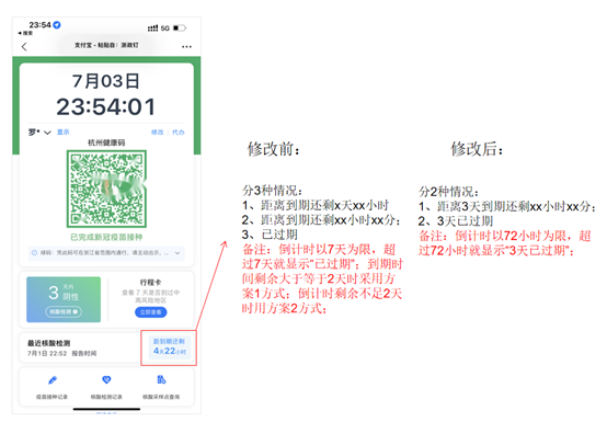
Hangzhou issued the latest notice: The frequency of normalized nucleic acid detection in related areas is adjusted from 7 days to 72 hours

The Office of the Leading Group of Hangzhou's New Coronatte Pneumonic Pneumonia Ep...
Beijing Forestry University's "Yellow River Entrance Haikou" inspection team carried out saline land and Yellow River cultural research and practice activities in our city

Dongying Daily/Aida Camp News Recently, the Xifu Begonia · Yellow River Entry Hai...