The weather will always be "hot" until the 7th, and the typhoon "Xuan Lannuo" will also affect Shenzhen?
Author:Crystal report Time:2022.09.03
Looking back on August, Shenzhen has experienced typhoon days, heavy rainy days ... Various early warning signals are switched frequently. Every time I go to work, I have never done my clothes; every time I do n’t bring an umbrella, it may become the one in the “bureau” of Ayu.
From the end of August to the present, the sun has stabilized "effort". When everyone thinks that they can rest assured to dry, there will be short -term shower in the afternoon. In the weather that was accompanied by the sun, Shenzhen people accepted the "sultry package" with tears, so the typhoon "Xuan Lannuo" attracted everyone's attention.

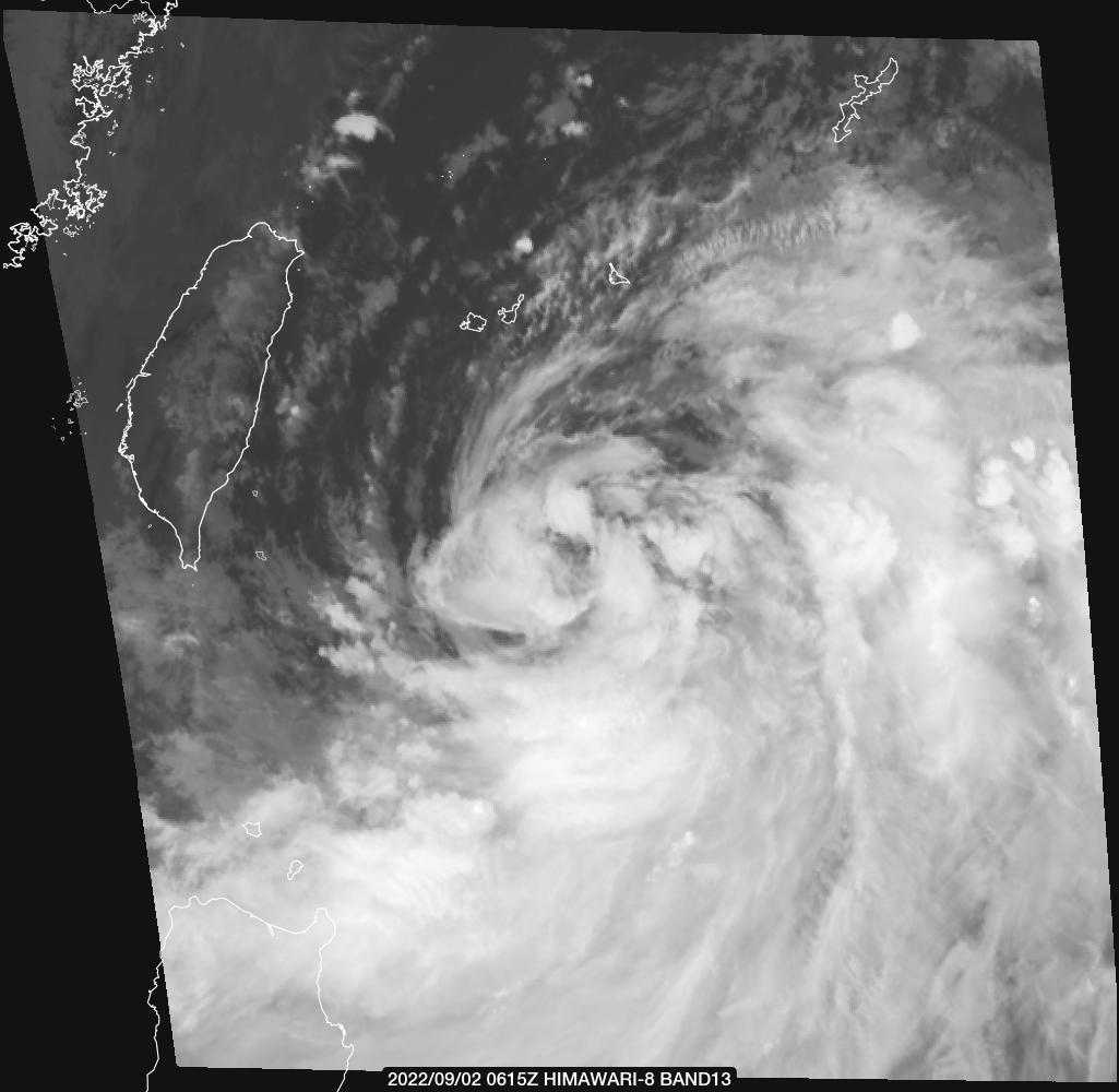
△ On September 2nd, typhoon "Xuan Lannuo" satellite cloud map
The Central Meteorological Observatory continued to issue a typhoon yellow warning at 06:00 on September 3: This year's Typhoon No. 11 "Xuan Lannuo" (strong typhoon) center today (September 3) is located at 5 o'clock in the morning in Zhujiajian, Zhoushan City, Zhejiang Province. Taiwan, which is about 860 kilometers east of the south of the island, is on the east side of the east of 860 kilometers. The maximum wind near the center is 14 levels (42 meters/s), and the lowest air pressure in the center is 955 hundred Pache.
It is expected that "Xuan Lannuo" will move north to the west at a speed of about 10 kilometers per hour. It will move into the East China Sea surface today. The intensity will develop again. The coast is approaching. On the 4th to the 5th, it will move to the northeast of the Zhejiang Sea on the morning of the 5th to the morning of the 5th, tending to the coast of the south of the Korean Peninsula to the area of Benshu Island, Japan.

△ "Xuanlan Nuo" path forecast map
As shown in the figure above, seeing the "V -shaped" position that "Xuan Lannuo" has taken a different approach, it is not easy to know that it is not simple. At present, Xuan Lannuo's path is still very uncertain. How to develop in the future needs to continue to pay attention.
At present, it seems that "Xuan Lannuo" has nothing to do with Shenzhen? No! If the "Xuan Lannuo" brand air conditioner is blowing in Taiwan, Zhejiang and other places, then we blow its "air conditioning machine". The deputy high BOSS and typhoon "Xuan Lannuo" jointly attacked the north of the periphery of the periphery, which brought us a relatively high humidity, temporary rainless weather, and a pretty comfortable body sensation.

What is the typhoon "outer sinking air flow"? Near the Typhoon Center is a strong rising airflow. After reaching a certain height, it will be scattered to the surroundings. When the typhoon is performed, the air and surrounding environment air sink to the low level, thereby forming a sinking airflow.
When the sinking air flow is controlled, it is generally sunny and less cloudy, the solar radiation is strong, and the ground is naturally baked. In addition, the sinking air current itself is like a pot covering the city, the heat on the ground is difficult to spread in it, the air sinking is being sinking and being sinking. The compression increases the temperature; in the end, the sinking airflow will also make the pollutants accumulate at the low level, which is not conducive to its spread and form haze weather.

Therefore, when the typhoon is mentioned, don't just think of the rain and rush. If you eat a typhoon "sinking the air under the periphery", it is inevitable that the haze and high temperature and hot weather are inevitable.

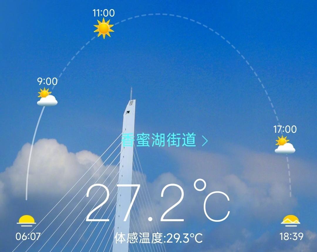
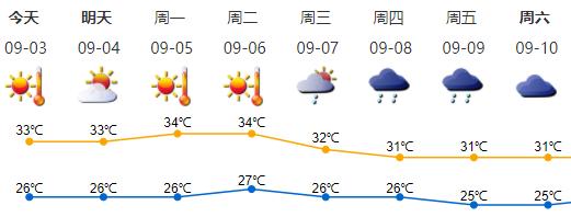
The weather today: dry day, hot at noon; temperature of 26-33 ° C; northwind 2-3 levels, gusts at the coast, highlands and sea areas 6-7; relative humidity 45%-75%.

Weather trends: September 4-6, sunny days, hot weather, and occasional (thunder) showers in the afternoon; 7-9 days of clouds increased, there are showers or thunderstorms, and hot weather is relieved.
At present, the city's high -temperature yellow warning signals are in effect. What life is small wisdom in the high temperature? Hurry up and learn ↓

Typhoon in August came in line, what will happen in September?
According to the weather in Shenzhen, the tropical system is expected to be active from September 12th to October 1st. During this period, 2-3 typhoons were generated at sea, of which 1-2 entered the range of 500 kilometers in our city and brought about wind and rain. The process appears in the middle of the middle, middle to late to late and late, late, late, late, late, late, late, late, late, late, late, late, late, late, late, late, late, late, late, late, late, late, late, late, late, late, and late, and late, and late and late and late, the order can reach the local heavy rain.
Source | Jingbao App
- END -
Favorites | A "shrinking picture", understand the party's congress!

June 18thCommunist Party of China Hubei ProvinceThe Twelfth Congress openedThe rep...
New progress is here!Do you expect this landscape construction?

National Highway G228 Binhai Scenic Road Fuzhou section has made new progress. The...