Notice!The super typhoon "Xuan Lannuo" will affect the eastern waters of my country
Author:China Meteorological Administr Time:2022.09.01
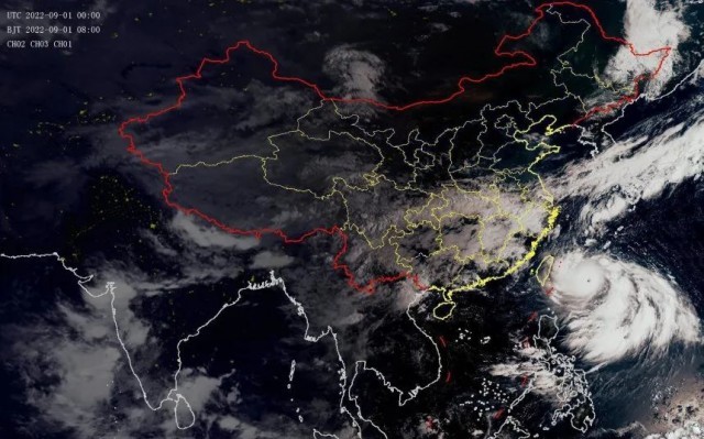
The super typhoon "Xuan Lannuo" is here!
Over the past day
It annexed the low pressure on the south side
As a result
At the same time, successfully complete the eye wall replacement
"Xuan Lannuo" behind the transformation
It will strengthen the second peak strength again

At 8 o'clock on September 1st
Typhoon Xuan Lannuo, No. 11 this year
Located in the east direction of Taitung City, Taiwan Province
About 480 kilometers on the northwest Pacific Ocean
The maximum wind near the center of the center is above 17 or more (65 meters/second)
The lowest air pressure in the center is 910 Baipa
Central Meteorological Observatory continues to release typhoon forecast this morning
It is expected that "Xuan Lannuo" will be about 5 kilometers per hour
Move slowly to the south west
The intensity will still be enhanced

Typhoon No. 11 this year "Xuan Lannuo" in the next 120 hours path probability forecast chart
From the perspective of the path, "Xuan Lannuo" will stagnate or rotate with the east ocean on the 1st on the 1st on the 1st, and the intensity will not change much; then move to the north to move north, and move into the south of the East China Sea on the 3rd on the 3rd.
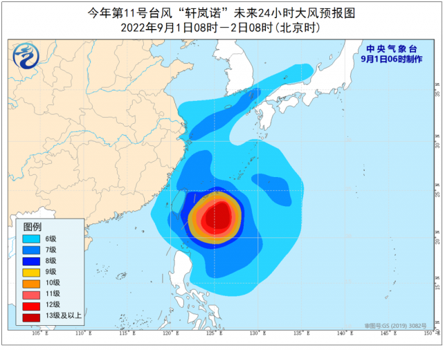
Judging from the influence of the wind, from 8:00 on September 1st to 8:00 on September 2nd, due to the common influence of "Xuan Lannuo" and cold air, most of the East China Sea, Taiwan Straits, Basilica Straits, Taiwan East Ocean, and Taiwan The coast of the island, the coast of Fujian, the coast of Zhejiang, the coast of Shanghai, the southern coast of Jiangsu, and the Yangtze River port will have 6-8 strong winds, and the gusts are 9-10; of which the wind on the east side of Taiwan will have level 9-12, and the gust of gusts 13- At the 15th level, the wind power of the nearby waters or regions passed by the Typhoon Center can reach level 13-17, and the gusts are above 17 or more.

From the perspective of precipitation, from 8:00 on September 1st to 8:00 on September 2nd, there are heavy rain (50-90 mm) in northern Taiwan Island.
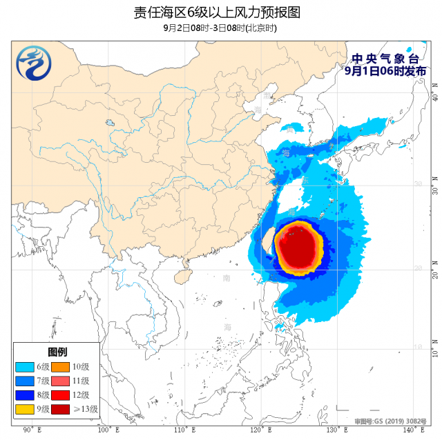
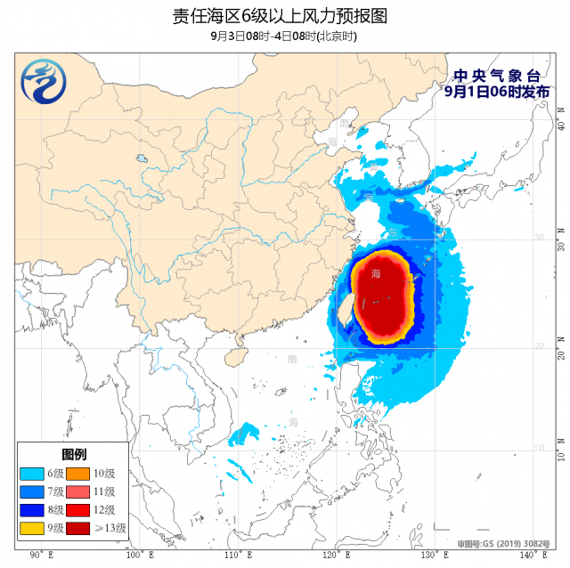
Affected by the typhoon "Xuan Lannuo", from September 2nd to 4th, there were greater storms in the waters of the southeast of my country. Among them, there were heavy rain or heavy rain in Taiwan. Land heavy rain or heavy rain. From the day of September 1st to the night of the 3rd, the east, the Taiwan Strait, the bus strait, the majority of the East China Sea, and the southern waters of the Yellow Sea will appear 6 ~ 8 to 10, and the gust of gusts. Among them The wind in the southern part of the East China Sea can reach level 9-12 and gusts 13-15. The wind power of the nearby waters passed by the Typhoon Center can reach level 13 ~ 17 and level 17.


Meteorological expert reminder
Typhoon "Xuan Lannuo" is still unclear
Can't rule out the possibility of landing in East China
The public needs to pay attention to the latest path forecast of typhoons at any time
Do a good job of defense in advance
Stay away from sea areas or coastal areas with large wind
be careful!
- END -
"Isn't this an elderly sick?" Hangzhou 30 -year -old white -collar worker was told to suffer from osteoporosis!The reason is that sunscreen "is too much"

According to the Central Meteorological Observatory, the largest and strongest hig...
State Grid Baoji Power Supply Company: The "Sanxia" Power Party member service team is in the field

Hello, the driver master, you must pay attention to the high -voltage transmission...