The strongest high temperature in history is ending!"Xuanlan Nuo" promotes super typhoon
Author:Changjiang Daily Time:2022.08.31
Two days ago, it was still under 40 ℃+hot weather
Chongqing people who are tormented never thought
After going out on the afternoon of August 30, I was dumped on the face of autumn
August 30 around 14:00
Most of Chongqing's temperature is in the early 20 ° C
The temperature in the north of rain is less than 20 ° C
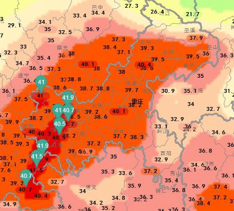
△ On August 28th, Chongqing (National Station) The highest temperature live map
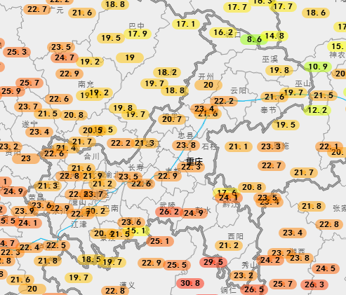
△ At 14:00 on August 30th
The "reducing fever" quickly cooling down Chongqing
Under the influence of cold air
Hunan, Jiangxi and other places on the list on August 29
On August 30, they also withdrawn from obvious cooling
The strongest high temperature process in this history is really coming to an end!
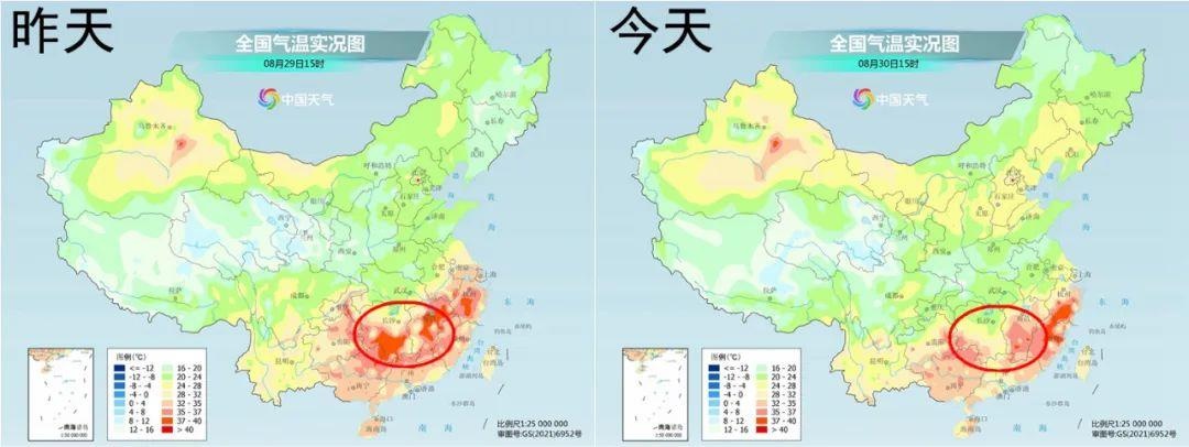
It is expected to be in the next few days
The subtropical high -pressure main body will still be controlled
Most parts of the middle and lower reaches and south of the Yangtze River
But as the low -level cold air gradually penetrates southward
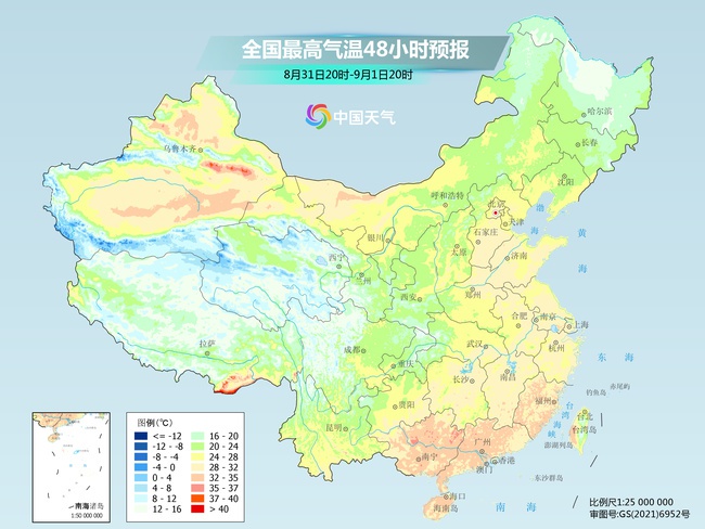
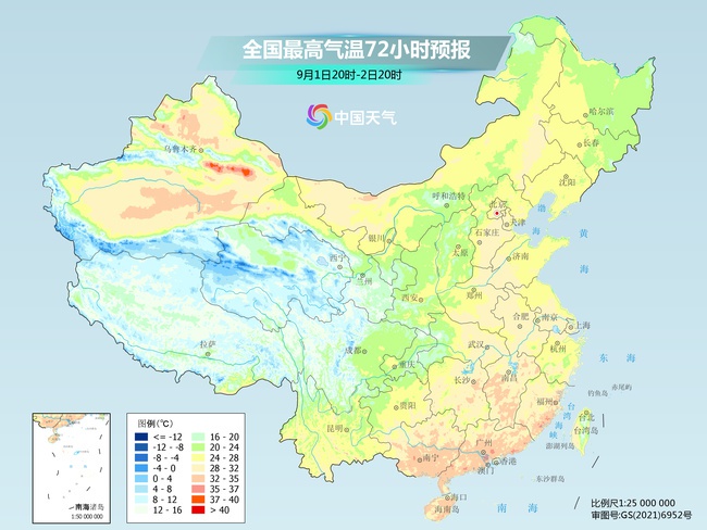
The high temperature range will quickly shrink south
On August 31, high temperature will be concentrated during the day
Fujian to northeastern Guangdong, west of Guangxi and other places
By September 1st
The high temperature in the south will be little left
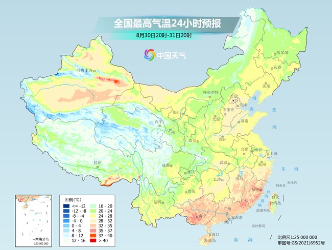
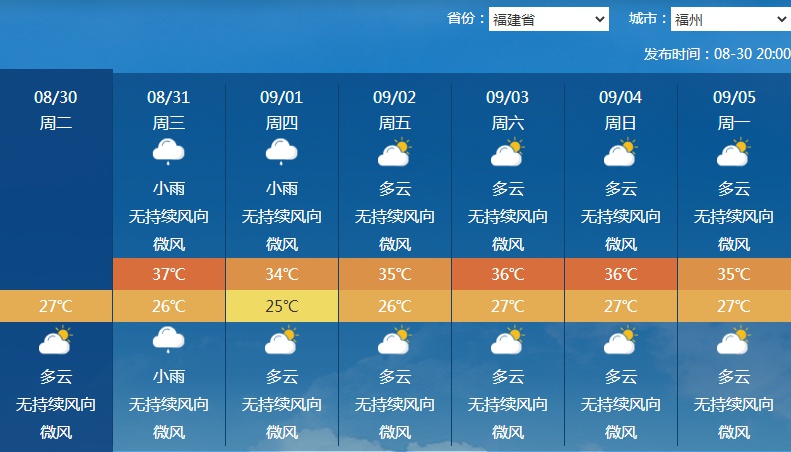
But the high temperature in Fuzhou continues
As of 16:00 on August 30
In the national capital -level cities, only high temperatures have appeared in Fuzhou
The cumulative high temperature days have reached 60 days since this year
From the forecast point of view
Fuzhou reported high temperature above 35 ° C in 5 days in 7 days on August 30
Rucheng True local cumulative high temperature daily this year will reach 65 days
It is expected to refresh the longest local record (previously 2003, 63 days)
Why do you have retired from South China high temperature?
It is still because of:
1. Cold air strength is not enough
2. The subtropical high pressure is not retreated enough
3. The high temperature here also has the "help" of typhoons -
Early morning on August 30
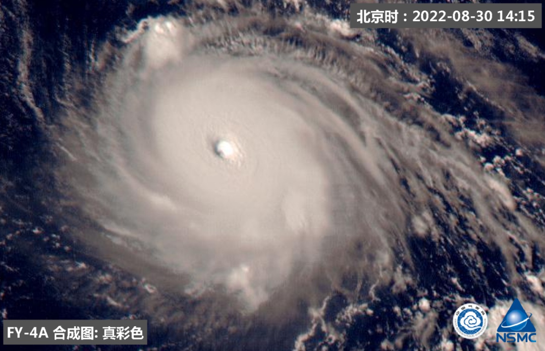
Typhoon Xuan Lannuo No. 11 this year
Upgrade to the first super typhoon in the Northwest Pacific and South China Sea this year
From the point of view of the cloud map
"Xuanlan Nuo" form is full of core cloud system close typhoon eyes clear
It's the standard "powerful" typhoon ↓
and
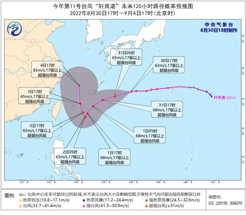
It can be seen from the probability forecast of the typhoon path in the next 120 hours
Until the 4th, "Xuan Lannuo" will maintain a super typhoon level
It's a very strong typhoon
Meteorological analyst explanation:
It is not uncommon to maintain a typhoon at the super typhoon level for so long
Due to the future travel route of "Xuan Lannuo"
High vertical wind cut in sea temperature small
Coupled with the weakening effect of the island land
These factors are very helpful to maintain or even enhance its strength
At present, there is still great uncertainty about its future path
But as the super typhoon "Xuan Lannuo" approaches
By 4th
Fujian and other places may also be affected by sinking air flow in its periphery
High temperature weather appears
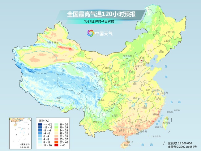
(Source: China Weather Network)
【Edit: Wang Yujin】
For more exciting content, please download the "Da Wuhan" client in the major application markets.
- END -
Party building leads the "small special" to promote development.
In recent years, the Chongqing Dazu District Market Supervision Bureau has firmly established the concept of grasping party building is to promote development and development must grasp the party bui
Qingdao, a new journey to the sea

Qingdao has determined the overall requirements and goals of the city's work in th...