The super typhoon "Xuan Lannuo" is coming!There will be 6-9 meters crazy waves in Zhejiang waters | This place has emerged from more than a hundred tourists
Author:Voice of Hangzhou Time:2022.08.30

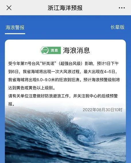
The Zhejiang Marine Monitoring Forecast Center released the waves of waves this morning:
Affected by Typhoon Xuan Lannuo (Super Typhoon Level) No. 11 this year, it is expected that from the afternoon of the 1st to 6th, there will be a big storm process in the waters of Zhejiang Province. 6.0-9.0 meters of mad waves. It is expected that the sea wave warning level will reach the yellow or yellow level.
Relevant units are requested to do a good job of preventing waves and preventing waves, and pay attention to the follow -up warning of our center.
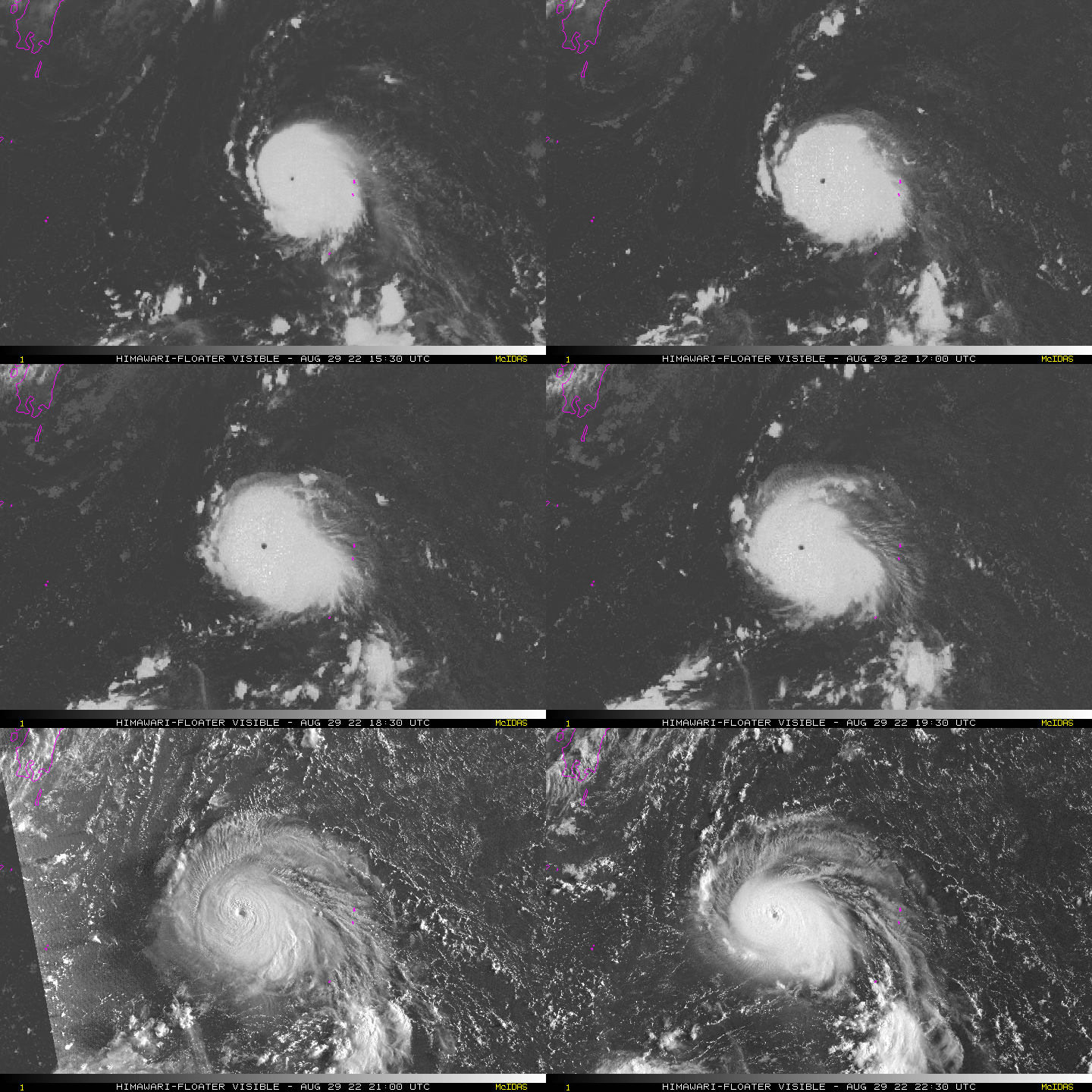
Typhoon "Xuan Lannuo" this year has been strengthened from a strong typhoon level at 2 am today (30th) to super typhoon. At 5 o'clock in the morning, it is located in the east of Naha, Okinawa, Japan, about 1060 On the northwest Pacific Ocean, the north latitude is 27.0 degrees north latitude and 138.3 degrees east longitude. The maximum wind near the center is 16 levels (55 meters/s), the lowest air pressure in the center is 930 hundred Pache, and the seven-level wind circle radius is 180-250 kilometers. The radius radius of the class is 70-80 kilometers, and the twelve-level wind ring radius is 50 kilometers.
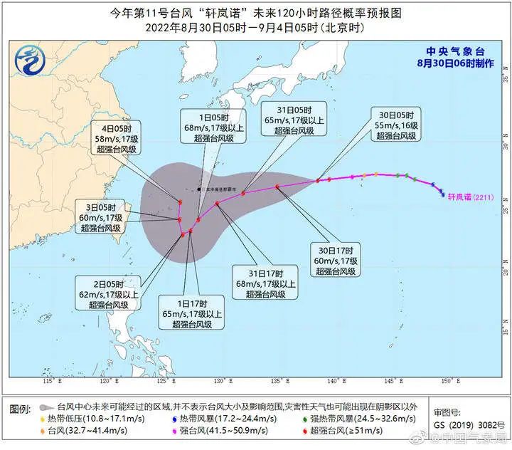
It is expected that "Xuan Lannuo" will move west at a speed of about 30 kilometers per hour, and the intensity will continue to strengthen. Closer to the waters of the Ryukyu Islands, it will begin to affect the eastern waters of my country on the 31st.
According to the Hangzhou Meteorological Observatory, in the short term, the typhoon has not had an impact on Hangzhou, and today's wind and rain are caused by cold air.
In the night to tomorrow, precipitation will gradually transform into the stability of the cold zone. The cooling brought by cold air will also be relatively obvious. The temperature in the urban area has begun to decline this afternoon.
Until tomorrow, Hangzhou temperatures are continuously declining. On September 1st, the weather turned cloudy, and the temperature rose slightly, but the highest temperature was less than 30 degrees. After the 2nd, we must pay attention to the impact of typhoon activities.
More than a hundred tourists from the Bei Ji and Beilong Island of Wenzhou and Beilong Island
Affected by the typhoon "Xuan Lannuo", the wind power will gradually increase to level 8-9 gusts from the coast of Ruian, the coast of Wenzhou.

At present, there are many passengers in the tourist tourism. In order to avoid a large number of tourists staying the island, the Wenzhou Feiyunjiang Maritime Department jointly launched the emergency plan and organized the evacuation of the two islands of Beisuo and Beilong. Equal -intensive areas reminds past ships to avoid avoiding the avoidance through high frequencies. At the same time, law enforcement officers conducted real -time escort of the two passenger ships of "Beilonghai" and "Ruian Beiso" through information technology such as maritime wisdom control platforms, reminding the surrounding waters at any time.
It is reported that the evacuation work started at 7:00 on August 30. As of 12:00 on August 30, 159 passengers had evacuated. About 100 passengers will continue to be evacuated on August 31.
Earlier report
Super Typhoon "Xuan Lannuo" may be in the early morning of the 31st
Crossing the 48 -hour warning line in my country
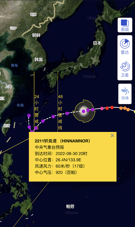
According to the Central Meteorological Observatory, at 8 am this morning, the center of Typhoon "Xuan Lannuo" is located about 970 kilometers east of Naha, Okinawa Prefecture, Japan, that is, 26.8 degrees north latitude and 137.4 degrees east longitude. At present, the maximum wind power is 16 levels, 55 meters/s (about 198 kilometers/h), and the central air pressure is 930 HPA. It is expected that "Xuan Lannuo" will move west at a speed of about 30 kilometers per hour. Essence
It is reported that the typhoon "Xuan Lannuo" No. 11 this year has been strengthened from a strong typhoon level at 2 am this morning to super typhoon level. According to the path forecast of the Central Meteorological Observatory, it will travel around the early morning of the 31st. Wire.
Source: Comprehensive CCTV News, China Weather, Zhejiang News Client, Hangzhou Weather
Copyright belongs to the original author
Edit: Zhang Jie
- END -
The Guizhou Provincial Institute of Health and Standardment issued the "Promotions for Promoting the New Era of Marriage and Education in the New Era"

On the occasion of the Decision of the Central Committee of the Communist Party of...
Walking in front of the new bureau 丨 "city" long shaft in Jinan: Have you felt the changes in Jinan change in the years?

Qilu.com · Lightning News, August 27th, keep in mind the instructions to entrust...