Affected by the typhoon "Mulan" to release the storm trend & wave yellow alert
Author:National Ocean Forecasting Tai Time:2022.08.09

The tropical low pressure in the South China Sea has developed into Typhoon Mulan, No. 7 this year (9th). It will move north to west at a speed of about 20 kilometers per hour, and the intensity will be slightly strengthened.
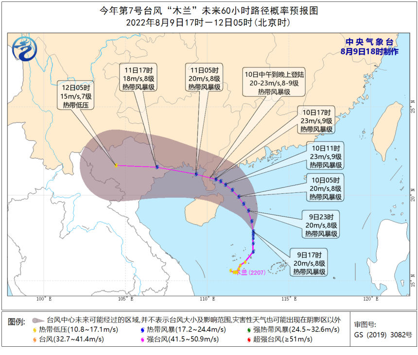
(Typhoon road map source: Central Meteorological Observatory)
The National Oceanic Forecasting Power issued a storm and a yellow alarm.
Affected by Typhoon Mulan (tropical storm) No. 7 this year, it is expected that from the afternoon of August 9th to the afternoon of the 10th, 30 to 90 cm of storms will occur from Shanwei, Guangdong to Zhanjiang. A 30 to 60 cm storm appears water. The storm warning level in Shenzhen, Guangzhou, Guangzhou, Zhongshan, and Zhuhai City is yellow; the storm warning level of the storm tide warning level of Huizhou City, Yangjiang City, Maoming City and Haikou City, and Eastern City, Guangdong is blue.
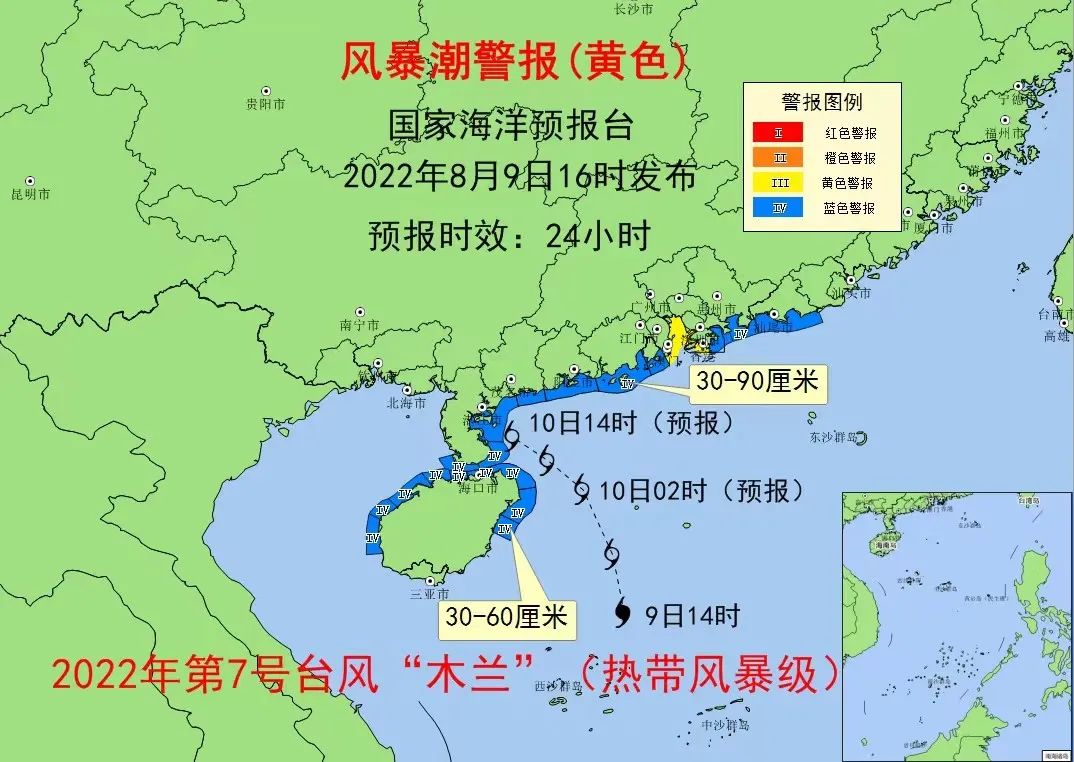
The coastal governments and relevant departments are requested to do a good job of emergency preparations for defensive storm tide; relevant units related to the sea -related units take positive and effective measures to organize fishing boats, farming and fishing row, farm, etc. Facilities, prepare moisture -proof.

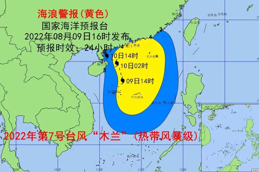
Affected by Typhoon Mulan (tropical storm) No. 7 this year, it is expected that from the night of August 9th to the 10th, there will be a large wave from 3.5 to 5 meters from the South China Sea; The 4 -meter waves to the huge waves, the sea wave warning level of the near -shore waters is yellow; 2 to 3 meters of the waves will appear to the large waves in the near -shore waters of Hainan.
Please pay attention to safety in the above -mentioned sea areas, and relevant units of the coastal coastal to take anti -wave avoidance measures in advance.
The marine environment forecast in the next two days
Expected tomorrow,
There are light waves of 0.5 to 0.8 meters in the Bohai Sea;
There are light waves from 0.8 to 1 meter in the north of the Yellow Sea;
There are 1.5 to 1.8 meters in the south of the Yellow Sea;
There are light waves from 1.2 to 1.6 meters in the northern part of the East China Sea;
There are light waves of 0.8 to 1 meter near the waters of the south of the East China Sea and the Diaoyu Islands;
The Taiwan Strait has a middle wave of 1.4 to 1.7 meters;
There are 1.2 to 1.6 meters of light waves from the east side of Taiwan;
There are 1.7 to 2.1 meters of Zhonglang District;
Beibu Gulf has 1.3 to 1.8 meters of the waves;
There are 2.5 to 3.8 meters in the northern and central parts of the South China Sea;
There are 2 to 3 meters in the southern part of the South China Sea to Dalang District.
Expected the day after tomorrow,
The Dalang District of the South China Sea weakened and disappeared.
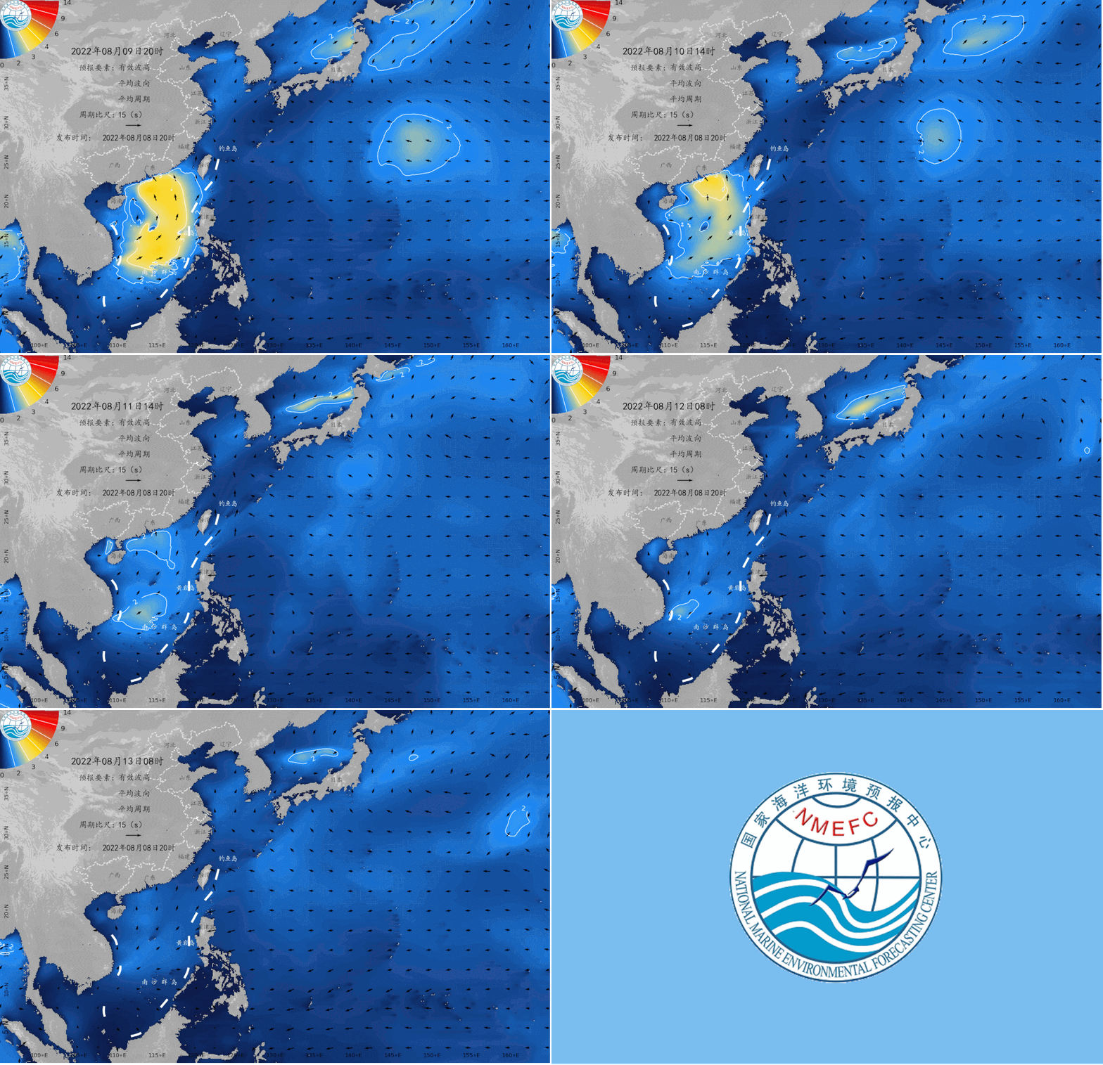
August 9 to 13
Beautiful island waters sea conditions
Expected tomorrow,
There are 2.8 to 3 meters near the waters of Wanshan Islands, Sichuan Mountain Islands, and the waters near Huangyan Island. Hailing Island, Yongxing Island, and Yongshu Reef are in the waters of 2.2 to 2.4 meters. Travel;
Dongshan Island, South Australia Island, Laizhou Island, Jiezhou Island, and Wuzhizhou Island have 1.9 to 2 meters of Zhonglang, Shengsi Islands, South Three Islands, and East Island. The waters near the island are more suitable for traveling by boat;
The waters near the other beautiful islands in my country are light waves, with good sea conditions, and they are very suitable for traveling and island.
Beautiful island refers to the following 35 islands:
Juehua Island, Changshan Islands, Bodhi Island, Long Island, Liu Gong Island, Lingshan Island, Qinshan Island, Lianjima, Chongming Island, Shengsi Islands, Sushan Island, Dongji Island, Putuo Mountain, Dachen Island, Yuhuan Island, Dongdong Tou Island, Nanji Island, Laoshan Island, Sandu Island, Pingtan Island, Meizhou Island, Dongshan Island, Diaoyu Island, South Australia Islands, Wanshan Islands, Sichuan Shan Islands, Hailing Island, South Island, Dong Island, Dong Island, Dong Island, Dong Island, Dong Island, Dong Island, Dong Island, Dong Island, Dong Island, Dong Island, Dong Island, Dong Island, Dong Island, Dong Island, Dong Island, Dong Island, Dong Island, Dong Island, Dong Island, Dong Island, Dong Island, Dong Island, Dong Island, Dong Island, Dong Island, Dong Island, Dong Island, Dong Island, Dong Island, Dong Island, Dong Island, Dong Island, Dong Island, Dong Island, Dong Island, Dong Island, Dong Island, Dong Island, Dong Island, Dong Island, Dong Island, Dong Island, Dong Island, Dong Island, Dong Island, Dong Island, Dong Island, Dong Island, Dong Island, East Island, East Island, East Island, Dong Island Dazhou Island, Boundary Island, Wuzhizhou Island, Yongxing Island, Huangyan Island, Yongshu Reef.
More coastal tourism forecasts are all in China's marine forecast

PC can log in to China Ocean Forecast Network http://www.oceanguide.org.cn/indexhome
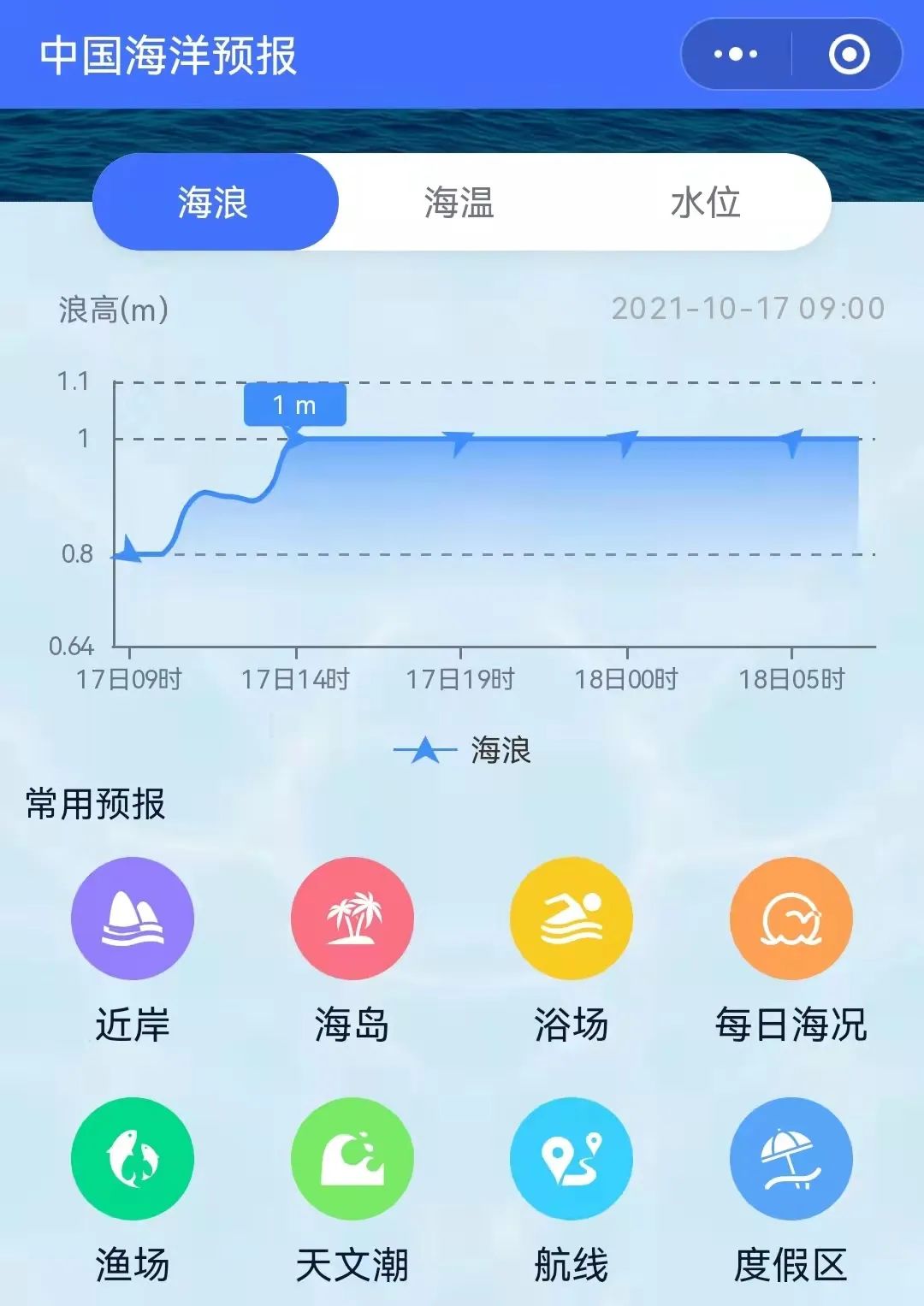
The mobile terminal can use China Ocean Forecast WeChat Mini Program
Click the picture below
Enter "China Ocean Forecast" WeChat Mini Program

Long press the picture below to identify the QR code
- END -
Teachers recruitment written test shortcomings are shortlisted for interviews?Official notice
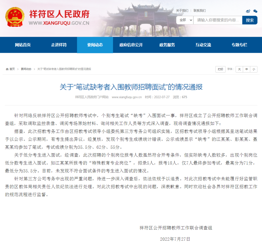
The portal website of the People's Government of Xiangfu District, Kaifeng City, H...
Party members run first in front line projects
Xingsha Times (Reporter Sheng Lei Correspondent Tong Xiazhou Huang Chuyun) Recently, the party school of the Changsha County Party Committee reconstructed and expanded the project site. The vehicles t