Will it cool in August?One word, difficult!Come and pay attention to heatstroke prevention
Author:Zhejiang Daily Time:2022.08.01
Zhejiang News Client reporter Zhu Cheng
Will it cool in August?
One word, difficult! As the typhoon goes far, the subtropical high pressure will be opened again to continue to "heated" for Zhejiang.

At least, in early August, the high temperature is still very arrogant.
Especially from August 5th, the high temperature range will expand and the intensity will also increase. In addition to the coastal islands, most of them will accept a high temperature crit at 37 ° C+, and the figure of 40 ° C+will be more.
However, from August 2nd to 4th, the coast and southern Zhejiang region were affected by the low-altitude southeast airflow and weak concentration. Sometimes there were shower or thunderstorms, and high temperatures were eased!
However, the highest temperature in most other areas can still reach 37 ° C.
Specifically, today's northern Zhejiang and coastal areas are cloudy. Some of them have shower or thunderstorms in the afternoon. Other areas are cloudy to cloudy, and there are decentralized thunder shower in the afternoon. The highest temperature tomorrow, 34-37 ° C in northern Zhejiang and coastal areas, 37-39 ° C in other areas, and local 40 ° C or more.
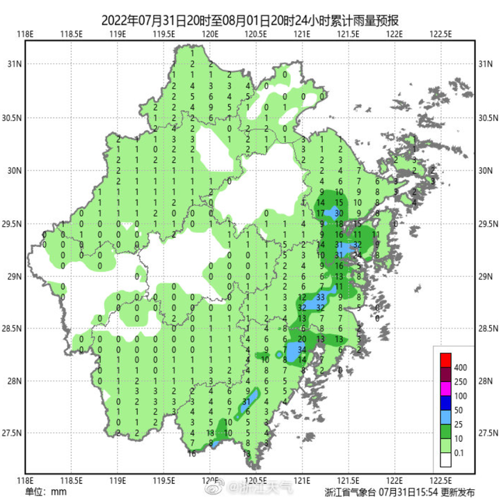
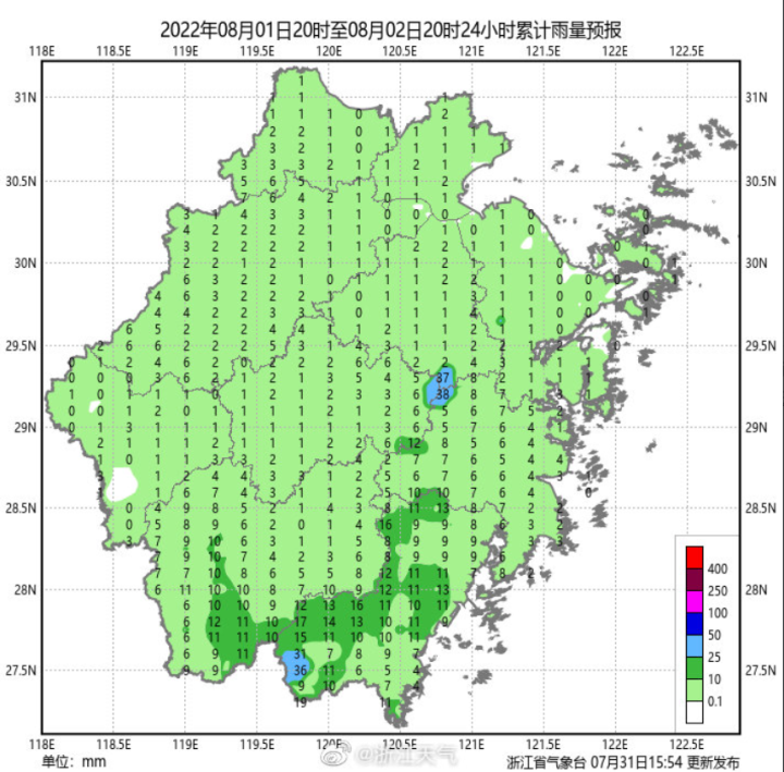
Tomorrow, the coast and southern Zhejiang region are cloudy to overcast. Some of them have shower or thunderstorms, cloudy in other areas, and decentralized thunderstorms in the afternoon. The highest temperature is 32-35 ° C in the southeast coastal area, 37-39 ° C in other areas, and part of the part of 40 ° C.
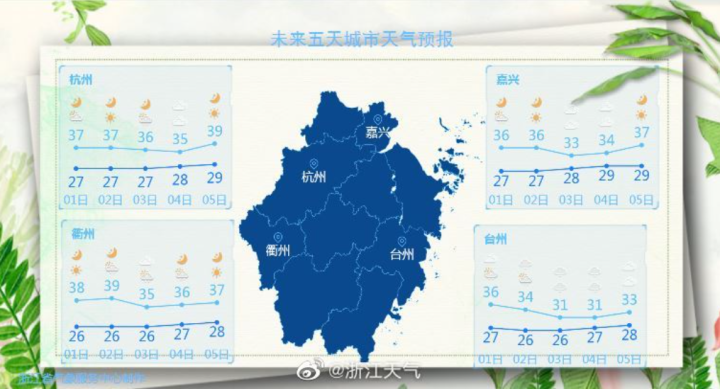
The following is the Details of Zhejiang weather in the next five days-
- END -
Which tobacco production skills are strong?On -site competition
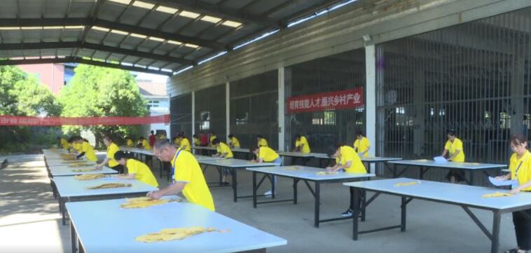
On July 25, the first tobacco production skills competition in Ningxiang City was ...
"Hot Number" Yan Bojun's "Hot Secret": Yan Bojun, who does not repair the border, is better than a beautiful woman.

Yan Bojun.You don’t have to be a handsome and beautiful woman, you can do it with...