Typhoon "Sanda" generates!These areas of my country will be affected by wind and rain!
Author:China Meteorological Administr Time:2022.07.29

Stormy is coming!
Typhoon Sanda No. 5 this year generates
Two days after the Ming Dynasty, as "Sanda" approached
The coast of East China will be affected by wind and rain
What is the development of typhoons in the future?
Typhoon Sanda No. 5 this year was generated last night. Among them, today (July 29) is located on the ocean surface of about 740 kilometers north of Naha, Okinawa Prefecture, Japan. The maximum wind nearby is 8 levels (18 meters/s), the center's lowest air pressure is 1,000 hundred Pache, and the seven -level wind ring radius is 120 kilometers to 180 kilometers.
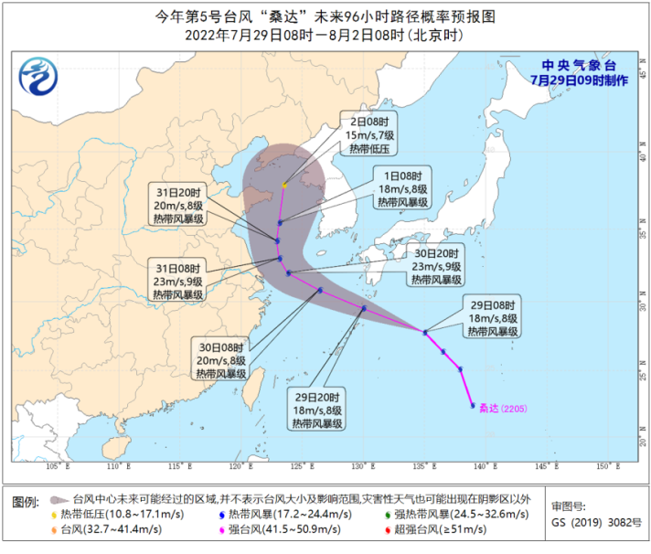
It is expected that "Sanda" will move to the west at a speed of 40 kilometers to 50 kilometers per hour, and the intensity will not change much. It will move into the East China Sea on the night of the 29th. The intensity gradually weakened.
Two days after the Ming Dynasty, as "Sanda" tended to my country's offshore, the coast of East China was affected by wind and rain.
Specifically-
In terms of wind: From July 29th to August 1st, the northern part of the East China Sea and the south of the Yellow Sea in my country has 6-8 storms, and the nearby sea surface passed by the Typhoon Center has a level 9 and a gust of gusts.
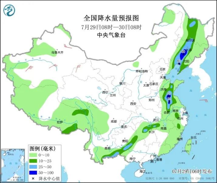
In terms of rainfall: On July 29th, there were heavy rain in the central and western parts of Liaoning, central and central Liaoning, central Jilin, northern Heilongjiang, southern Shandong, northern Anhui, northern Jiangsu, northern Hunan, southeast of Yunnan, northwest of Guangxi There are heavy rains in local areas such as southern Shandong, northern Jiangsu; some areas of the above areas will also be accompanied by strong convective weather such as short -term heavy precipitation, local lightning wind or hail.
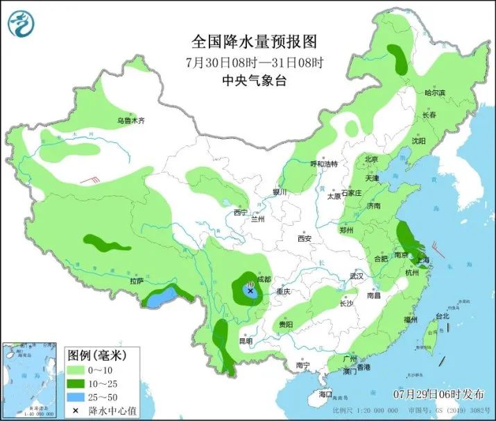
From July 30th to 31st, due to the influence of the typhoon "Sanda" to the north, there were medium to heavy rain in parts of Jiangsu, Shanghai, Zhejiang and other places.
Affected by typhoons, in the next three days, there are 6-7 gales in the East China Sea, most of the Yellow Sea, and the coast of East China. The nearby sea surface passed by the "Sanda" center will have 8-9 large winds, and the gusts can reach 10 levels.
at last
Send it for everyone
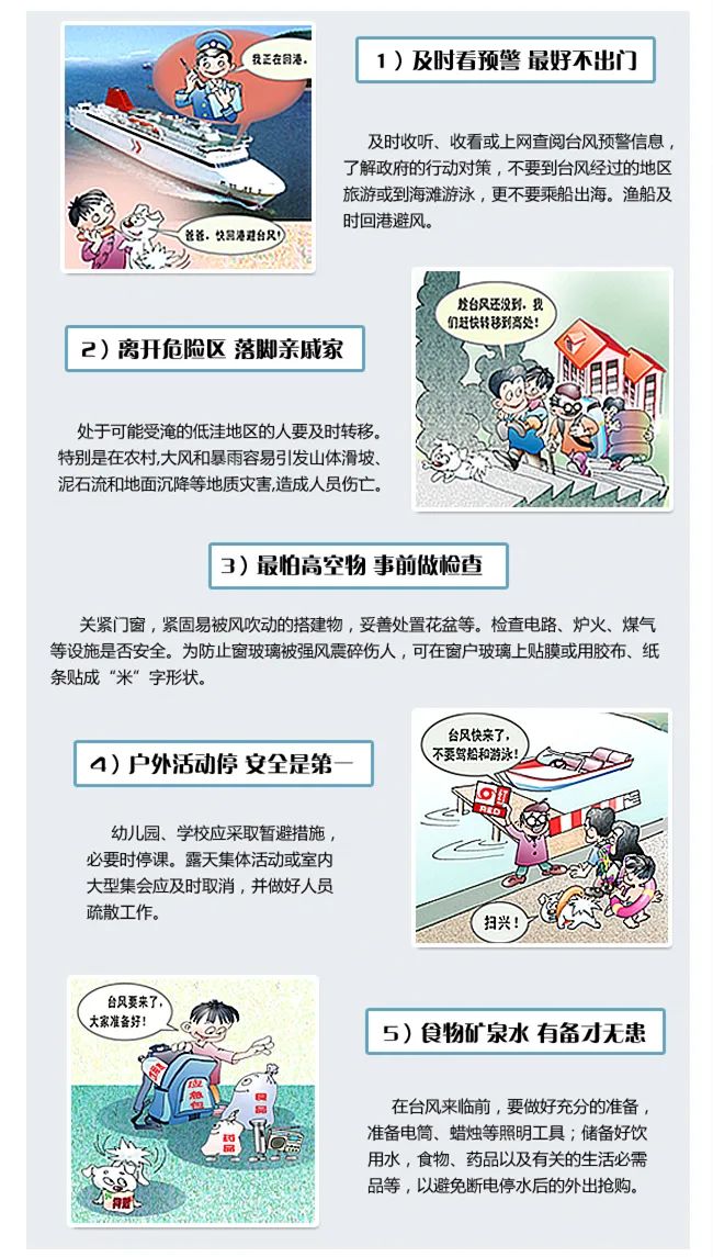
Typhoon Defense Guide

What should I do before the typhoon comes?

What is a typhoon landing point?
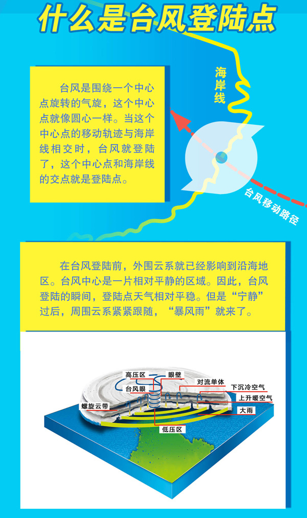
Typhoon landing point
Will it be the worst disaster?
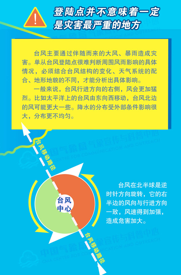

How to avoid the typhoon?
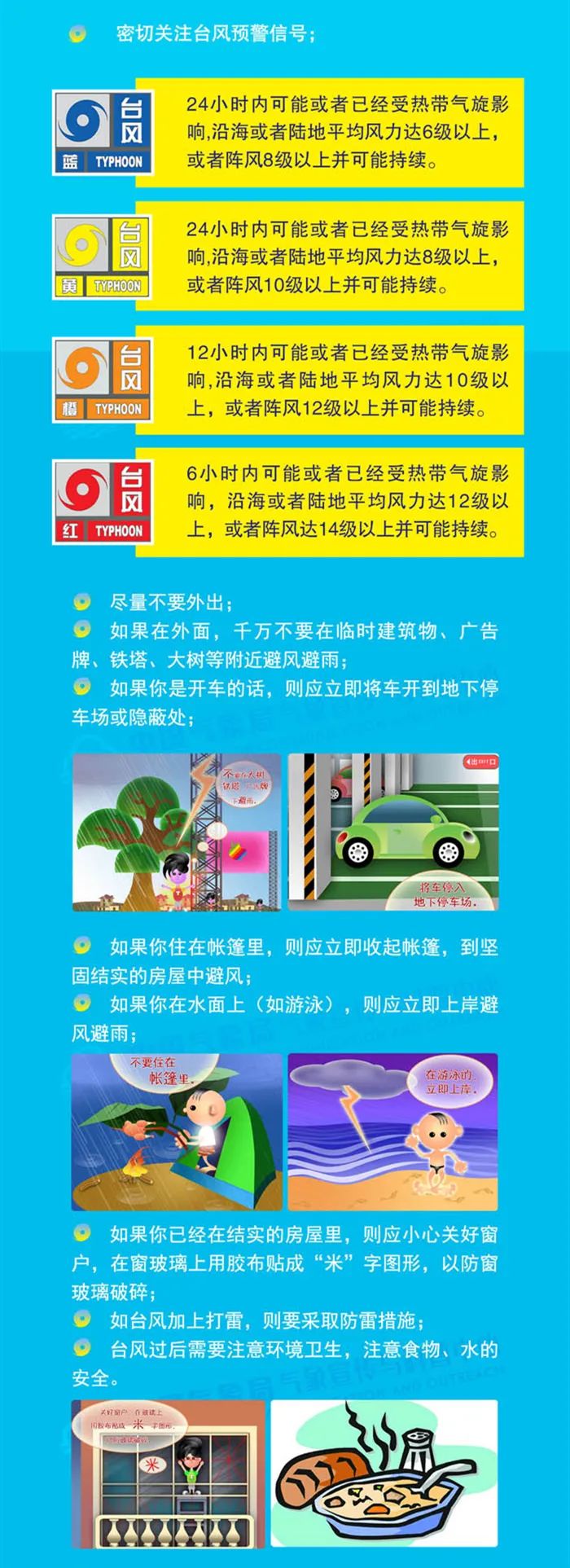
We always follow
Your shade and cold and warm


Produced by China Meteorological Administration Xuanke Center (China Meteorological News Agency)
Source: Central Meteorological Observatory
Edit: woody
Review: Duan Haoshu

- END -
Han Xu welcomed the WNBA "China Derby" and "second grade students" to think more mature

Cover reporter Yan WenwenWhen I was in elementary school, the teacher asked everyo...
Xianyou Lai Store: "Organ+Rural", party building leadership promotes revitalization

On July 22, He Jingjian, Executive Deputy Secretary of the Working Committee of th...