Typhoon "Sanda" generates!Jiangsu, Zhejiang and Shanghai are one of the potential landing sites
Author:Voice of Zhejiang Time:2022.07.28
Source: Voice of Zhejiang reporter Cai Jikang, Central Meteorological Observatory, Zhejiang Weather,@Weatherman_ Xinxin
The copyright belongs to the original author, if there is any infringement, please contact it in time
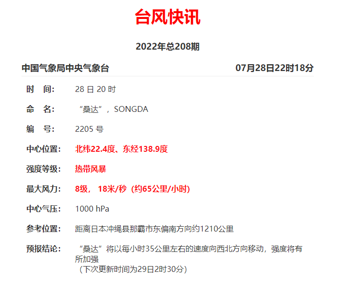
On July 28, the Central Meteorological Observatory issued a typhoon News. At 20:00 on the 28th, Typhoon Sanda No. 5 this year was generated.
It is reported that the fifth Typhoon "Sanda" is currently the largest wind power 8, 18 meters/s (about 65 kilometers/h), about 1210 kilometers south of Naha, Okinawa Prefecture, Japan, and will be around 35 kilometers per hour. The speed of the speed will be strengthened in the northwest.

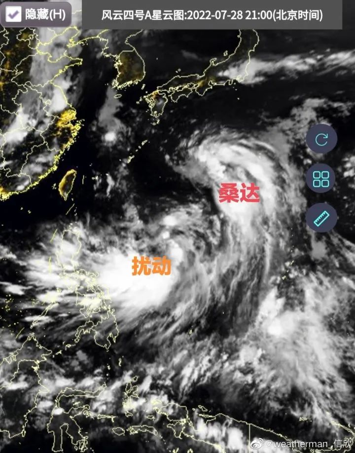
China Meteorological Channel Meteorological Analyst Xinxin posted a Weibo saying that Sanda will generally move northwest in the future, and the path variables in the later period are large. Regardless of the 70%probability circle or the collection of forecast divergence, it is very large. It is a potential landing place. The situation may gradually be clearer on the 30-31 days. In addition, there is also a disturbance in the southwest of Sanda to develop into a typhoon in the future.

- END -
[Follow] The establishment of the provincial teaching teacher studio in the field of basic education in Yunnan Province launched the work

To give full playXing Dianying only support plan basic education fieldDemonstratio...
Environmental protection must be heard 丨 Wind blow grass and see cattle and sheep -Gansu Provincial Department of Ecological Environment published "Gansu Biological Diversity" reading

What is biological diversity?Biological diversity is a concept describing the degr...