Typhoon Sanda may generate!The cooling is on this day ...
Author:Voice of Zhejiang Time:2022.07.27
Source: Comprehensive Chinese weather, Zhejiang weather, Hangzhou weather
The copyright belongs to the original author, if there is any infringement, please contact it in time
New typhoon, there is news
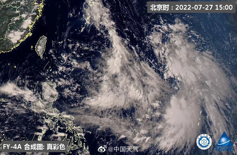
The maritime will give birth to typhoon embryos. Figure: National Satellite Meteorological Center
Earlier, according to the Central Meteorological Observatory, the tropical disturbance of the South China Sea and the Northwest Pacific has become active. There may be a typhoon generating, which has a wind and rain impact on the eastern and southern sea areas.
According to the analysis of meteorological experts, due to the strong subtropical high pressure, the activities of the maritime tropical system have been curbed. By July 30, the subtropical high -voltage may weaken the "weight loss" and gradually release the development space for the development of the tropical system.
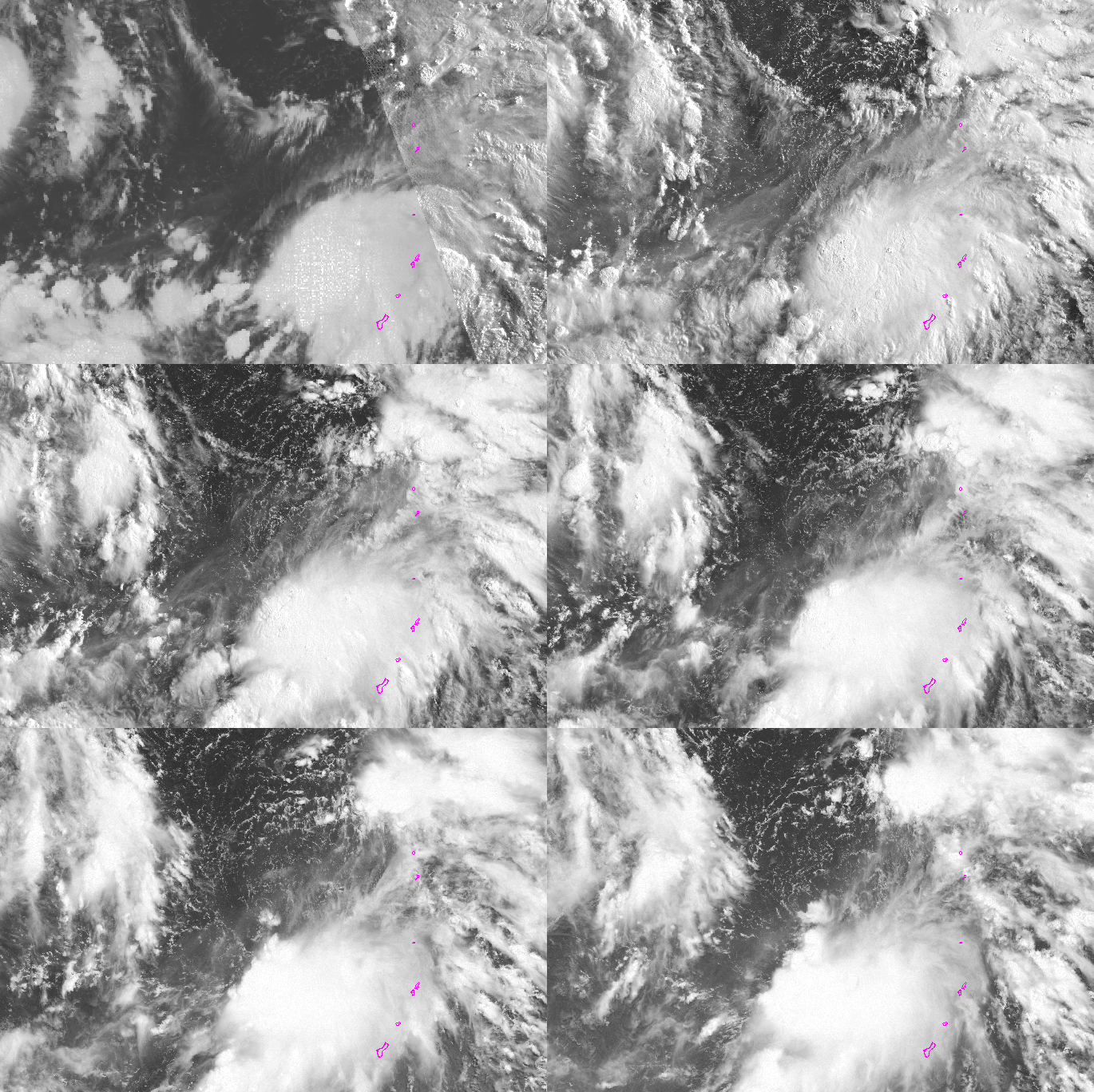
The tropical low pressure monitored by Sunflower-8 satellite (original tropical disturbance 93W) can be seen in the animation of the light cloud map (time period: 04:00 on July 27, 2022 to 11:00 on the 27th)
On July 26, the typhoon embryo near Guam has developed all day long. At night, it already has a recognizable circular center and the largest 7 -level wind. To this end, the Japan Meteorological Agency has upgraded it to a tropical low pressure, and it is expected that it will be strengthened to Typhoon Sanda No. 5 this year.
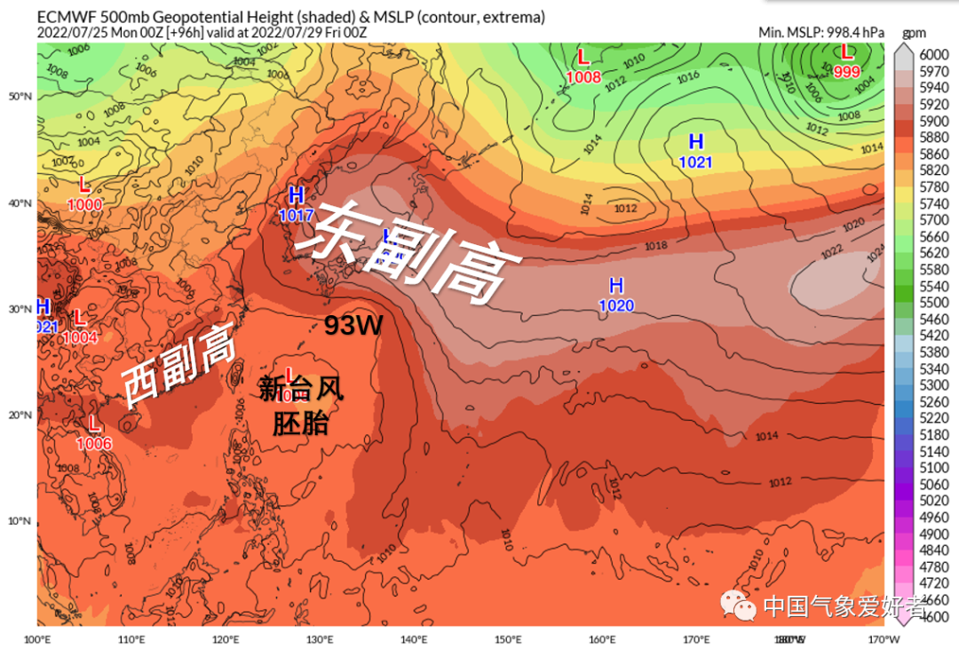
In the future, Typhoon Sanda will be close to the east subtropical high -voltage and move at a high speed on the Pacific Ocean. On July 29, it will come to the Ryukyu island chain.
However, after this, the situation will be intricate: at this time, the cracks between the East and Vice Vice Vice -high at this time are too large. Not enough; second, the tail residual cloud system of typhoon embryo 92W, as well as the new typhoon embryo east of the Philippines, will be assembled to form a large and scattered new typhoon embryo, which will occur with Sanda.
But no matter where Sanda landed, it would definitely bring some ocean winds to Jiangsu, Zhejiang and Shanghai and northern Fujian. Affected by the weakened subtropical high pressure and the east atmosphere of the ocean, the high -temperature weather in Shangcheng may ease compared with the previous period. What is the specific situation at that time? We will continue to pay attention.
Let's take a look at high temperature
I entered Zhongfu yesterday
10 days
Wenzhou directly won the high temperature "full diligence" award
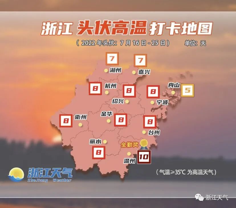
"Three volts" has only been a quarter of the past
This year's three volts ultra -long online for 40 days, 10 days in the head, 20 days in the middle, 10 days in the last 10 days
But friends from Zhejiang have been punched in the high temperature every day
Torture enough

Fortunately, the day before yesterday
Large -scale afternoon thunderstorms rose one after another
Because the rain is not small
The next one is no longer "boiling water"
It is a solid cooling
There are places where rain and no rain
The temperature difference is obvious
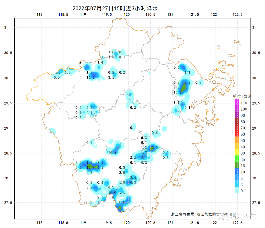
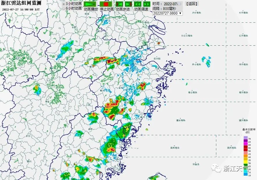
The thunderstorm still appeared on time this afternoon
Northwest Hangzhou and northwest of Lishui
There are also Taiwan, Shao, and Wenjiao Communities
There is a match for Liuyun Group
Echo is more obvious
The temperature of this afternoon is still enthusiastic like fire
Especially southern Zhejiang
After yesterday
The highest temperature of Lishui rushed to 42 ℃ again
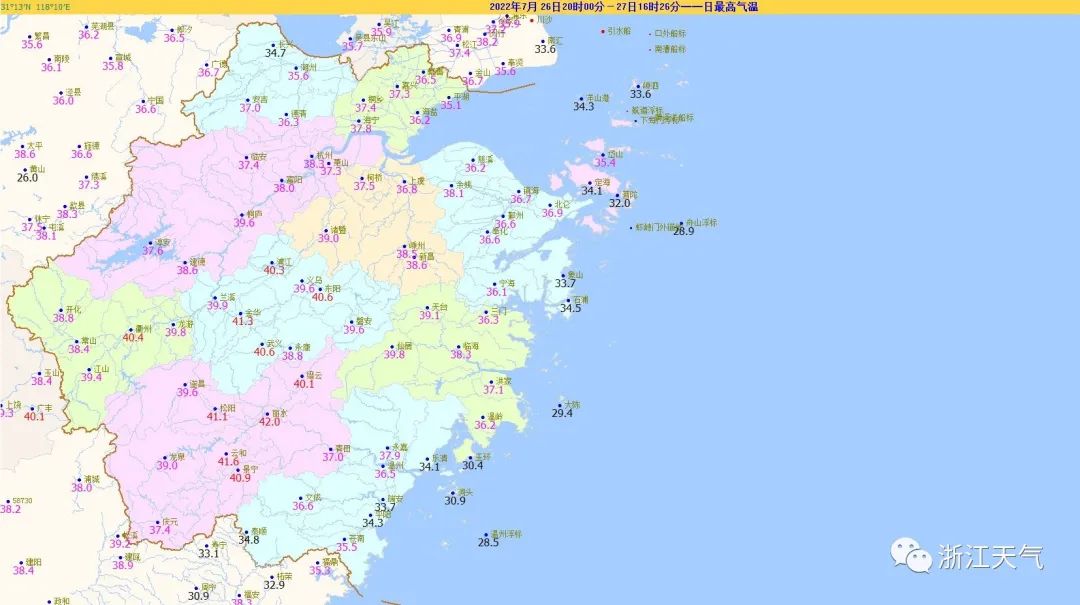
Today's highest temperature is active
Friends
Don't take it lightly
During the heatstroke prevention and cooling, it is still the number one task
The weather trend in the later period
The focus of today's weather is except for the high temperature that is always talking about
Before the middle of the night and the afternoon of tomorrow to the night
In some areas of our province, we still need to prevent showers or thunderstorms
There are some short -term heavy rain in the thunderstorm area
Level 8-10, Level 11 or above thunderstorms
For strong convective weather such as Xiaodi Xiaodi Hail
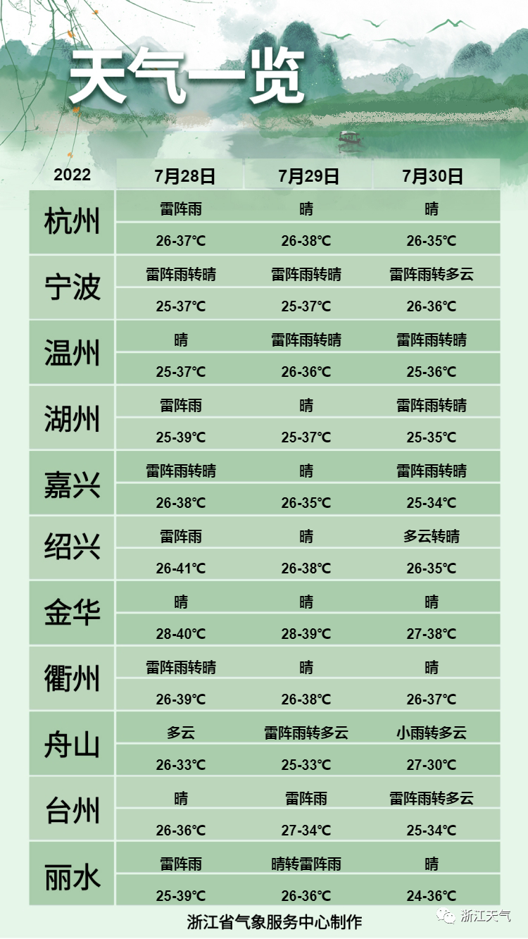
High temperature has eased
From the day after tomorrow until the 2nd
Affected by the weakened subtropical high pressure and the seafire at sea
The high temperature in most areas in our province eases compared to the previous period
40 ° C and above extreme high temperatures to appear opportunities to reduce
But the high temperature above 35 ° C will continue
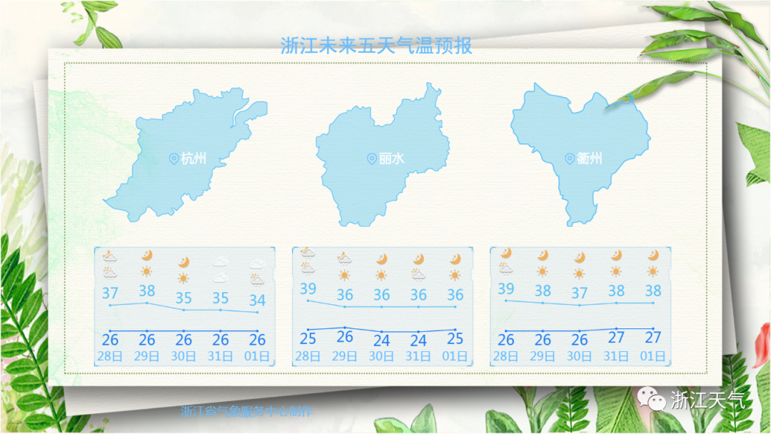
Increased precipitation in coastal areas
1 30 to August 1st
The number of cloud systems in the coastal areas of our province began to increase
There will be shower or thunderstorms in some areas
Other areas still maintain the old -fashioned appearance
It is a decentralized thunder shower in the afternoon
☞ 2-3
Affected by the further influence of the east atmosphere at the sea
Rain in coastal areas will visit more frequently and obviously
The thunderstorms expanded in other regions in the afternoon
- END -
Shanwan Morning News 丨 Jiangsu Wuxi found 39 positive personnel; from July 1st, new changes in the ban on train bands in train;

Good morning Life is simple and plain. May you have a normal heart, the eyes are ...
The launching ceremony of the red preaching group of the district of Shibei District and the "Hundred Thousands" series of preaching activities

In order to promote the normalization of party history learning and education, we ...