Xinhua Full Media+丨 Land Ecosystem Carbon Monitoring Satellite "Jumang" successfully launching high -profile perspective perspective
Author:Xinhuanet Time:2022.08.04
Xinhua News Agency, Beijing, August 4th. Question: Land Ecosystem Carbon Monitoring Satellite "Jumang" successfully launching Perspective
Xinhua News Agency reporters Hu Yan and Song Chen
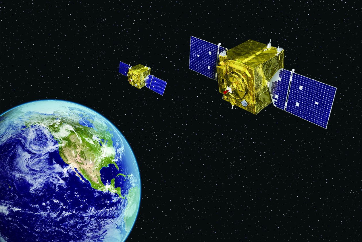
On August 4, the "Jumang" of the carbon monitoring satellite of the land ecosystem was successfully launched by the Taiyuan Satellite Launch Center at the Taiyuan Satellite Launch Center. The carbon monitoring satellite of the land ecosystem is the first remote sensing satellite for the passive joint observation of the main forest carbon exchange owner in my country. It can realize the high -precision quantitative remote sensing measurement of forest vegetation biomass, air -soluble gel distribution, and chlorophyll fluorescence. The "Jumang" is promoted, marking the era of my country's carbon exchange monitoring into the era of remote sensing.
This launch is also the 100th Aerospace launching task of the Long March 5 Lange Rockets since the successful first flight of the Long March 5 Lange Rockets. Organize and launch license approval, and the Fifth Hospital of Aerospace Science and Technology Group and the Eighth Hospitals are responsible for the general development of satellite systems and carrier rocket systems.
Try "cross -border": "Star of Skills"
Sentences are wooden gods and spring gods in ancient Chinese folk mythology. They are in charge of the growth of trees and grow their names with Zhu Rong, symbolizing the awe and responsibility of the natural environment. According to the information released by the National Aerospace Bureau, after the "Junman" satellite can obtain the multi -factor remote sensing information of global forest carbon exchange, improve the efficiency and accuracy of carbon exchange measurement, and change the traditional artificial carbon exchange measures for it, as a means of The implementation of my country's "Carbon Dafeng, Carbon neutral" strategy provides important remote sensing support.
Forest carbon exchange monitoring requires high -precision vegetation data as a support. In order to meet this requirement, the development team tries to "cross -border", innovatively drawn the active and passive joint observation method represented by the "lidar+optical camera" as the representative Apply to forest monitoring.
Getting high -precision vegetation height and area information is the key to the monitoring of forest carbon exchange. Corresponding to satellite design, that is, high requirements for laser radar and multi -spectrometer camera. In order to allow the "Juman" to have high -precision forest carbon remittance monitoring capabilities, the development team made innovation breakthroughs in terms of performance improvement, configuration method, and overall design based on the existing technical foundation, and finally met the needs of forest carbon exchange monitoring.
According to experts from the General Department of the Fifth Hospital of Aerospace Science and Technology Group, this active and passive joint observation model not only gives full play to the advantages of laser radar and multi -spectrum cameras, but also uses the accuracy of multi -spectrometer camera for laser schools.
"Quasi, full, fine, fine": the "professional star" of carbon exchange monitoring
The content of vegetation height, vegetation area, chlorophyll fluorescence and atmosphere PM2.5 is the core data for calculating the carbon exchange capacity of forest. As the "professional star" of forest carbon exchange monitoring, the "Summi Mang" is equipped with four loads such as multi -wave laser radar, multi -angle multi -spectrometer camera, ultra -spectrometer detector, and multi -angle polarized imaging instrument. Data "quasi, full, fine, fine".
The result of high vegetation is "accurate". The "Summare" uses multiple beam laser radars for high vegetation measurement is actually a sample measurement process. By calculating the height of the trees by calculating the laser to the crown and the ground, the number of beams and frequency of the satellite measured to emit laser beams and frequently determines Measurement accuracy. In order to maximize the data accuracy of the high vegetation measurement, the development team passed data countermeasures, simulation analysis, and application tests, which eventually greatly improved the high accuracy of vegetation measurement.
Get the vegetation area "full". In order to accurately restore the dense forest, the development team installed 5 multi -spectrum cameras for satellite design to achieve three -dimensional observation of the 5 -angle of the ground. At the same time, in order to avoid the impact of vegetation yin and yang surface light, the development team's innovative method proposes the method of setting the moon to ensure that the 5 -angle imaging spectral response is consistent. After implementing these capabilities, the 5 -angle multi -spectrometer can help the "Sentera" draw a "three -dimensional" vegetation distribution map.
Chlorophyll fluorescence detection is "fine". Chlorophyll is a key influencing factor in the photosynthesis of vegetation. High -precision diagram of chlorophyll fluorescence is an important part of the "Jumang" supporting high -precision monitoring. However, the energy of chlorophyll fluorescence is very small, and only about 0.5%to 2%is launched in the form of fluorescence. In order to improve the degree of fineness of chlorophyll spectrum detection, scientific researchers have designed a super spectrum detector for the "Juman" design. The principle of grating splitting can detect the slightly bright and dark changes that the sun cannot see.
Atmospheric correction data "fine". In order to remove the impact of atmosphere on monitoring data, the development team first provided a polarized imaginger for the "Juman", supporting 35 angles to monitor the PM2.5 content of atmosphere, and obtain the atmospheric horizontal PM2.5 content information. In addition, the development team also added atmospheric lidar to obtain the atmospheric longitudinal PM2.5 content information. The data results change from two -dimensional three -dimensional information from two dimensions to three -dimensional information, which is more accurate.
Convenient control: "Smart Star" that can plan tasks independently
The "Juman" has many loads and many models, but its control is very convenient. It is a "smart star" with independent task planning capabilities.
Forest carbon exchange monitoring is the main task of the "Saimang". In addition, it can be widely used in the fields of environmental protection, surveying and mapping, meteorological, agriculture, disaster reduction and other fields. Therefore, there are many tasks of "Jumang" and complicated working models. The development team must consider not only to allow satellite to support more applications, but also consider making satellites easy to use and easy to control.
To this end, the development team ensures that various load data data is transmitted independently from the hardware, and the satellite "intelligent" is "intelligent" from the software.Realize independent task planning.[Editor in charge: Shi Ge]
![]()
- END -
The US satellite frequently approaches China's space target, experts: The United States has a huge threat to space security

The US media recently described the Sino -US Satellite Satellite Space Confrontati...
Standing up the new look of the barracks in the new era

Standardized construction of the base areaWhat is the barracks in the new era■ PL...